Lake County Highpoint Trip Report

McDonald Peak (9,820 feet)

Date: July 12, 2008
Author: Adam Helman

Participants include John Hamann, Charlie Winger, Tim Worth, Edward Earl, John Stolk, Grant Myers, and Adam Helman.

All photographs are courtesy of Charlie Winger. Mouse-click any photograph for enlargement.

"Birthday Ultra Climb"

This effort is part of a larger journey collecting Montana and Idaho county highpoints in July 2008.

wildflowers
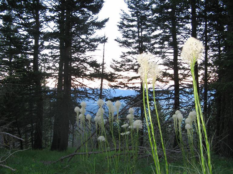
Long-stemmed wildflowers on
the northeast-trending ridge.
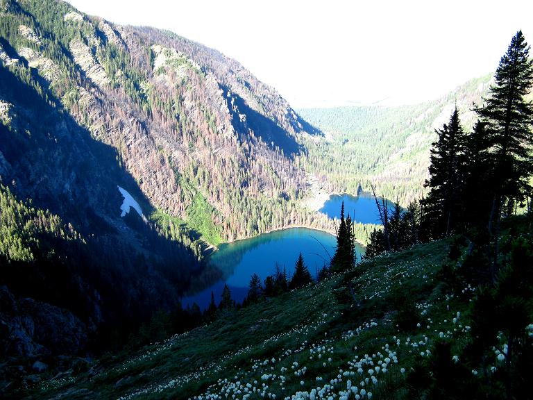
Owing to their proximity, this climb of Snowshoe Peak it paired with an ascent of Snowshoe Peak; yet with a rest day in-between since each effort entails over 5,000 feet of elevation gain. This rest day is essentially mandatory given the 14+ hour days each mountain poses.

Ashley Lakes
Ashley Lakes

For many of us the chief draw of McDonald Peak, and indeed of Snowshoe Peak as well, is that they are both ultra prominences, i.e., peaks with at least 5,000 vertical feet of
topographic prominence. We are all "working" on completing the 57 summit ultra list of the contiguous United States; and these two summits fit neatly into that picture as two of the four ultra summits in Montana.

I arrange this ascent for just prior to the mandatory wildnerness closure that extends from July 15 through October 1. The Mission Range is "grizzly bear central", and, with that description, one surely is not interested in violating this stricture.

Ashley Creek
We begin ascending
alongside Ashley Creek.

Unfortunately the cited dates include the optimal, relatively snow-free climbing period. The best we can do is enter very near to the closure date. Then, noting that my 48th birthday, on July 12, is on a Saturday, I earmark that weekend date for the convenience of those who have a working schedule to consider.

uphill
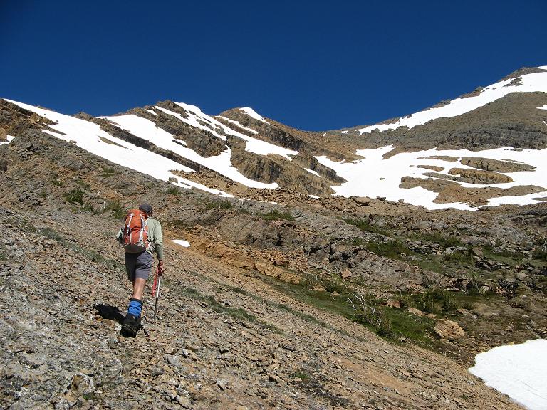
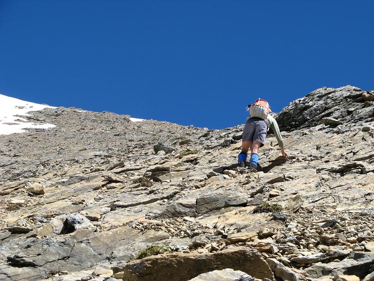
John Stolk trudges uphill
beyond the 8,200 foot saddle.

By mutual consent we choose a western approach via the Ashley Lakes.

Thereby a gaggle of climbers meet July 11 from 5 to 6 p.m. inside the 44 Bar parking lot at the Red Horn Road / US Route 93 junction - John Hamann (New Mexico), Charlie Winger and Tim Worth (both Colorado), John Stolk, Edward Earl, Grant Myers (all Washington) ... plus Jim Perkins (of Montana) who climbed McDonald Peak two weeks earlier. Jim is here to assist us driving the often muddy approach road with his tire chains.

snow slope
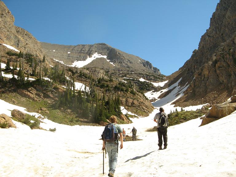
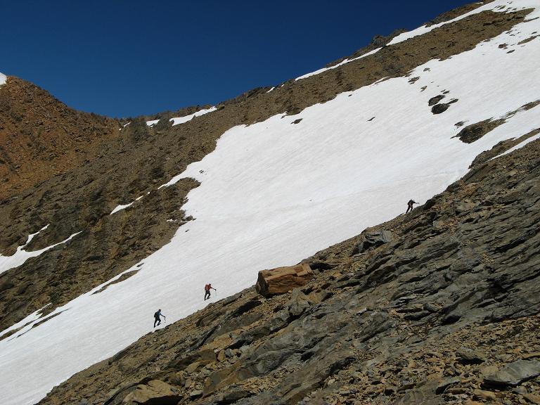
Three of us choose
this snow route...

This is Flathead Indian land, and each person must purchase, invididually, both an entry permit and an overnight camping permit for this climb.

The following road log is most helpful in getting one to the "trailhead" for this peak. Distances are in Adam truck miles, which are roughly one-sixtieth mile longer than a standard mile. Hence "6.0 miles" is more likely 6.1 miles in-truth.

0.0   Route 93 / Red Horn Road ("44 Bar").
        WGS84 (47.38484° N, 114.09635° W) at 2,792 feet.
3.5   Road deteriorates to dirt. You will need four-wheel drive
        but the most ideal of conditions. We are lucky.
4.9   Junction - bear right (south).
6.8   Possible park (with "mailbox" on pole).
        WGS84 (47.37286° N, 113.99725° W) at 4,700 feet.
7.5   Possible park 0.7 road mile farther.
        WGS84 (47.37381° N, 113.99323° W) at 4,950 feet.

With several vehicles there is insufficient area for everybody to park at the higher location. Hence Edward and I park at the lower trailhead; and, by morning, will hike the road 0.7 mile and for 15 minutes to meet the remaining group.

rock slabs
... while others choose
rock slabs and talus.

I give two entire pies to the upper group for safekeeping until my birthday tomorrow lest I dive into them prematurely. These were purchased in Kalispell while driving through there at the noon hour: a chocolate turtle fudge pie for the group; and a lemon meringue pie all to myself. Without the ablity to eat ice cream (it will melt before the big day), cream pies serve as a very good substitute as the texture is similar.

As stated, Edward and I walk from the lower to upper carpark, meeting the group at 5:15 a.m. amidst shouts of "Here comes the old man!" - an obvious reference to my new age. I appreciate the round of recognition for this most special day in my calendar.

I then enjoy my first slice of lemon meringue pie - deeelicious! We are off.

Edward Earl
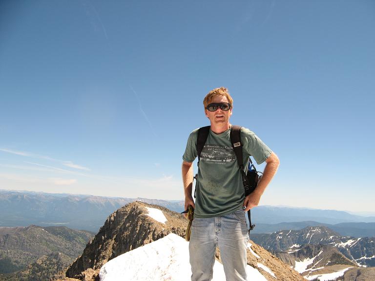
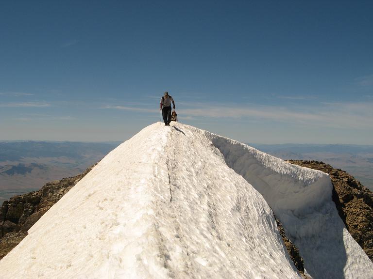
Edward Earl summits.

The climb has four components - ridge; bushwhack; along Ashley Creek to an 8,200 foot saddle, and the summit push on a mix of snow and scree.

We follow the obvious ridge on a trail, deadfall being a minor annoyance. At some point we must leave the ridge and begin the dreaded bushwhack - and we find it convenient to do such at roughly the 7,200 foot level.

John and Adam
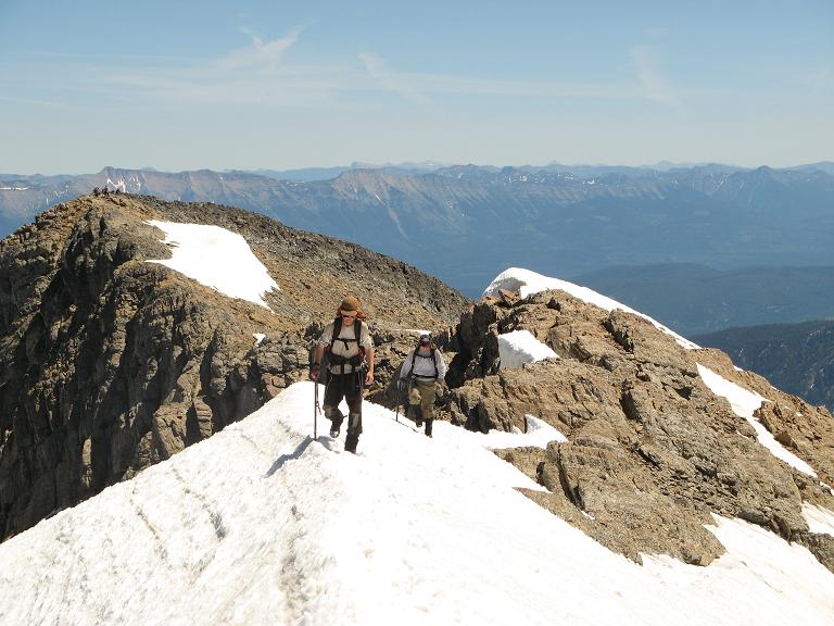
Adam Helman (front)
and John Hamann
take the final steps.

The bushwhack, due to sidehilling, is most tiring, consuming four hours each way. At times the slope is steep - up to forty-five degrees. The terrain is most pretty yet tedious to negotiate in practice. Had there still been snow at this level it would have been well-nigh impossible to accomplish in a single day.

We had decided to climb the ridge to avoid the reported horrific brush along the Ashley Lakes' margins. Indeed, Bob Bolton claims one has to walk on top of brush to make forward progress.

John Hamann
John Hamann summits.

The terrain forces a descent to the 6,700 foot level as we approach Ashley Creek above cliff-like terrain, in turn just above the uppermost of the Ashley Lakes. The 500 foot elevation loss is recommended owing to cliff bands and other obstacles.

We have a large break at Ashley Creek. I emplace glacier glasses and, with ice axes no longer stashed for travel, we move upstream, on the south side, amidst a combination of dry rock and modest snowfields. It is disconcerting and a large waste of time to be constantly stashing the ice axe for the rock travel only to remove it for the snow.

Tim Worth
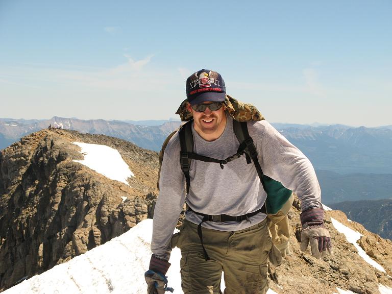
Steep dropoffs on both
sides of Tim Worth
along the final section.

Eventually we come to an 8,200 foot saddle, and see our ultimate objective for the first time. The creek takes a significant bend at roughly 7,400 feet; and it is important to continue left rather than be duped into following the right-hand fork.

Above the saddle there are snow-free routes along nasty scree; and largely snow routes, albeit moderately steep, for those who are more comfortable on that terrain type.

summit view
summit view northwest
into the next drainage

Not surprisingly, John Hamann and I opt for the largely talus scree-based route; while the long-term Washingtonians take the snow.

Having separated in this fashion (without mutual consent that this was safe), we all head willy-nilly to the obvious east-west summit ridge.

The final hundred horizontal feet is an airy ridgewalk with snow underfoot; and features steep dropoffs in both directions. I most gingerly tread its length.

bushwhack
Our bushwhack is often
arduous and distasteful.

We congratulate one another on this - a bluebird, cloudless day!

I enjoy camembert cheese on an "everything" bagel along with assorted sweets. After perhaps 40 minutes it is time to go ... but not before I remind folks to touch the very highest natural point for earning the ultra prominence.

It is nearly 2 p.m.

Tim, Adam, pies
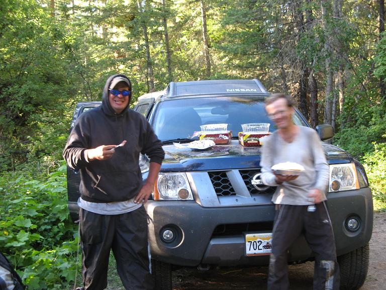
Tim Worth (left) and
Adam Helman (blurred)
with birthday pies.

To expedite our descent we all snow glissade to varying extents. In so doing Edward, wearing his characteric Levi's blue jeans, generates a hole in the most unfortunate of private places...and he will certainly retire this pair!

We take a well-earned break by Ashley Creek at the 6,700 foot location, none of us particularly enthusiastic about the upcoming bushwhack with its sidehilling. Now it will be even worse as the sun has warmed the day and we are quite tired.

Adam and pie
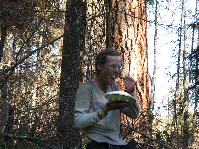
Adam Helman consumes
his lemon meringue pie.

We are heartened by finding the trail, and with it much easier travel down the ridge. The descent is rapid now, and we return to the upper parking area at 7:42 p.m, having left 14 1/4 hours earlier at 5:28 a.m.

The ascent consumes 7 hours 40 minutes; the descent exactly 6 hours. Our times can likely be improved upon with a smaller party than our seven. However climbing McDonald Peak as a dayhike is still a taxing, tiring affair.

The net elevation gain for Edward and myself is 5,132 feet. The total gain is some 6,200 feet due to descent from 7,200 to 6,700 feet at Ashley Creek; the reascent on return; and some minors "ups and downs" along the route.

On return to the upper parking area I open the chocolate cream pie for the group's enjoyment; and eat the great balance of my lemon meringue pie. After that I amble down to my truck; call my folks with the weakest of cell phone signals; and leave a message with Jim Perkins that we all are successful. Then I eat a small supper ("man does not live on pie alone"); and finally sleep by 10 p.m.

cursing the pie Charlie Winger and pie
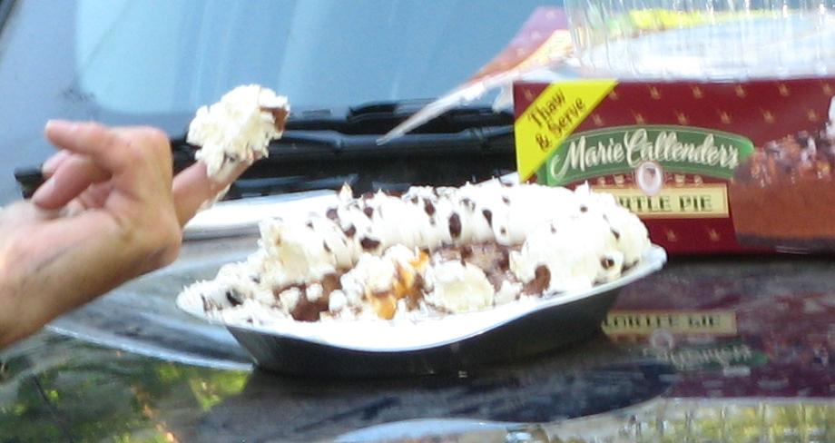
What did the pie do to YOU?
- A photograph taken out of context...
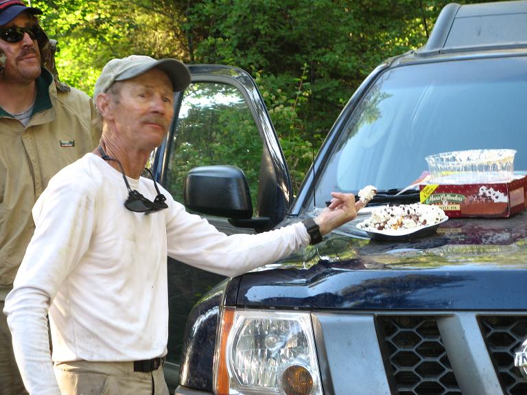
...and the original with Charlie Winger.

I eat the final slice of pie at 5 a.m. in bed - with mixed nuts atop for variety.

All the other climbers drive out this evening; and camp at a state park where they encounter some terribly noisy and disturbing people. They are awakened by a large bond fire; and with headlights shining brightly, these lunatics are intentionally attempting to disturb. Eventually Grant Myers suggests departing, and this the climbing party most appropriately does.

Climbing McDonald Peak in one waking cycle requires fortitude and willpower. Experience with cross-country navigation is essential; and it does not hurt to have experience on many types of terrain from boulders to snowfields.

group photo
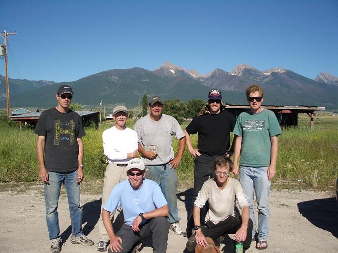
The McDonald Peak group. From viewer's left -
John Stolk, Charlie Winger, Tim Worth,
John Hamman, and Edward Earl.
Seated from left - Grant Myers and Adam Helman.