|
Expedition Chronology IV. Upper Mountain |

|
call out,
"Caitlin Climb!"
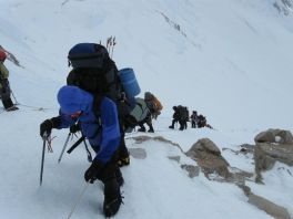
to signal that our rope team, led by Caitlin, is to resume movement. We are on the fixed lines, ascending to the West Buttress proper between 16 and 17,000 feet. The fixed lines are ropes anchored into the snow by the National Park Service, to aid climbers as they negotiate a steeper section of the route.
There are actually two ropes to handle the bidirectional human traffic, and as one nears them the rope employed is always that one on the right hand side. They extend for some 700 vertical feet from 15,400 to 16,100 feet elevation. I have read somewhere the average slope angle is 44 degrees.

|
|
These climbers are near the fixed ropes' upper terminus. |
One uses an ascender which accepts the rope with a one-way grip such that the device can readily slide uphill - yet "catches" the other direction to prevent falling. In addition a carabiner is affixed to the rope, thence attached to your waist harness with specially knotted cord using a girth hitch.
When an anchor is reached one must notify the team (tied together on a separate rope) to temporarily halt while you first move the carabiner from below to above the anchor - and then unfasten the ascender, briefly, thence attaching it to the fixed line above the carabiner.
On the descent one's arm replaces the ascender device - and the carabiner is moved after your arm is thoroughly wrapped around the fixed line. The required actions can be both frustrating and painful as your (left) arm is now under tremendous stress.
I suspect there are less time-consuming, more efficient ways to descend the fixed line - and yet they are not employed by our expedition owing to a lower safety margin. Else there would be no advantage to the current method and it would be abandoned. Don't you just love logic?
Let's recall the following arrangements are also in-place -
Plus that helmet is worn in the unlikely event of rockfall. When you add the multiple clothing layers and thick gloves that impede all but the coarsest of motions one is reminded of Apollo astronauts bouncing on the lunar surface.

|
|
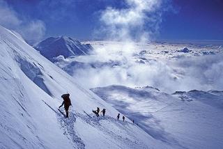
Approaching Denali Pass, High Camp in background. (Mouse-click image to view.) |
It's somewhat clunky - the antithesis of comfortably watching TV in your night pajamas. Roped-in on the lower glacier, plodding along in snowshoes and with a sled behind and in front of you is similarly cumbersome.
I am not complaining - only describing. You'd be arrested if caught walking downtown with such an assortment of metalwork affixed! An insanity plea would likely be accepted by the jury...

|
never passed through the fixed lines more than once each way. We already know that - as I never participated in the move to High Camp.
Having never been to High Camp I cannot provide a firsthand account of the events there and above. The following details are based on word of mouth and Mountain Trip's website blog. I have no means of verifying their correctness until some team member provides me an accurate accounting. At that point speculation and analysis can be replaced by first-hand description as a surrogate for fact.
The team was going to make a summit bid the very day after reaching High Camp, that is, without a rest day. However smoke from a far off fire near Chena, to the north, could make for labored breathing - exacerbating an already difficult effort.
So the following day becomes SUMMIT DAY.
Dave Colley becomes exhausted well short of the summit. His rope team, with guides Dan and James, turn around. I really do appreciate details of this event - Dave deserves the true story be revealed as "exhausted" without qualification seems too harsh. Why? What predisposing issues existed?
Jonathan Sugarman and rope team, with guides Caitlin and Yoshiko, turn back from the summit with only "a few feet" remaining (according to the website blog).
A raging thunderstorm with much lightning forces this decision / action. It's a freak weather event, nearly unheard of in Mount McKinley climbing circles.
Some accident occurs coming down from High Camp wherein Dan (??) is nearly impaled by an ice axe after he or someone else falls down. Again, I do not have any details - and wish that somebody clarify what really happened.
I also wish to understand why only a single summit attempt was made when there were sufficient supplies for a rest day followed by another attempt. Given the ENORMOUS financial expense and physical effort of getting to High Camp, from thousands of miles away on a future expedition, a couple extra days of suffering is a bargain!

|
| High Camp panorama |
Analysis
May we quantify "a few feet"? I am just as concerned about the noncommital nature of this phrase as any of several friends, who, reading the website blog, have no idea whether "Dr. Helman" (in the words of a peakbagging friend) realized his dream. (The fact that they knew not of his true whereabouts, at Advance Base Camp, is a separate issue.)
If the true tippy-top had been reached then it surely would have been noted. I thereby posit that nobody reached the summit, even if they were spooked by lightning by only a car's length from it. Again, the author wishes a detailed account so this matter can be resolved without speculation: did our expedition 'succeed' in that at least one client summitted or not?
A side benefit of such a description is that the current web page can be extended with additional content, allowing as well for the placement of more photographs as kindly provided by Dave Colley and others.

|
lobal climate change. In Alaska that translates to markedly elevated temperatures, especially in winter. It's well documented. An afternoon thunderstorm is more appropriate to August Colorado - not the continent's highest mountaintop!
It's of course true that one cannot attribute a single weather event to long-term climate shift. There is always a distribution about certain mean values of temperature and precipitation totals. However when those average values shift, even slightly (that IS "climate change"), the probability of "freak events" at one extreme of the distribution curve increases markedly. Do the math for a Gaussian function's "skinny tail" to convince yourself.

|
|
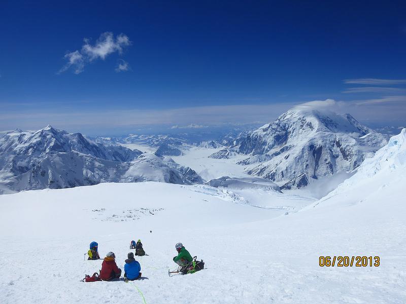
View from roughly 15,000 feet towards Advance Base Camp with Mount Hunter left and Mount Foraker at right. (MT photo) |
| previous page - Advance Base Camp | next page - Epilogue |