Elevation : 9190 feet Prominence: 5643 feet Location : 49:44.8 N 117:08.5 W Backroads Mapbook: Kootenays, Map 11:C3 Climb Duration: 1 moderate day from the cabin or camp sites near Kaslo Lake. Difficulty: Class 2+ with Glacier travel-bring rope, crampons and ice ax. Additional Resources: www.bcparks.ca,
www.alpineclubofcanada.com Where locals hike in the West Kootenay by Kathy and Craig Copeland
Driving Instructions: From the town of Nelson BC take Hwy 3A northeast crossing
the west arm of Kootenay Lake on a bridge just outside of town.
From the north side of the bridge follow the highway along the north shore for perhaps
11 miles or so to the signed Kokanee Glacier Road. Camping is available in the vicinity
of the turnoff at both public provincial and privately owned campgrounds.
Turn left (north) onto Kokanee Glacier Rd. and follow it 10 miles to its terminus
at Gibson Lake, elevation approx. 5000 feet. This road is fairly rough in places
and requires high clearance (unless you consider an exhaust system optional equipment).
Be aware that porcupines
frequent the parking lot at night and apparently like to
chew on tires, hoses and wires! Consequently anyone leaving a car overnight there
wraps their vehicle in chicken wire
to prevent this occurrence. Generally there is enough wire
lying around to use but if you wish to be certain, bring a roll with you.
Description: Cond Peak is the highest point in Kokanee Provincial Park,
a lovely gem containing many alpine lakes and a fine system of trails.
The main trail leaving the parking lot
reaches Kaslo Lake, elevation approx. 6500 feet
in about 5 miles. Along the way it passes several other lakes including
Kokanee,
Keen and Garland Lakes. At the south end of Kaslo lake there are a number of
campsites
and a bearbox for food is provided. At the northeast end of Kalso lake lies Kokanee Glacier
cabin where bunks can be obtained. This is a large beautiful cabin (more like a lodge)
with kitchen facilities and a spacious common area. Reservations should be made at
alpineclubofcanada.com.
From Kaslo Lake the general idea is to head uphill and to the southeast onto alpine terrain.
Along the way work past some small rock outcroppings and stands of trees.
Once out of the trees look for the first major ridge culminating in a peak (The Pyramids).
Hike up over open ground toward the ridge and aim for the point just below where the ridge
steepens dramatically below this peak. A good view of the terrain can be seen
here.
The point marked with a red “X” indicates the location where we were able to cross over
the ridge and get onto the glacier.
Here, after roping up, we headed up and to the left on the glacier by the path of
least resistance. Although not steep, the glacier was icy in places so crampons may be useful.
As we gained elevation we eventually passed just left of a
sub-summit with a large obelisk
(seen in the center distance). From here we continued over an intervening rock ridgelet
and beyond over easy terrain to the highpoint which is somewhat farther to the east.
Note: It might be possible for a strong party to do this route from the trailhead
in one long day. A possible alternative route which provides shorter but steeper access
to the upper glacier via “the keyhole” is described in the Copeland book.
I cannot personally vouch for this route but if one is looking for the quickest way
to the summit, further research might be warranted. Finally I would add that this area
is so lovely that not spending a night or two in the area would be a shame.
With the accommodations available at the cabin a few extra days exploring the park
are highly recommended!
Photos (taken July 2006):
0475: Parking lot at Gibson Lake.
0476,
0477,
0478,
0479,
0480,
0481,
0482,
0510,
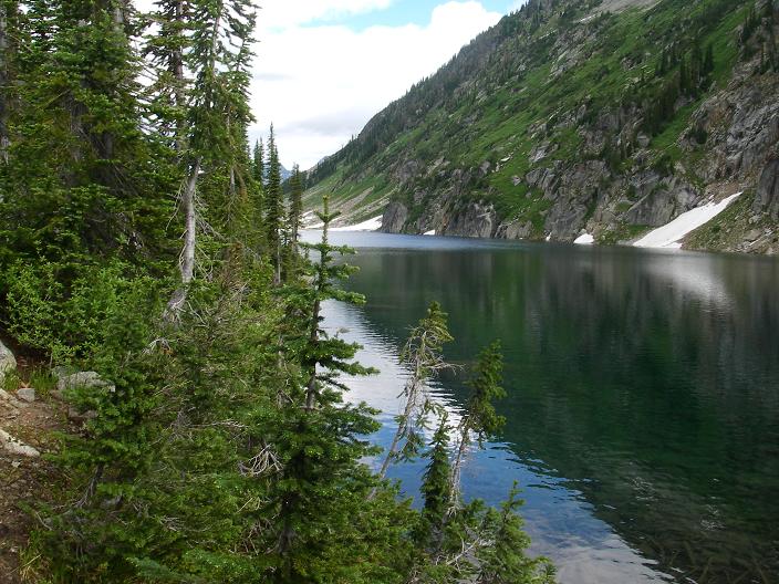
0511: Views along trail to Kaslo Lake.
0484: Open portion of the route below the crossover point to the glacier
0502: Crossover point on ridge just below where it steepens above.
0487: First section of glacier crossing. Route goes up and right out of the photo.
0488: View of the summit of Cond (center of photo) about midway along the glacier portion
of the route.
0489: Summit view.
0490: View from summit back down the route toward the obelisk on the ridge
(Obelisk is not the highpoint).
0492,
0493,
0494: Views from the top. The Valhalla group is in the distance in 0494.
Kokanee Peak is seen in 0492.
0495: Looking down the glacier.
0496,
0497: Views back down to Kaslo lake from the glacier.
In 0496 the red “X”
just to the left of the climber indicates the crossover point back onto the ridge.
0504: Campsite at Kaslo Lake.
0507: Grand view of the route from near the campsite up to the point where the glacier
is attained. See photo 0484 for a closer view of the upper half.