Elevation : 8442 feet Prominence: 5469 feet Location : 50:11.7 N –118:13.7 W Backroad Mapbooks: Kamloops/Okanagan, Map 30:G5 and Kootenays, Map 16:C3 Climb Duration: One day. Difficulty: Mostly Class 2. A short Class 3 crux just below the summit.
Grizzlies reported in area. Others in Party: Edward Earl Additional Resources: Edward Earl has written an excellent
trip report
which can be found at Peakbagger.com.
Driving instructions and details of the route are thoroughly covered in Edward's
trip report so I won’t rehash them here. Included here are some photographs of the area.
I have tried to match the photo captions to descriptions in Edward's report where possible.
Photos5809: Parking area at the end of the road with view up towards the Pinnacles.
5810: Looking down the rocky gully into the valley. The trail is a bit obscure here.
5811: View from above the rocky gully of peaks to the south.
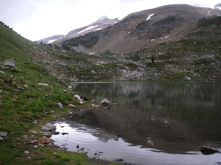
5812: Monashee Lake. The summit is visible in the center background.
5815: Slabby area above the pass looking down the route.
5816: View of the summit from the grassy col at ~8000’.
5817: Summit photo (Edward signing the register)
5820: Summit view……
5821: Edward downclimbing the Class 3 section near the top.
5823: View of the upper lake. Out of sight behind the moraine to the center-left is Monashee Lake.
5824: View from the pass to the NNE.
5826: Monashee Lake on the return leg.
Monashee Lake. The summit is visible in the center background.