Wedge Mountain
- by John Stolk
Elevation: 9527 feet
Prominence: 7379 feet
Location: 50:08.0 N 122:47.6 W
Backroads Mapbook: Vancouver, Coast & Mountains, Map 30:B4
Climb Duration: 2-3 days from the trailhead.
Difficulty: Glacier Travel, bring rope, crampons and ice ax.
Steep, loose scree above glacier to summit.
Driving Instructions: Drive Highway 99 north from Whistler, British Columbia to the
Wedge Creek FSR (rough approximation 7-10 miles). Turn right (east) onto the
Wedge Creek road and bear left at a fork and follow the road to its terminus
at the Wedgemount Lake Trailhead. This road is rough and the last section is steep
but it is possible to coax a passenger vehicle within reasonable walking distance
(10 minutes or so) of the trailhead parking area.
Description: Wedge Mountain is the highpoint in Garibaldi Provincial Park
and is one of the most prominent peaks in Canada that is relatively easy to climb
under the right conditions. The climb involves about a half day of hiking up the steep trail to
Wedgemount Lake (elevation 6200 feet).
There is a small BCMC hut located at the west end
of the lake. There are also a number of small tent sites in the area near the hut.
From here the route passes around the north end of the lake to its eastern end
and onto the heavily crevassed Wedgemount Glacier.
In late season finding a route
through the maze of crevasses can be a challenge so it is probably best to climb
this route while there is still good snow cover in June or early July.
The route heading south up the glacier is not steep but care must be exercised
due to the many large crevasses.
From the top of the glacier continue hiking south up to the saddle between Wedge
and Parkhurst Mountain located a couple of kilometers to the northwest.
From the saddle gradually swing around onto the
west ridge or southwest scree slopes
and follow the easiest gradient to the summit.
Note: On our late August 2005 attempt we were turned back by incoming weather
at the base of the scree slopes approximately 2000 feet below the top.
There does not appear to be any technical difficulty on the remainder of the route.
Photos (taken August 2005):
1301:
Parkhurst Mountain with Wedge obscured in the background.
1302:
Closer view of Wedge Glacier.
1313:
Wedgemount Lake and the Glacier. Good overview of the section of the
route above the BCMC hut.
1315: Wedgemount Lake
1317:
Route through the glacier goes from left to right out of the frame.
The more difficult route up the north arete follows the snow ridge to just west of the summit.
1319:
Looking out to the west from camp near the BCMC hut.
1321: BCMC hut above the lake.
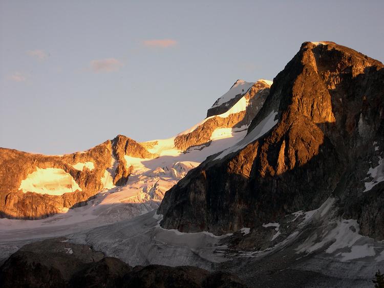
1328: Sunset on Wedge.
1334:
Toe of Wedge Glacier. Wedge in the sunlight in the center right background.
1338:
View above the glacier looking east up the scree slopes towards the summit.
From a second climb in July 2009 -
4659:
Final corniced portion along the summit ridge.
4661: Andy on the summit.
1010212: Summit view looking east.
1010214: View to the north.
Mount Weart (2870 m) can be seen on the right.
|
|
sunset on Wedge Mountain
|