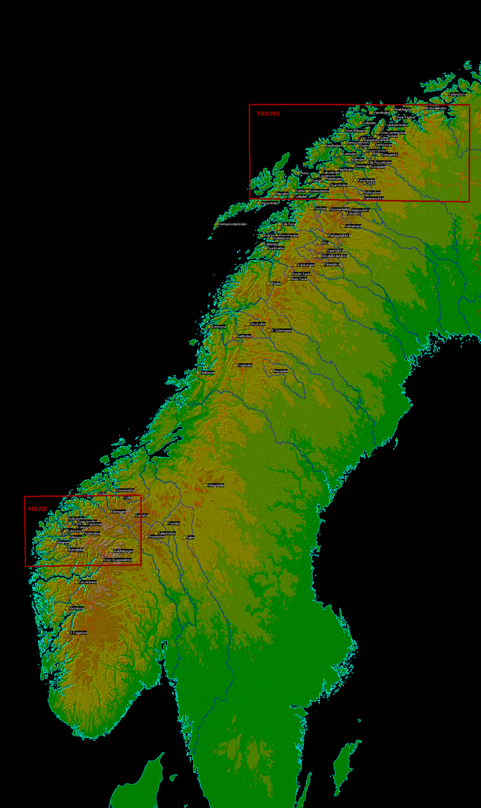
This representation of Scandinavia 1,000+ meter prominence cells comes with the following
description by Edward Earl.
The 1,000+ meter Scandinavian cell map is based on a
Winprom database that was extensively reviewed by Petter Bjřrstad
and myself over a year ago. The 99 peak list corresponding to this map is well-verified.
Certain aspects of the cell map require explanation.
For a few peaks, the key saddle can be any of a succession
of saddles that fall within the same contour interval. The true saddle identity
can affect the cell on either side. Winprom's philosophy has
always been that, in uncertain cases, all possibilities are shown.
This principle holds true for cells as well. In these cases, both possible cell
boundaries are shown, leaving the appearance of a (usually small) cell with
no peak inside. A peakless cell on the map signifies that cell
actually belongs to the cell on whichever side connects to it via the higher saddle.
Such cells appear between the following peak pairs:
- Frostisen and Kebnekaise
- Sřlenkletten and Rondslottet (this cell is barely visible)
- Spanstinden and Storsteinfjellet
- Gielascohkka and Kebnekaise (small and mostly obscured by Storsteinfjellet)
There are also several possibilities for the ridgeline divide that
connects Scandinavia to northwest Russia. Though an expert can probably tell which
one is the correct one, Winprom cannot determine this given the information it has.
Therefore all possibilities are shown.
The originally provided map is somewhat large for efficient Internet transmission unless
you have a high-speed connection. Thereby a smaller version of the map is shown here with,
unfortunately, most of the detail lost due to the resizing.
To recover the original map, just click inside the small map on this page.
Beware of the download time - this is a 675 kilobyte file.