* By Aaron Maizlish with peak list compiled by Andy Martin, Edward Earl, John Roper,
David Olson, Ken Jones and Ron Tagliapietra.
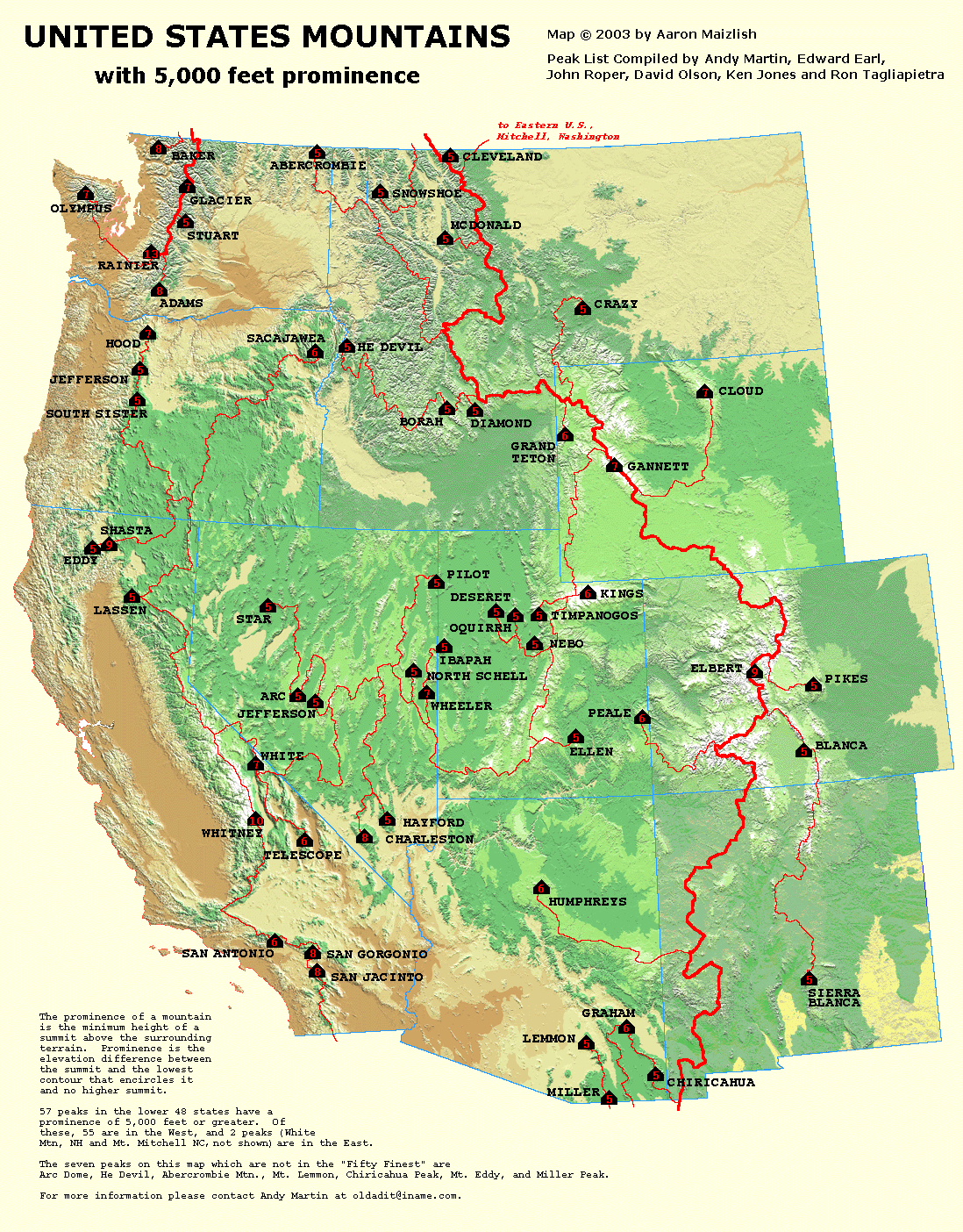
Map Comments
This beautiful representation of western USA prominences of at least 5,000 feet has the key
and explanation embedded on the map itself. The continental divide is represented by the
extra bold, red divide line. The originally provided map is somewhat large
for efficient Internet transmission unless you have a high-speed connection. Thereby a smaller
version of the map is shown here with, unfortunately, some of the detail lost due to the resizing.
To recover the original map in all its glory, just click inside the small map on this page.
Beware of the download time -
YOU HAVE BEEN FOREWARNED!!