With all the talk about the flatness of Kansas and Saskatchewan, I decided to take a
light technical look.
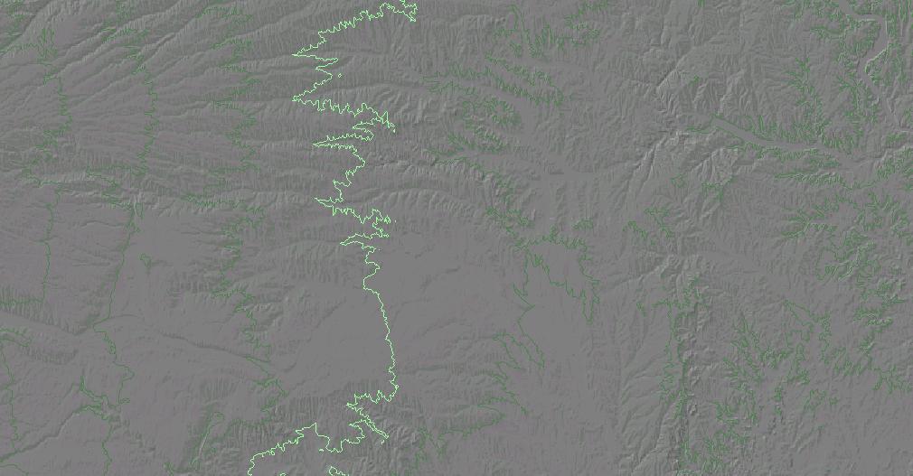
Using the SRTM30 data, I generated a shaded relief map for both -
The Kansas map goes from 37°N to 40°N and from 94°40'W to 102°W. The Saskatchewan map goes from 49°N to 60°N and from 100°W to 110°W. The Saskatchewan-Manitoba border varies from about 102°W to 101°30'W; I chose not to clip Manitoba from the map because the Manitoba prominence winner may be showing.
Both Kansas and Saskatchewan are shown at the same scale and with the same degree of shading. Saskatchewan is by far the more interesting! Most notable is a northwest to southeast - trending line of mesas sprawling across the eastern border of the province and on into Manitoba, and as noted in a previous message by Mike Cleven. Each of these mesas has about 1,000 feet of prominence.
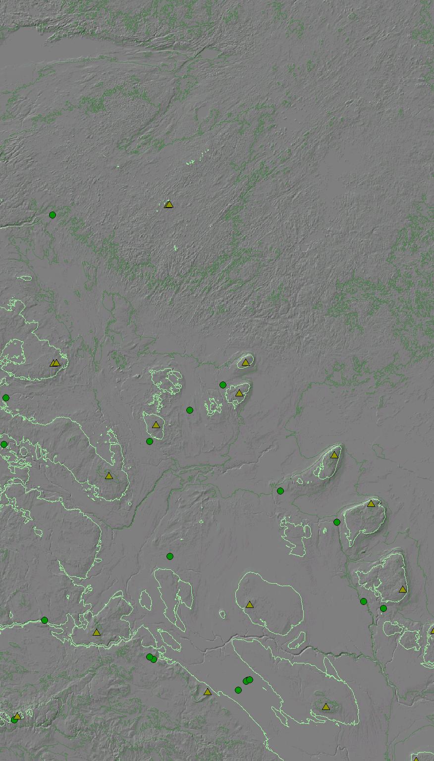
I ran a cursory prominence analysis of Saskatchewan (and western Manitoba). Peaks with over 500 feet of prominence are shown as olive triangles, and their saddles are green circles. The results are listed below. When a number shows up in the "Off" column, it is the prominence to which the peak might be lowered by rising terrain outside of the area included in the analysis.
In a few cases, the peaks and/or saddles are ambiguous because of their apparently equal heights. Thereby I cannot tell which is the true prominence winner, and, as such, I listed all possibilities. I was able to identify only a handful of the peaks using an atlas, and I leave it to our Canadian contingent to continue the work.
MB = Manitoba, ND = North Dakota, SK = Saskatchewan
| Prominence | =======================Peak======================= | ===========Saddle=========== |
| On Off | Elev Location Name | Elev Location |
| 1198 | 2730 51°28'30"N 100°43'30"W Baldy Mtn MB | 1532 51°18'00"N 101°37'30"W |
| 1125 | 2700 52°43'00"N 101°27'30"W Harte Mtn MB | 1575 52°27'00"N 102°15'00"W |
| 1109 | 2703 53°25'00"N 102°18'30"W SK | 1594 52°54'00"N 103°32'30"W |
| 1042 | 2541 49°00'00"N 100°25'30"W Boundary Butte MB/ND | 1499 48°11'00"N 100°33'30"W |
| 1499 48°12'30"N 100°30'00"W | ||
| 886 571 | 2641 53°07'00"N 107°29'30"W | 1755 53°34'30"N 109°54'00"W |
| 876 853 | 2825 50°51'00"N 107°46'00"W | 1949 51°02'00"N 108°58'00"W |
| 817 | 2474 54°45'30"N 104°20'30"W | 1657 53°37'00"N 106°33'00"W |
| 810 | 2703 49°46'30"N 102°29'30"W | 1893 50°01'30"N 104°30'30"W |
| 1893 50°09'00"N 104°20'00"W | ||
| 1893 50°10'00"N 104°18'00"W | ||
| 1893 50°10'30"N 104°15'00"W | ||
| 748 | 2454 51°15'00"N 104°15'00"W | 1706 51°57'30"N 106°05'00"W |
| 741 387 | 2454 54°45'00"N 108°42'00"W | 1713 54°15'00"N 109°51'30"W |
| 2454 54°44'30"N 108°45'30"W | ||
| 689 | 2402 53°51'00"N 106°24'00"W | 1713 54°04'00"N 105°38'00"W |
| 682 | 4206 49°38'30"N 109°35'30"W | 3524 49°35'30"N 109°39'30"W |
| 647 | 2402 54°18'30"N 104°29'30"W | 1755 54°26'00"N 104°52'00"W |
| 623 417 | 2044 57°02'30"N 106°06'00"W | 1421 56°53'30"N 108°47'30"W |
| 2044 57°02'00"N 106°08'00"W | ||
| 578 | 2356 50°53'00"N 100°00'00"W | 1778 51°12'00"N 101°10'30"W |
| 515 | 2808 49°59'30"N 105°13'00"W | 2293 50°30'00"N 106°33'30"W |
| 2293 50°28'00"N 106°28'00"W |
| back to main prominence page |