Note 1: All NAD27 UTM coordinates are in zone 12S. Note 2: Click on any photograph for enlargement. Full descriptions are given in the
             
Utah County photo page.
Background
This climb formed part of two larger road journeys -
for myself a highpointing trip, in part with Edward Earl
described here;
and for Bob Bolton, my partner in ultra ascents,1
a highpointing trip designed to secure him a string of
eight 5,000+ foot prominence summits in eight days.2
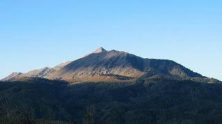
Mount Nebo from the northeast.
Approach
Bob Bolton and I opted for the northerly route described in Gerry Roach's report.
We found his description accurate and the route preferable to the southerly route described in
High in Utah with more distance and far more elevation gain.
Locate a turnoff on the paved Nebo Loop Road at UTM (438477 E, 4410376 N) and 9,253 feet.
Although one may commence the climb
from this point, we went a rough 0.6 road mile to a more desirable,
closer-in trailhead at UTM (438309 E, 4410971 N) and the same elevation.
Climb
Sign-in at the register one hundred yards up-trail to the west, and continue in that direction
until a junction at UTM (437481 E, 4411159 N). Here, continue west on the ridge,
instead of dropping down south into the basin.
The trail drops 100 feet, and slowly arcs into a southerly direction as it passes counterclockwise
around North Peak - an 11,174 foot summit separate from the Nebo massif itself
and at UTM (435932 E, 4409884 N).
The trail climbs up the northwest ridge of North Peak, topping out at 10,800 feet as it
traverses its west face. It then drops down 200 feet to Wolf Pass at 10,600 feet,
a great spot to take a breather and at UTM (435815 E, 4409058 N).
A subpeak of Mount Nebo's north summit lies immediately
southwest from here, with a use trail leading up the obvious ridge. Take it.
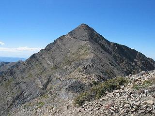
Mount Nebo from the 11,450 foot subpeak
immediately to the northeast.
The trail passes within five horizontal feet of the subpeak's top (estimated 11,450 feet),
and then drops down perhaps fifty or even one hundred feet to the saddle connecting
with the desired, north summit.
There are a couple of obvious paths along this section, and it is possible to ascend the
remainder of the route while remaining entirely on a faint use trail - so relegating
the ascent to class 2 status.
Bob Bolton and I had a marvelous summit siesta lasting an hour, with excellent views in
all compass points. Bob successfully called his wife on the cell phone. We both had
another ultra prominence, as well as the Utah County highpoint, and, I believe,
the Wasatch Range highpoint. Summit UTM coordinates are (435002 E, 4408052 N).
Just one more county for my state completion! -
a sentiment aptly scrawled into the summit register.
My lunch plans were partly foiled when I failed to locate
the garlic clove that was to enhance the marinated artichoke
and Iberica cheese "sandwich" on a whole wheat tortilla.
The entire climb consumed about seven hours, including all breaks. We completed the
Nebo Loop Road. At the nearest community we enjoyed refreshments, including a pint of
Haagen Dasz coffee ice cream
with mixed-in granola bars pieces intentionally saved from the day's effort.
We then proceeded to our next venue as Ibapah Peak, to be climbed with Dean Molen.
Dean had not joined us on Mount Nebo due to a Sunday family reunion.3
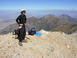
View north from Mount Nebo
summit; Adam in foreground.
Bob and I were amazed that nobody else was climbing the mountain on a beautiful
Labor Day weekend. We surmise that Mormon etiquette might sneer upon climbing on Sunday.
The net elevation gain is 2,700 feet as previously reported. The total elevation gain
is calculated as 2,700 + 2 x (100 + 200 + 50) = 3,400 feet, the latter fifty feet
being the estimated drop between the subpeak and Mount Nebo's true summit.
1An ultra is any mountain with at least five thousand vertical feet of
prominence. 2Bob succeeded in his effort, and I am pleased to have joined him in four
of his eight ascents. 3Dean climbed Mount Nebo four days later, on Thursday, using the route described here.
  I thought of Dean as Mount Nebo passed under the jet airliner's left wing.