Glossary - Standard Definitions
- Acme - The free website acme.com that is
currently used for "deep links" to topographic charts for every county highpoint.
- BM - Bench Mark, a survey marker that the government installs at a
surveyed spot, but not necessarily the highest point.
- cohp - Acronym for COunty HighPoint.
- Contour - Line connecting points of equal elevation.
- FRL - Front Runners List; a tracking system to record who is the leader
in a variety of cohp'ing categories
(there are two documents, one being the records and one being a
collection of lists such as "all the continental divide counties").
- Glob - A collection of contiguous counties in which the highpoints have been
visited. Counties must share a border shown on USGS maps. No corner
touching allowed.
- Glob Radius - Radius of biggest circle you can place in your glob. Circle
can not extend into foreign lands & oceans.
- Home Glob Radius - Radius of biggest circle you can place in your glob,
centered at your primary residence. Circle can extend into
foreign lands & oceans. Alaska and Hawaii are special cases.
- Glob Span - Longest line you can draw that starts and ends in your glob.
Non-endpoints may lie outside of your glob.
- The Group - Cohp'ers who are members of cohp@egroups.com e-mail group.
Others (such as completers of cohp in a state) are probably given "honorary" membership.
- Hand level - A hand held device used to determine relative elevations in
the field; operates by lining up a bubble level with a horizontal bar
and sighting through a tube.
- Helman County - County with the greatest elevation difference between
its highpoint and lowpoint for a given state.
Also known as "H-county".
Additional information
- HP - An acronym for HighPoint (see below).
- Highpoint - The highest point of natural land in a geographic or political area;
not to be confused with the highest peak or summit, which is the
highest landform in an area.
- Prominence - A new measure of mountain impressiveness.
Additional information
- THE RULES - Rules that define valid claims of reaching the highpoint of
a county; aka Fred's Rules after Fred Lobdell who tends them.
- Spot Elevation - A surveyed location that is indicated by a "x" on the
map; no marker was placed at that spot.
- Stealthing - Tongue-in-cheek term for doing county highpoints on the sly, so
you can achieve a large amount of progress unbeknownst to other highpointers.
- Topoquest - The free website www.topoquest.com that has all the USGS topographical
charts so that cohp's can be searched for, located and printed. Topozone.com used to be
recommended but has undergone major reduction in quality for its free services.
- Virgin - A county whose single (or multiple) HighPoint(s) have not ALL been
visited by members of "The Group" (see above).
Glossary - Personal Highpointing Philosophies
- Olsonizing (David Olson) - Discovering a different highpoint for a county; usually
after someone has gone to great lengths to reach the original
highpoint, thus negating that achievement.
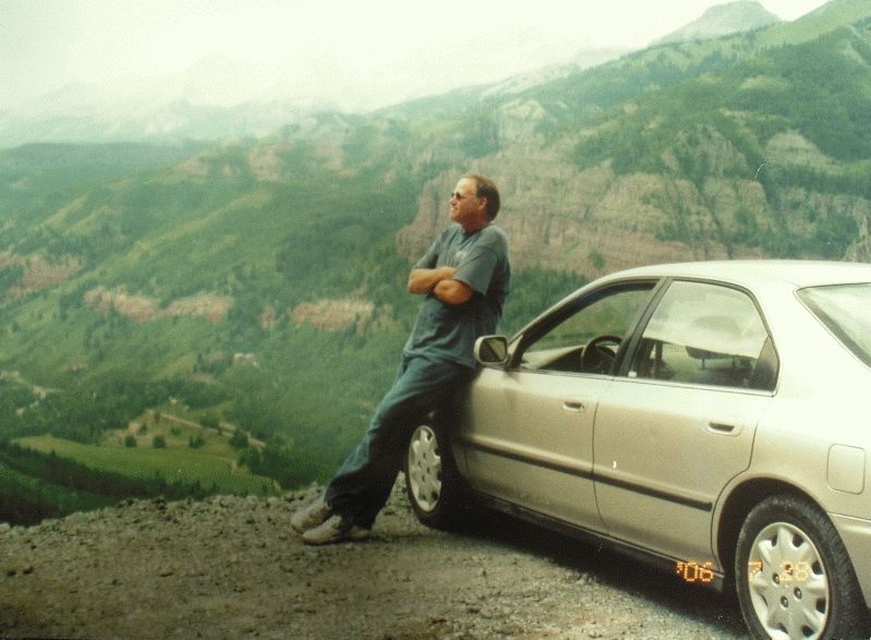
- Martinizing (Andy Martin) - Driving to the highpoint. In its ultimate form this allows
occupants to simply open the car door and take the first step
directly on the benchmark. A perfect Martinization is a rare feat.
A nice example of Martinizing is shown in
this photograph
of Andy with his infamous Honda Accord overlooking Telluride, Colorado in July 2006.
- Earlizing (Edward Earl) - Dropping down from the trailhead to a lower elevation so
that additional vertical gain is required. The goal is to make the HP worthy
of being claimed a true ascent by allowing for at least 1,000 vertical feet
of gain under one's own power.
- Lobdellizing (Fred Lobdell) - Systematically tromping around a HP area to ensure you've
touched the HP; often done by imagining a grid layout and walking it.
- Schwiekerizing (Roy Schwieker) - Claiming a cohp by simply reaching some part of the
area of the highest contour.
- Mitchlerizing (John Mitchler) - This has bounced around from "using a hand level" to
"talking to the owners" to something about being nekkid; the consensus
is not yet decided.
- Covillizing (David Covill) - Expertly executed landowner schmoozing.
- Helmanizing (Adam Helman) - A corollary of Earlizing (see above) wherein the attempt
to Earlize is made when time constraints permit. If time is short, then
less than 1,000 vertical feet may be considered. However short the hike,
Martinizing is never allowed: there must ALWAYS be a nonzero amount of
vertical gain under one's own power.
Hand Levels
(a detailed description is available)
Hand levels at may be found at scientific stores that sell
chemicals and rock/mineral collecting supplies and survey equipment.
A cheap hand level can cost $20 and most are more than $75. If you
get one with magnification nike shox classic and scaling it can cost $200. Some hand levels
have no magnificiation and simply have a horizontal line with a level bubble.
When magnification is available it may be 2x or 5x.
Hand levels are crucial for multiple area highpoints. One may use them as follows.
Take the topo chart and highlight each area by numbering them. Then when in the field
under investigation hand level each area and write down notes on your topo such
as "1 > 2" which means "area 1 is higher than area 2." If you write down
"1 >> 2" then it means that area 1 is much higher than area 2. One often
tries to eyeball the highest area and go to it and sight to as many other
areas as possible. If any areas are similar in elevation, one should go over
to those areas and back sight. One would then write down "2 < 1" which
tells you that you went to area 2 and found it to be lower than area 1.
The above procedure may eliminate some areas as being too low and thus
save future cohp'ers time and effort. Of course, many multiple areas
can't be evaluated because 1) they are too far apart, 2) are cloaked by
trees, or 3) are too similar in elevation for hand levels to determine.
Check out an on-line supply store
for hand levels.
Highpointing Rules
*
* promulgated by Fred Lobdell Release V - Thu Feb 8 16:01:01 MST 2001
1. Pillar claiming
If there is a definite high point, some part of your body should be
placed on the highest point.
Cairns: It is considered sufficient to touch the top of the cairn and the
highest natural point outside the cairn. Actually, we wouldn't consider it
necessary to even touch the top of the cairn, since it's obviously an
artificial surface. There's no guarantee the highest point on the cairn is
directly over the highest natural point.
2. Access issues - private, military, prisons, atomic tests, etc...
If access is restricted or denied [and you are unable to get to the HP],
that's tough: you don't get to claim the high point.
If the (former?) HP is under a house or other structure, the natural
surface has almost undoubtedly been excavated for a basement, and thus no
longer exists. In these cases, the highest natural area near the structure
would be good enough.
3. Summit fences around towers
If the ground inside the fence is about as high as that outside it,
then walking around the fence is good enough. If, however, the ground
inside the fence is significantly higher than that outside, then you need
to figure out a way to get inside, by crawling under, over, or through.
[Caution: a fresh cut in a fence or lock and a pair of bolt cutters in your
pack would probably be accepted as adequate circumstantial evidence by most
judges and juries. Also: the natural surface inside the fenced area has in
many instances been "modified" by earth-moving equipment, and thus does not
constitute a natural surface. In these instances, the highest natural
surface should be accepted.]
("significantly higher" follow up) -
This is rather subjective, but we'd like to stick with "not significantly
higher" within the fenced area. That is, it MAY be a few inches higher
within the fence . . . or it may not. We would suggest that if you feel it
is more than about a foot higher, you should figure some way of getting
inside the fence in order to claim the HP. (Use your own judgment in the
case of prisons, insane asylums, and military firing ranges.)
We're not talking 1/2 mile fenced in, but not more
than 100 to 200 yards at most. These are the small "keep away from the
equipment" fences, not the large "this is private property" fences which
are covered under "access". You also have to be able to see if it rises
significantly inside.
4. Multiple Areas
If it is not known which is the higher, then all should be visited.
If, however, you or someone else has done the necessary comparison with
hand level, clinometer, survey instruments, or whatever, then it is only
necessary to visit the highest area(s). In some cases, we would be willing
to accept probabilities. Thus, when there is one large area with a spot
elevation only one foot lower than the next higher contour line, and a
second, tiny area, we would be willing to accept visiting the first area as
being sufficient for claiming the county.
Note: if all areas are close enough and with enough of an unobstructed
view for you to be able to determine which is the highest, then you
only have to visit the visually highest one. (Usually this is not the case.)
The question is raised whether one needs to visit areas that are definitely
lower than other areas if they're listed in the County High Points book.
Absolutely not! If one can determine that one or more areas are definitely
not in contention for the CHP, then there is no need to visit them.
With regard to state HPs, if a reliable (?) authority such as the USGS
has determined that one of several points is the highest, then we accept
this, and there is no need to visit alternate areas.
For the state HP, it is necessary to visit only the "official" HP.
If field observations find certain HPs that are lower than the "true" HP,
and further if these same HPs are noted in Andy's bible, then it is only necessary
to visit the remaining candidates.
5. How close must one get on flat terrain.
One should make a "good-faith effort", to use David Olson's phrase, to
get to the "true" HP. When you are in a large, flat area that is inside
the highest contour, you should wander around and stand on all the areas
that appear to be slightly higher, then invoke the Rule of Schweiker. [Roy
Schweiker proposed, several years ago, that if you were inside the highest
contour and it was not obvious where the true HP was, that that was good
enough to claim the HP.]
Two or three people have recently said something or asked questions that
suggested that they thought that simply getting inside the highest contour
was good enough to claim the HP. This is absolutely not the case. If you
are inside the highest contour, and another area over there looks higher
than where you're standing, you need to go over and stand on that area. In
the case of large open fields or areas above treeline, this does not pose
much of a problem, except for the time and effort necessary to tramp all
over the area. But in large flat areas of dense forest or swamp, it may be
very difficult to visit all possible HPs.
Thus, I regard some of the
southern Florida counties as essentially undoable, as are some on the
southeastern coastal plain. These counties have large areas (in some cases,
several square miles) of "high point", and without a major effort that might
involve days of mucking through swamps, it's not possible to feel reasonably
confident of having stood on the highest area. Pasquotank County, NC has
several square miles of Great Dismal Swamp at an elevation of 20 feet, with
no part of the county reaching 25 feet elevation. The HP may well be some
hummock in the swamp, but I'm not going to find out. And I accept the fact
that I'll never complete NC. So, in my opinion, simply getting inside the
highest contour is, by itself, inadequate to claim the HP.
6. Pre-bagging (before a county/province/etc is created)
**
I am opposed, but willing to entertain counter-arguments. My feeling is
that we should wait until the political entity is in legal existence before
we can do and claim the HP.
Someone suggested that the "pre-bagged" peak should
have been, at the time of bagging, the HP of some jurisdiction; since we're
county HPers, let's say it should have been the HP of a county. Thus, Bob
Walko's ascent of Harquahala Peak, at the time the HP of Yuma County (Arizona),
now counts for La Paz County (also Arizona):
he doesn't have to go back and re-ascend Harquahala.
Consider it this way: if the northern part of the former Yuma Co. had
retained the name Yuma and the southern part had been renamed, no one would
think of saying that Bob hadn't ascended the HP of Yuma Co. Which part
retained the original name and which part was renamed represents an
arbitrary decision on the part of the political authorities.
Which brings us to Broomfield county in Colorado.
The HP of the soon-to-be Broomfield County
has never been a county HP, just as Broomfield has never been a county. Our
feeling is that credit should be given only for those ascents done after
the establishment of the county. Of course, if you've ascended this HP
previously, you are free to claim the ascent as an ascent, but not as a
county HP.
**
VIEW COUNTERARGUMENTS
7. HP mined away, or naturally diminished (e.g. Mt St Helens)
The next higher HP becomes the HP, and should be visited even if the
prior HP had previously been climbed. However, claims of completing all
Washington's county HPs that included Mt St Helens, if completed prior to May 18,
1980, should be honored. (We are willing to bet that most of us would go back
and visit the new HP, but we wouldn't require it.)
8. Man made HP - towers - landfills - Indian mounds - etc.
They don't count and as such need not be visited to claim a county highpoint.
9. Drive-over HPs
Your must need step out of the car and onto the HP.
Foot-dragging is permitted if you're being shot at. Otherwise, just like
baseball's balk rule, you have to make a full stop of at least one
second's duration. But seriously, we believe most of us would like to get out
of the car, stretch our legs, and have a look around.
10. Machine aids - snow mobile, parachute, helicopter, etc...
There are those who maintain (like Jeff Rand) that any way you get to
the top of the mountain, even if dropped off by helicopter, is legitimate.
We are recognizing the achievement of "getting there", not the method
or distance/elevation gained (but see "Earlizing" above and the
"Helmanizing" collorary thereof).
If this becomes a real problem (highly doubtful) we can re-think this.
12. Climbed the highest summit, not the highest point in county
If you don't climb to the highest point, you can not claim the county.
A good example of this is in Connecticut where the highest summit, Bear Mtn,
is lower than the highest point in Connecticut, where the state line crosses
the south slope of Mt Frissell. State highpointers seek this highest
point (not Bear Mtn), county high points are determined in the same manner.
Open issues
- 7A. Former counties legislated out of existence.
- 8A. Strip mines & gravel pits all over big natural HP area.
- 11. List errors and later fixes. This includes higher ground found
and/or finding more areas that tie the HP in elevation.
- 13. Changing unvegetated sand dunes/Mississippi river mud hills (see LA).
