(click for detail).
Mountain climbing stands apart from other sports in several respects. It is a challenging activity testing one's physical and emotional strength to whatever limits you allow. It is not a competition between individuals. Rather, Nature provides hurdles, as well as avenues of retreat and of safe passage, to which one meets the challenge without going beyond one's personal limitations.
|
|
|
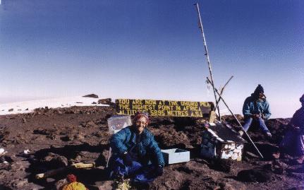
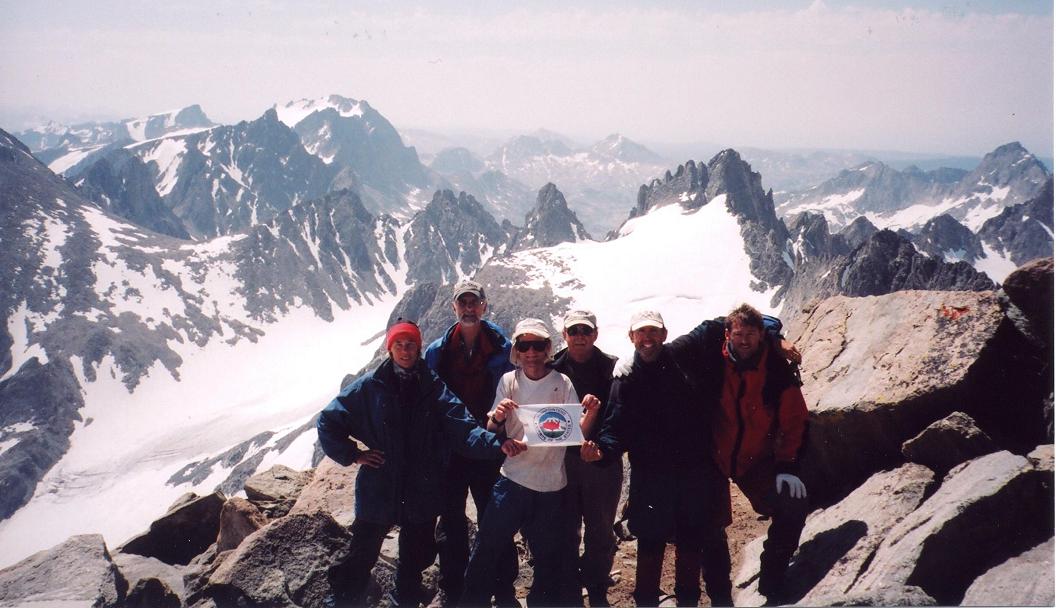
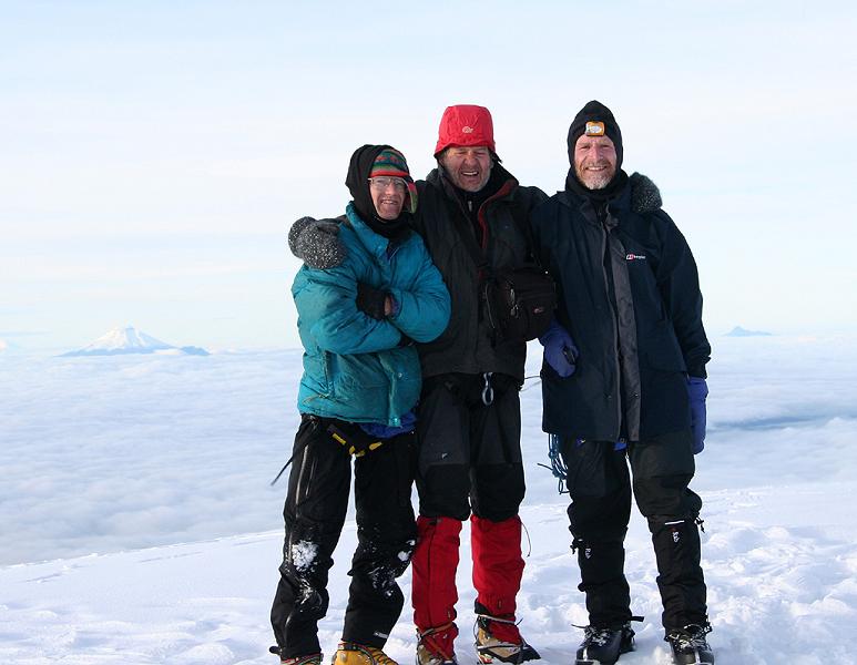
Atop Kilimanjaro in 1996 (click for detail). |
In climbing, if hazardous, the essence of life and its fragility is accentuated by demands of the moment. All else, including work and the whole mundane world we have created in the cityscape, is of no consequence. As such a new perspective is gained, one wherein our everyday toils and trials suddenly appear petty by comparison.
|
|
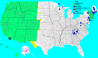
county highpoints completion map (click for full-size version). |
When this attitude is applied to our daily tasks we grow inside, having gained the confidence that accrues from having passed the more severe tests Nature hands out.
This then is one main reason I venture into the mountains. Another is the sheer beauty of mountain scenery. Indeed, the higher one climbs the more stark and seemingly surrealistic the mood invoked. Camping on a glacier miles and miles from any human generated garbage, there is a keen sense of the awesome grandeur in G-d's creation and, simultaneously, of the puny role we play out in our brief lives. Another reason to climb is the innate desire of reaching the highest point within one's visual horizon. Standing atop Kilimanjaro in July 1996, I was keenly aware that there is no higher ground for some 3500 miles. The Karakoram range of Northern India and Pakistan, including K2 (28,250 feet), lay across the Indian Ocean to my northeast. As for the old adage "because it's there", some truth does exist. However I have not met anyone who does not have some quite personal reasons for pursuing this demanding yet rewarding activity.My interest in climbing harks back, in its earlist stages, to when I lived in Denver, Colorado from the ages of seven to nine. My family owned a Volkswagon camper which was taken on numerous camping trips throughout the western United States.
|
|
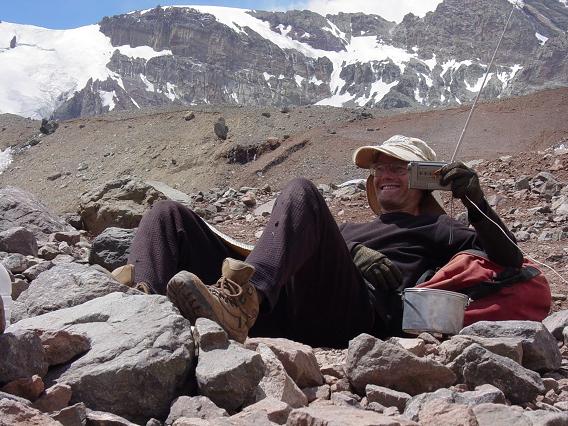
Adam with penitentes at Aconcagua (click for detail). |
We visited essentially every national park, and most of the national monuments, west of the Great Plains. I have an enormous number of photographs from these trips as well as progressively more distant memories of both good and not-so-good times.
|
|
Gunung Raung summit crater in east Java (click for detail). |
Between my second and third year of medical school in Michigan, I got the seemingly irrational urge to take a survival course in Colorado with the Outward Bound school. For 23 days we slogged through knee-deep snow in the Collegiate Range of central Colorado, legs and shoulders groaning from the weight of our backpacks.
Remarkably (at least to me at the time), I was the only person with an intense desire to actually get to the top of surrounding peaks. Other people simply wanted a wildnerness experience. I actually cried when at some 12,000 feet our group leader, for safety reasons, prevented us from summitting Mount Massive (14,421 feet), the state's second highest. Years later I would climb it on my 40th birthday with John Mitchler. The mountain will always be waiting for another day, a realization which, when considered, should prevent many climbing accidents when pushing forward in dangerous conditions of terrain and/or weather. Mount Saint Helens is one exception! One summer I visited my parents in California and, with the family stationwagon, rented a motel room in Lone Pine near the base of Mount Whitney. The latter at 14,495 feet is the tallest mountain in the 48 contiguous states, and is typically hiked via an 11 mile long trail from the campsite and trailhead at 8,300 feet. I hiked the 22 miles from sunup to dusk, having enjoyed four peanut butter and blueberry jam sandwiches at the summit plus a gallon of water along the trail.
|
|
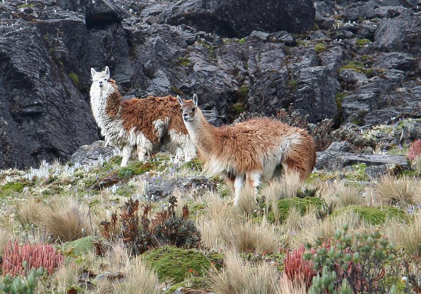
Llamas on Ecuador's Nevado Cotacachi (click for detail). |
After accepting a postdoctoral position at Caltech in Pasadena, I participated in a 12 day alpine mountaineering course in Washington state. I learned essential skills in snow and ice travel which were then applied to a climb of Mount Baker. We also did rock climbing; and, later, failed to climb another Cascadian volcano (Glacier Peak) due largely to a freezing rain.
(I did not realize these are both county highpoints and ultra prominence summits, with Glacier Peak successfully climbed several years later for those reasons.)
|
|
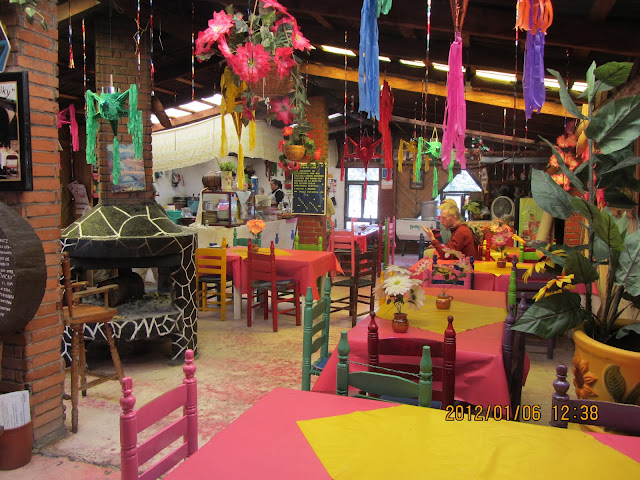
Restaurant interior near Cerro Ajusco in central Mexico (click for detail). |
Denali, known also as "Mount McKinley" is North America's highpoint at 20,320 feet. For some unexplainable reason I decided that someday I would climb this mountain, and would, bit by bit, gain the skills and experience needed to make this a safe and successful task. This would include, as will be seen below, experience in cold weather camping; high altitude; and overall knowledge available only by practice.
I have participated in five other guided climbs. One was a winter course of instruction in the High Sierra the last week of February. We learned avalanche safety, cross country skiing, spent a day climbing waterfall ice (very demanding), and an ascent of Bear Creek Spire (13,720 feet) to conclude. I traveled to Central Mexico with the intention of climbing Popocatepetl (17,887 feet) and Ixtaccihuatl (17,343 feet) in December 1990 on a guided excursion. The chief goal here was to gain high altitude experience.

|
|
Silversword plant within Haleakala's crater on Maui, Hawai'i (click for detail). |
At 2 AM on the morning of our Popo ascent I awoke with a severe headache. Nobody believed it was real as I heard claims that I had "wimped out". And so, aware that I would not work at home with such a pain, let alone climb higher than ever before, I elected to start out with everyone, and turn back at the first rest one hour later. This I did and, returning to the base, threw up and slept until three that afternoon. Upon noting the oderiferous mass on the floor everyone finally believed me that my condition had not been contrived.
I succeeded in climbing Ixta, the more difficult of the two climbs owing to the varied terrain encountered on a traverse of its slopes.
|
|
Setting a snow anchor high on Bolivia's Nevado Illimani (click for detail). |
I climbed Mount Rainier (14,410 feet) in Washington state by the Ingraham glacier route on a guided ascent. Rainier is a mountain well known as a challenging test of basic mountaineering skills, and serves as a training ground for many American Himalayan expeditions.
To gain further experience for Denali I attemped a winter ascent of Mount Shasta (14,162 feet) in northern California. This guided climb failed owing to severely cold conditions at some 12,300 feet on the Cassaval Ridge, a route which would be a class 5 rock climb in the summer but preferred in the winter to avoid avalanche danger in the gulleys below. Later I would succeed at Shasta, having climbed it as the premier peak of Northern California. Even then I was unaware of its status as Siskiyou County highpoint and ultra prominence. In June 1995 I participated in an expedition to the Saint Elias Range of Alaska. We flew in by ski plane to a glaciated valley untrammeled by humans (or most animals for that matter), and succeeded, as first ascents, in climbing four of the surrounding peaks. I climbed three of them.Many people are attracted to climbing the 50 United States highpoints. Books are available describing the various routes, many of which are trivial, e.g. a roadbed makes for the highpoint of Delaware while a pig stable serves for Iowa.
|
|
Atop Montana's Granite Peak in 2002 (click for detail). |
For the western states this silliness is not the case. As such one summer Edward Earl and I drove through Utah, Colorado and New Mexico while climbing their respective state highpoints.
|
|
Atop Wyoming's Gannett Peak in 2004 (click for detail). |
We also met my brother Dale in Aspen, Colorado, so he could climb Mount Elbert, the highest of Colorado (and hence of all the Rockies) with us. He failed, having feigned altitude sickness, apparently preferring to watch Labor Day football games in the motel bar back in Leadville.
Note: Although Leadville is commonly thought of as the highest town in the United States at some 10,200 feet, on a climbing trip through Colorado in July 2000 I drove through the unincorporated community of Alma in Park County just northwest of Fairplay. Upon entering Alma the green elevation sign announced that Alma rests at 10,576 feet. That said, Leadville has much historic significance, and was, for a time in the late Nineteenth Century, the second largest town in Colorado. On another summer vacation Edward Earl and I climbed the Oregon highpoint - Mount Hood (11,239 feet), Mount Shasta (14,162 feet) in northern California (as noted above); and the Nevada highpoint, Boundary Peak (13,140 feet). On that vacation, I first climbed the Arizona highpoint as Humphreys Peak (12,633 feet), and then flew from Phoenix to Portland for meeting Edward who had driven there (he had allready climbed Humphreys). Humphrey's Peak was a hike by moonlight, and is a story all in itself.On many many weekends Edward Earl and I drove into the backcountry and hiked one of the local mountains. Prior to my current climbing binge that commenced in May 2000 (see below), Edward had more enthusiasm than I for these small hikes, seeing as I largely viewed these ascents as having little bearing on real climbing.
Nevertheless I was amused by his efforts in these matters since they are more noteworthy a pursuit than just sitting at home eating ice cream and preparing wonderful food (my ultimate homebound activity back then AND at present). As such prior to my current climbing binge he had accumulated some 150 peaks to his credit, many of them in the High Uinta and Wasatch ranges of Utah when as a graduate student at the University of Utah. By contrast, prior to May 2000 I had amassed a mere 66 ascents of all types.I experienced a flurry of mountain climbing beginning in summer 2000. It began with a trip that Roy Wallen (see below under county highpointing), Edward Earl and I took to southwest Utah and south Nevada with the goal of four county highpoints (Lincoln Co, NV and Kane, Iron, Washington Cos, UT). The Lincoln and Kane County highpoints are "liners", i.e. theoretical points on a county boundary along the slope of a mountain whose summit lies in an adjacent county.

|
|
Aconcagua's northwest face at sunset (click for detail). |
In July 2000 I flew to Denver and climbed several 14ers in Colorado - Longs Peak (14,255 feet), Mount Massive (14,421 feet), Pikes Peak (14,110 feet), Blanca Peak (14,345 feet), and Mount Evans (14,264 feet). Longs Peak is a classic - here is a trip report at my county highpointers website.
|
|
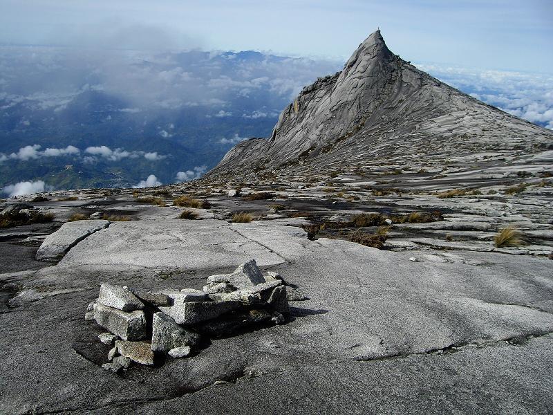
Gunung Kinabalu upper slopes in Malaysia (click for detail). |
Mount Massive was climbed with the celebrated John Mitchler on my 40th birthday two days later (and as noted above). Although John had completed all Colorado (i.e. climbing to all of the county highpoints therein), Mount Massive, although second highest in the state, is NOT a county highpoint as a mere 12 feet shorter than Mount Elbert of the same (Lake) County. It is, for my sake, the more impressive mountain owing to its obvious bulk - especially as seen from Leadville immediately east.
Pikes Peak was "Earlized" to a 1,100 vertical foot elevation gain starting at the 13,000 foot level on the summit road. Earlization is explicitly insisting on a minimal elevation gain on-foot even when there's a summit road. Blanca Peak is uniquely a "three-fer", i.e. the highpoint of three counties. A trip report documents my experience there. Mount Evans was originally driven to the summit parking lot with my parents when we lived in Denver. The actual summit lies some 100-200 feet higher still after a 1/4 mile trail. Having never actually gotten to the true summit back then, I ascended the north slope from Frozen Lake (12,800 feet), and, after reaching the parking lot, scrambled on rocks to the very top. I got a ride for the five miles back to my rental car at the lake.
|
|
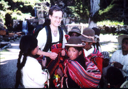
Bolivian girls trying to sell Adam handwoven goods (click for detail). |
The climbing binge continues to this day (March 2013), with all manner of mountains being targets of my attention. I categorize climbing trips into four classes depending upon the distance and duration required.
|
|
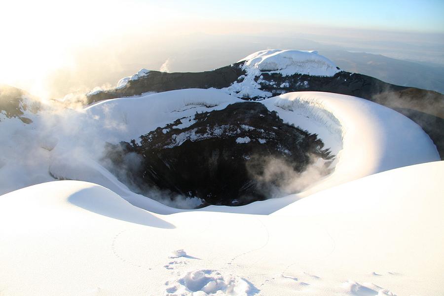
Cotopaxi summit crater in Ecuador (click for detail). |
The web presence was initially limited to a subdirectory at my Geocities web pages - a state of affairs that lasted from roughly October 1999 to early April 2000. After formatting and posting some six hundred trip reports I felt the need to avoid the stupid pop-up advertisements that adorn every HTML page on Geocities.
|
|
Collapsed atop the 19,210 foot summit of Cerro Tomasamil in southwest Bolivia (click for detail). |
Thus was born cohp.org - with "cohp" for "COunty HighPoints". It is nearly a job given the amount of human effort required to design, implement, maintain, and incrementally upgrade the site from my home in Del Mar.
In addition to making many friends through the county highpointers group, I too became infected with the county highpoints bug. I began in earnest my quest to collect counties in summer 2000 after returning from Colorado (I "inadvertantly" had been collecting county highpoints for years with Edward Earl on numerous class 2 trips to western Arizona and in California itself). Living in San Diego poses some geographical challenges as regards county collecting. As San Diego is at the continent's edge, and noting the large areas of western counties, it is impossible to effectively rack up large numbers of counties as one can, for instance, living back east. In compensation one may readily collect all counties within a specific radius from home - especially since one only has about one-third of the full circle in which to travel. In calendar year 2001 I decided to pursue 4 climbing goals, one of which is based upon the above home glob radius records category -
|
|
Adam calls family atop Bolivia's Nevado Illimani (click for detail). |

|
|
Giant leaves on Volcán Irazu in Costa Rica (click for detail). |
|
|
California completion atop Lassen Peak (click for detail). |
Fortunately for the sake of my climbing hobby I was laid off from Peregrine Systems at the end of June 2002 - perfect timing for the upcoming season! I spent the entire summer largely on the road and in the mountains, coming home to Del Mar only to pay bills, perform a half-hearted job search, and the like (I was determined not to accept ANY job until after Labor Day).
I indeed completed California on July 9, 2002 at the Shasta County highpoint - Mount Lassen. Remarkably this was only seventeen days after Edward Earl independently completed California on Placer County's Granite Chief in the presence of Scott Surgent (of Phoenix, AZ) and myself. Some noteworthy peaks required for this completion -
|
|
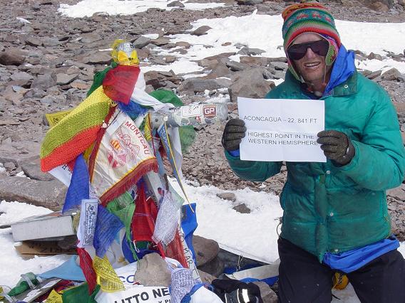
Adam atop Aconcagua in 2006 (click for detail). |
|
|
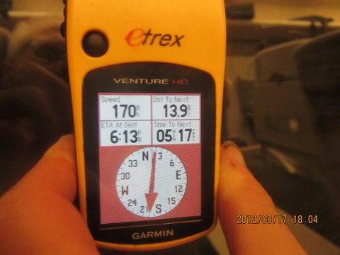
GPS unit records 170 mph speed aboard a Japanese bullet train. (click for detail). |
Hence commencing in 2002 I post online an overview of every trip taken, and with links to individual county highpoint trip reports.
These trip reviews become ever-more detailed, with embedded photographs each of which is mouse-clickable for a larger-scale image; hyperlinks to online topographic charts, Google Earth compatible files showing visited venues and more.
|
|
Cayambe summit team in Ecuador (click for detail). |
There are dozens of such general trip reports, all posted, and linking to over one hundred reports for individual county highpoints.
The first trip-wide story available online has no photographs and provides the barest outline of a four county journey in southwest New Mexico. The final trip-wide story for western county highpointing available online has all manner of media incorporated
|
|
Shortwave radio at Aconcagua Base Camp (click for detail). |
Counties beyond the tri-state region are pursued. There is no long term plan, I will "take them as they come" to continually raise my home glob radius while as a side benefit completing this-and-that western state's county list.
For some reason the lower left triangle of western states intrigue me as one feasible long term county highpointing goal. This includes New Mexico, Utah and Oregon in addition to the three states already completed. I even create a "fun map" wherein all six states are colored green as motivation for the concept. Gee it would be great to have my actual map look like that!
|
|
Pre-dawn Kamakou team - highpoint of Moloka'i in Hawai'i (click for detail). |
I start with New Mexico, and largely because I've already done some counties there with Edward Earl.
The first post-employment New Mexico-centric journey is in September 2002, and is followed by trips in October 2002, May 2003 and June 2003 wherein I complete New Mexico at Little Costilla Peak of Colfax County. A sizeable and most productive Utah trip is conducted with Scott Casterlin in July 2003. Then too I visit Oregon and Idaho in August - partly to climb Borah Peak, the Idaho highpoint, with Barney Metz and Scott Surgent. I am pleased to join Barney for his home state's highpoint.
|
|
Camp on Gunung Raung in east Java (click for detail). |
2003 concludes with the six state triangle project proceeding nicely and as documented here. Indeed, only a handful of Utah counties remain plus about one dozen in northern Oregon.
Long story shortened, I complete Utah in September 2004 at Juab County's prominent Ibapah Peak - with both Bob Bolton and Dean Molen participating. I have by then also made significant progress in Oregon AND on the High Plains of eastern Colorado. However the Oregon completion waits until late July in 2006 because of multiple cancelled climbs of Mount Jefferson, the APEX highpoint of Linn and Jefferson Counties.2 By then, however, I have already visited much of Colorado and Wyoming as shown here. 1 My previous vehicle was a Saturn sports coupe with an aquamarine color trending to the blue rather than green.
|
|
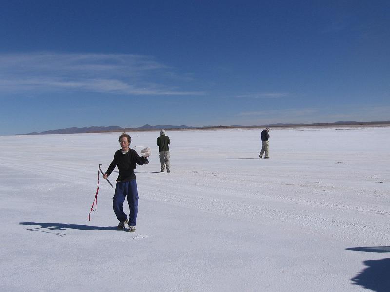
Bolivia's Salar de Uyuni - Earth's largest salt flat (click for detail). |
Consider a simplified model wherein the same numbers of counties are climbed per trip and with roughly equal areas. Through elementary integral calculus the resulting amount of driving scales as the cube of the desired home glob radius. Thus to double one's home glob radius an octupling (eight-fold increase) of the total driving is required.3
With ever-mounting gasoline prices this impediment may some day be nearly insurmountable.
|
|
Atop Norway's highpoint Galdhøpiggen in 1999 (click for detail). |
Still, in April 2004 I include the entirety of counties on Colorado's High Plains in an intricately planned trip for a bunch of southwest New Mexico prominences. April is of course too early for Colorado's mountainous counties.
The first major effort making inroads to Colorado's mountainous highpoints is in August 2005, and is followed in short order by another one in September. Meanwhile Wyoming has its own issues, in particular a trio of APEX county highpoints that Colorado cannot match in difficulty - Gannett Peak, Washakie Needles and Grand Teton.
|
|
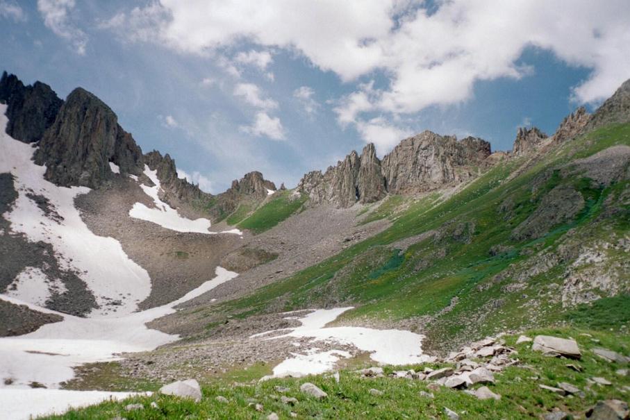
Alpine basin under Lavender Peak in Colorado's San Juan Range (click for detail). |
Gannett Peak, the state highpoint, is climbed at July's end in 2004. Later in my overall journey my vehicle is smashed by a full size male elk while driving to the trailhead for Sacajawea Peak of Wallowa County, Oregon. I proceed with the 1 1/2 day effort, succeed, and then drive home with piano wire holding down the front hood!
By the end of summer 2006 I have visited all but two of the Colorado highpoint list - Mount Lincoln of Park County and Vermilion Peak of San Juan County. I have planned for years to finish in Park County, leaving it as a "doughnut hole" in my glob as Mount Lincoln was for a while the nation's highest peak after the Louisiana Purchase!
|
|
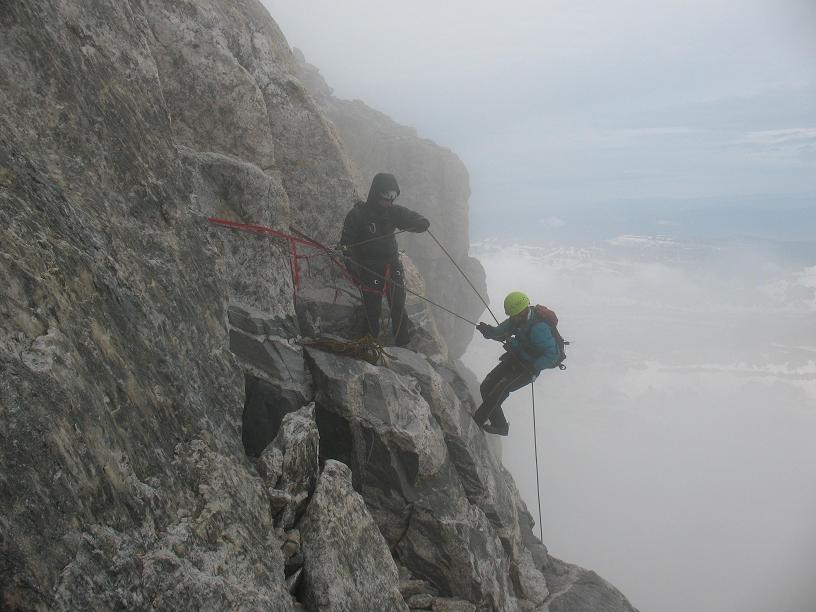
Adam on the overhanging rappel of Grand Teton in Wyoming (click for detail). |
Vermilion Peak keeps tampering with that concept, failing to climb it in both July 2005 and then again in 2006.
I climb Washakie Needles of Wyoming's Hot Springs County in August 2007 with Tim Worth, Charlie Winger and George Vandersluis. Driving south through Colorado, Park County is encountered well before San Juan County. Thus in opposition to my longstanding desire I am compelled to climb Mount Lincoln BEFORE Vermilion Peak. Nevertheless Colorado is finished on the 12th - an effort that I am justifably proud of. Wyoming is eventually completed atop Grand Teton in 2008, Dennis Poulin my partner. This concludes realization of a "fun map" painted with 8 green states several years previously. I could rest on my laurels at this point, the resulting map impressive indeed as all the western states are in a large green glob apart from Montana, Idaho and Washington. 3 A narrow annulus (ring) of counties at distance r from one's home has an area
|
|
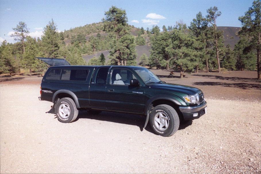
Pickup truck "DENALY" with new camper shell (click for detail). |
So I proceed to consider Montana, Idaho and Washington despite large driving distances and short seasons.
Montana's High Plains are among the earliest to fall. Thus in May 2005 I rent a passenger car from Denver and bag many highpoints from the Canadian border to southern Colorado. Many many long distance journeys ensue over the coming summers, each filled with a unique assortment of experiences worth sharing.
|
|
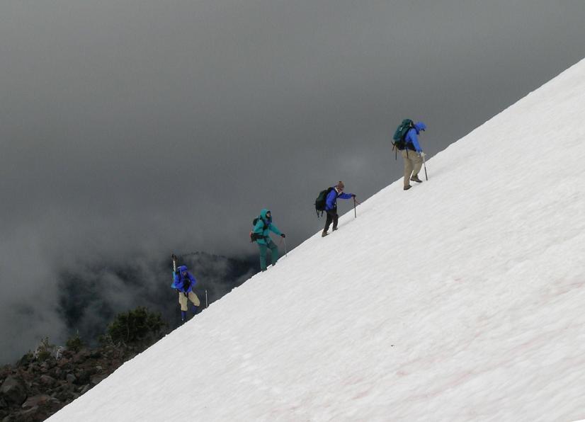
Oregon's Mount Jefferson, Adam is second in line (click for detail). |
In July 2005 is a Washington trip. (We) never climbed either main goal - Glacier Peak and Mount Jefferson, and salvaged the journey with an assortment of other Washington counties.
August 2005 is devoted to Colorado, the first long distance journey with a camper shell on my pickup truck. For the $1,300 price I no longer have sleep on the driver's seat while my duffel bag and its contents get soaked on the truck bed. In compensation "DENALY" no longer looks like a capable, half-ton hauling machine. It appears to be (and is) a mobile bedroom. In June 2006 I start in southeast Washington and continue east along the "High Line" (U.S. Route 2) through northern Montana for a string of counties, eventually returning to Spokane for my home flight. Details are available in this trip report.
|
|
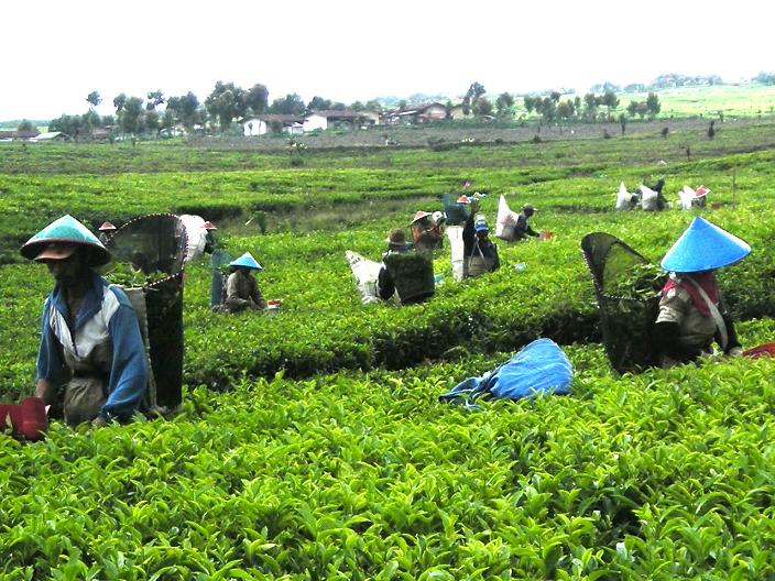
Sumatra tea plantation during a southeast Asia volcano-bagging trip concurrent with completing Colorado. (click for detail). |
A highly successful and enjoyable climbing trip with Edward Earl and others occurs in July 2006, including ascents of both Glacier Peak and Mount Jefferson where I complete Oregon. My overall trip review is posted here.
As noted above, in July and August 2007 I drive to southeast Idaho, followed by several Wyoming counties including Washakie Needles. I conclude in Colorado with its completion at Vermilion Peak. The overall trip is described here.
|
|
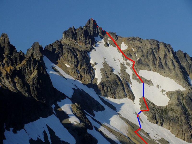
Mary Green Glacier at Bonanza Peak (click for detail). |
July and August 2008 see a pair of county highpointing trips (as with most other summer seasons). However this time I avoid the high cost of returning to the northern tier by leaving my pickup truck in the Billings, Montana long term airport parking lot and flying home between the two journeys.
The July trip features, among other venues, joint climbs of McDonald Peak in Lake County, Montana and of Snowshoe Peak in Lincoln and Sanders Counties, Montana. The former effort is on my 48th birthday, and is appropriately celebrated with a pair of cream pies at our trailhead. Grand Teton is climbed at the trip's conclusion, so completing Wyoming as noted previously. These events and more are described online. The August trip is highlighted with an ascent of Mount Stimson (of Flathead County and Glacier National Park) using a novel eastern route from Two Medicine Lake. It's a mammoth effort, and I am glad it is done as Stimson may be the overall toughest Montana county highpoint. There are five of us, including Greg Slayden, Bob Bolton, Duane Gilliland and Edward Earl. The entire August journey is documented online.
|
|
Bonanza Peak summit (click for detail). |
By now Montana is well-filled with "yellow" and a bit of "blue" on my completion map. Then in summer 2009 I make additional progress on July and August journeys, continuing my habit of TWO summer trips to my home glob's outer edge.
The July journey is highlighted by a climb of Bonanza Peak in Chelan County, Washington - and attended as well by Dennis Poulin, Greg Slayden and Grant Myers. Bonanza Peak is arguably the technically toughest county highpoint in the lower 48 states, combining rock and snow/ice sections on its summit day. In August I drive through Utah to Montana and meet Jim Perkins, a local resident, for his climb of Mount Douglas in Sweet Grass County. It's his penultimate Montana county highpoint, and he will soon enough be the first and only resident to finish its list.
|
|
Blue Glacier at Mount Olympus in Washington (click for detail). |
However this journey's main climb is Mount Olympus in western Washington. It's a significant achievement all by itself, and merits an adequate description. Attendees include Dave Covill, Don Nelsen, Richard Carey and Ken Russell. My overall trip is documented.
A La Niña event dumps a huge amount of snow onto Washington state during the 2009-2010 winter. Worse still for summer plans, the 2010 spring is uncommonly cool and cloudy, preventing snowmelt. So my July 2010 journey's plans are largely foiled, stymied by snow at elevations well below expectation.
|
|
Big Horn final ridge - the Lewis County, WA highpoint (click for detail). |
To salvage the journey I research the 7 remaining Nevada 4,000+ foot prominences yet unclimbed, and succeed at all of them before driving home on my 50th birthday. Details of my overall trip are available.
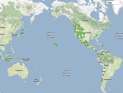
I finally complete Montana in August on Peak X of Missoula County. Included as well is a one day climb of Hilgard Peak and several more 12+ hour efforts. The durations of these climbs, far longer and arduous than found, say, in Colorado, eventually suggest rest days in-between them. A trip report describes the overall journey. Now I have only 14 counties remaining of the 414 western county total. The status of my all-west completion is succintly portrayed by this timestamped map. Thereby in 2011 I intend getting close to a western list finish, with all but a few hold-outs remaining for calendar 2012 in light of the near zero chance for succeeding at 14 peaks without a hitch. However this was not to be.
|
|
Buckner Mountain route - Skagit County, WA highpoint (click for detail). |
|
|
Atop Mount Adams - the final, 414th western USA county. Mount Rainier in background (click for detail). |
Thus in 2012 I am confronted with 9 more counties - 5 in Idaho and 4 in Washington. I plan on a longer-than-normal itinerary, figuring that it's far more efficient to simply remain in Washington for decent climbing weather than to return the next summer for just one or two lingering counties.
The Idaho component is first - and is aided by the presence of Bob Bolton and Duane Gilliland who join me at both "Unnamed 9439" of Idaho County and for Big Baldy of Valley County - the state's only overnight backpack of all its 44 highpoints. Thereby I complete Idaho by July 28 and head into Washington. Where I finish Idaho depends on the elevations of possible contenders for the Idaho County highpoint - both He and She Devil. IF it is someday proven these are indeed both lower than "Unnamed 9439", then I completed Idaho two days earlier, July 26, at Monument Peak of Adams County. Miraculously fine weather blesses my time in Washington, allowing me to complete that state at Mount Adams of Yakima County, and as planned for several years running. This is actually a double list completion, as that impressive volcano is also my final, 57th ultra prominence peak in the 48 contiguous states! Bob Bolton accompanies me despite the workweek, and so is the only other highpointer privileged to witness this over-the-top event - one that occurs most rarely indeed. The Mount Adams climb is described online. There is a summit videotape posted at Youtube. ThusProminence as a mountain measure is richly deserving, a list of prominent peaks being THE big mountains one wishes to climb. Throw aside summit elevation: it fails to account for a peak's vertical relief. Prominence does.
|
|
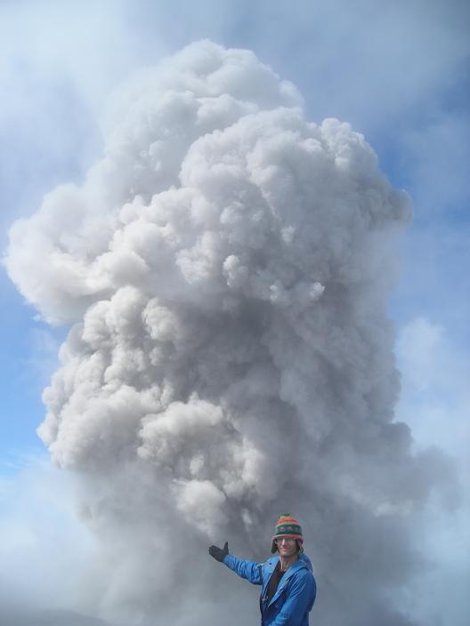
Eruptive gas plume atop Gunung Semeru - Java highpoint and Earth Fifty Finest peak. (click for detail). |
I have written a book, The Finest Peaks, the only publication specifically addressing the prominence subject. It is available for-sale online, and comes as both a black/white and color editions.
I am enamored of travel with climbing as the chief draw. Reports for some of the more notable journeys are provided here.
|
|
Click here for a list of distinct summits attained,
of which there are 1285 as of December 31, 2014.
There have been 1186 distinct summit climbs
involving significant elevation gain on-foot.
Click here for a list of summits revisited,
of which there are 70 such events
(37 doubly-climbed, 4 triply-climbed, one 4 times,
one 11 times, one 13 times) as of December 31, 2014.
Click here for a list of peaks unsuccessfully climbed,
of which there are 54 such events
(48 singly-failed and 3 doubly-failed) as of December 31, 2014.
|
|
|
|
Atop Japan's Fuji-san (click for detail). |
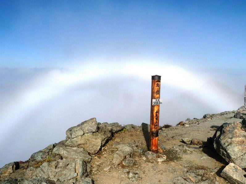
'Glory' - an optical phenomenon atop Kita-dake, Japanese Alps. (click for detail). |
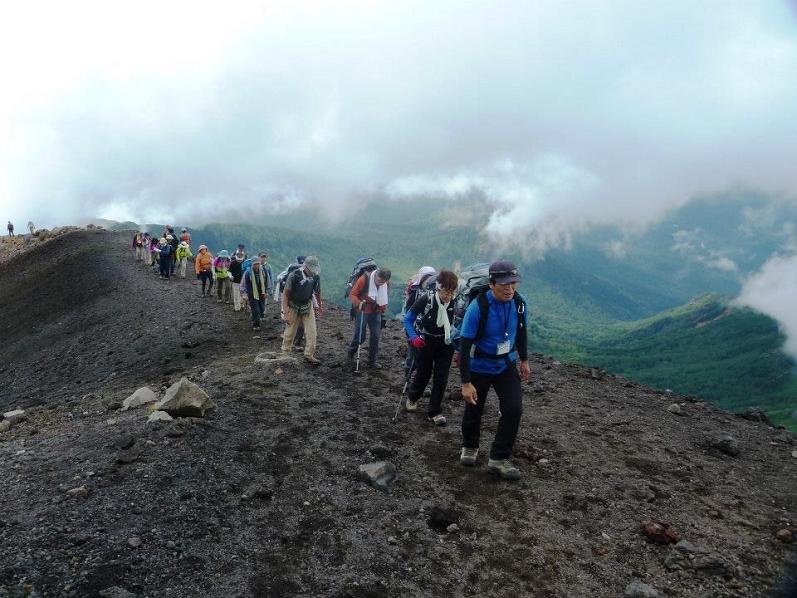
Japanese hikers near northern Honshu's Iwate-san summit. (click for detail). |
I have produced several mathematical analyses directly related to mountains and climbing them.
|
Pico Bolivar summit - Venezuela highpoint (click for detail).
Bushwhack at Mexico's Cerro la Joya, ultra and Querétaro state's largest prominence. (click for detail). |
|
|
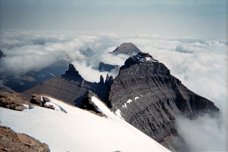
View northeast from Mount Cleveland's summit. Awesome, glacially-scoured topography, such as shown, spurred the formation of Glacier National Park. |