

|
|
|
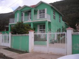
Pretty green home enroute to Cerro la Joya. (BP) |
Regardless, the office staff provides Bob and myself green tourist cards. We fill them out - and they are taken from us! We are directed to a second building, with a bank, where the paperwork and payment for Bob's camper is addressed.
|
| Pemex station decoration (AH) |
The Nogales, Sonora office for international traffic lies fully 22 kilometers inside the country. Does this mean that somebody with business inside Nogales itself is considered to have never entered? Or must they continue south to the checkpoint just to have their passport stamped?
The line barely moves and is outdoors, the metal roof funneling a cold north wind into us. It is absurdly inefficient, dealing with this government crap. There is no competition for services, and so no incentive to improve either worker conduct (I see them laughing and joking rather than waiting on customers) or customer satisfaction (Bob begins to shiver).
After 2 1/2 hours the automobile papers are completed, Bob having returned to the original office with the required forms. His green card in-hand we drive south, noting that I don't have one. Not ever having to fill one out on my previous journeys, I discard this comment as irrelevant. After all, every time Bob and I enter Mexico it seems like the required paperwork changes.
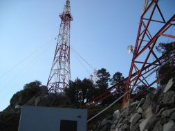
Finding a camp spot after dark is problematic when you are unable to see side roads sprouting from the main highway. We try a hilltop microwave tower approach road and find it is gated near the highway. Eventually we camp on a lonely dirt road to the east. Yet well after sundown, while eating supper, a local man on his motorbike stops. Opening the camper's rear door, I learn that he's part of a community patrol, complete with radio and flashing lights. After some cheap tequila he leaves on good terms, but not before nearly begging for more food and/or cash so that his poor children could have a Christmas gift. We deny him.

|
|
|
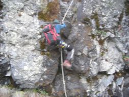
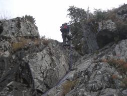
Adam quickly descends the fixed rope at Volcán de Tequila. (BP) |
We camp in the dark corner of a gravel lot behind a government-run Pemex gasoline station. Nobody disturbs us here, although for much of the night big trucks pass by on the highway, some of them stopping as we do for either a break or a complete rest.
Bob's camper makes for very comfortable accomodations. I enjoy greatly the convenience of cooking supper on the stovetop, rather than outdoors (subject to weather), and then actually sitting down at a TABLE to consume it. Happy with our progress I imbibe a bit too much tequila, and, after supper, meander some 100 yards to the station's convenience store. I am obviously "new" to these parts, the store clerk and some kind of watchman immediately following my every movement. Eyes glazed and with a slight stammer, I do my best to maintain composure - even when asked if there's something in particular I seek.
|
| At the Cerro la Joya trailhead. (BP) |
Of course I gravitate to the ice cream chest and get a pair of chocolate-coated chocolate novelties. Under the covers and reading his magazine on humanist thought, Bob is the picture of comfort enjoying ice cream - well deserved after a full day's driving chore.
One concern is whether the gasoline stations would be open on Christmas Day. After all, the vast majority of Mexicans are Catholic. However we easily learn this is not an issue. One unexpected problem occurs when purchasing gasoline. The attendant insists that Bob gave him a one dollar bill when Bob surely recalls it was a fifty dollar bill. Bob admits that he should have simply driven-off at that point. Yet the likely reality is unsettling: he overpaid the man some 49 dollars.
By roughly 2 p.m. we take this diversion north into the community of Tequila as it's the only way to access the cobblestone approach road for climbing the eponymous mountain south of the highway. After some fumbled road navigation we locate the desired Avenida Hidalgo. After the road turns to cobblestone, it crosses under the Tequila community approach road, and then over the main highway.
We arrive at the expected locked gate around 3:30 p.m. with plenty of time to unwind. A family of seven is parked at the only level spot we require for sleeping. Around 5 they return from a hilltop outing, and Bob expertly repositions his camper for the night. The elevation is 8,800 feet - just 700 feet shy of the summit and making for a cool, pleasant evening.

|
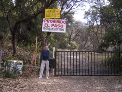
|
| Tequila trailhead with Adam. (BP) |
We hike the summit tower approach road. I speed ahead to explore the tower area, and find an opening through the razor wire fencing where somebody had, illegally or otherwise, busted into the complex. Using it I search for the highest ground - and find it outside the fenced compound!
Quickly I tell Bob that he needn't follow suit. We access the highest ground by hiking around the fenced area's northern perimeter to a white, outhouse-sized shed with a view east to the volcanic plug. Bob hand-levels it to learn that it's surely higher. Damn. Three hours estimated round-trip time.
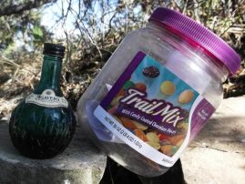
|
|
Tequila summit register with blue liqueur bottle. |
We return via the road to an obvious saddle where according to a previous report a footpath leads to the plug's base. It traverses southeast, and we stop briefly at the plug-comm tower saddle some 300 feet below both.
The first 100 vertical feet is easy. Then comes a black rock band some ten feet tall that seems to wrap around this side's entirety. A fixed rope with knots every foot provides passage. I easily climb using it, and top-out while Bob considers his options. He requests a belay, and, as I remove both rope and harness to that end, he climbs the brief section without assistance.
There follows about 50 vertical feet of Class 2 terrain before the next obstacle. Bob searches to the left, seeking passage within a combination of steep rock riddled with bunchgrass. I search to the right, finding a bolt where some ropes, now removed, were once anchored.
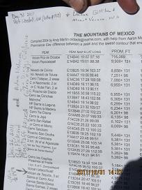
|
|
Summit register - Andy Martin's Mexico Fifty Finest list. Note the four signatures. (DG) |
To my upper left is the preferred route, a fact that becomes obvious only later. Instead I climb to the upper right, towards my skyline, with precious few handholds and a considerable amount of exposure - several hundred feet. It's actually beyond my comfort zone and done only because a highly-valued ultra summit is just 100 feet above me. I liken the difficulty level, and exposure, to the crux rock pitch at Mount Olympus in Washington state.
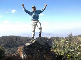
|
| Duane atop Tequila five days later. |
Above this obstacle I traverse left, and find myself immediately above an obviously stout dead horizontal tree trunk. Bob appears some 40 feet below, and we agree that he should use the rope as a handline for reaching the trunk.
With both of us above this rock band we easily hike the remaining short distance north to the highest ground. There is a tree with soil at its base that seems high; and, perhaps 30 feet north, a boulder which is likely the true tippy-top. At the tree Bob constructs an elaborate rock cairn, placing a summit register within. It is a plastic jar, roughly gallon-sized, and contains both Andy Martin's Mexico Fifty Finest list and a tiny yet empty bottle of tequila liqueur of beautiful blue glass.
Bob and I sign the new register, and he back-sights with hand level to verify that we are higher than the summit tower hilltop.
On our descent the tree trunk-bound rope is used again. Bob downclimbs using it as handline. Ater untying the knot to retrieve it, my rope is doubled-over to rappel with belay device and harness. The remaining descent is trivial apart from downclimbing the first vertical rock band.
To Climb Volcán de Tequila (ultra prominence)
Location: 20.78827° N, 103.84244° W
50,000:1 chart F13D54 "Tequila"
From Mexico Route 15D about 30 miles west of Guadalajara exit north to the Tequila community. Within town, turn left (west) to locate Avenida Hidalgo at (20.87381° N, 103.84230° W). Take this cobblestone road south for 2.3 miles as it first passes under the northbound entrance road and then over the main highway. From that highway overpass it is 7.8 miles to a locked gate at (20.79219° N, 103.85361° W), elevation 8,796 feet. Park. Allow one hour from Tequila.
|
| Adam rappels the upper rock band. (BP) |
Walk the road to a junction at (20.79089° N, 103.84946° W) and bear right (south). Continue until you see an obvious saddle at (20.78950° N, 103.84820° W) a few hundred feet to the left (east) and about 50 feet above the road. Go to the saddle and locate a trail trending to the right heading for the volcanic plug. Take the trail as it sidehills to the communication tower / volcanic plug saddle at (20.78779° N, 103.84416° W), elevation 9,302 feet. The climbing begins here.
|
|
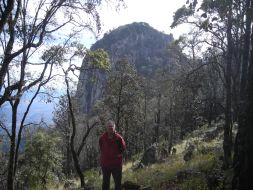
Bob and the volcanic plug. Route is near its right skyline. (BP) |
Follow a path for about 100 vertical feet (Class 2) as it winds around a large rock mass on its north side. Here is a 10 foot band of vertical black rock. There is a fixed rope with knots every foot. There follows about 50 feet of Class 2+ terrain. Stay generally to the right until the base of a moderately-angled (45°) set of rock slabs with few handholds.
Note the dead horizontal log about 30 feet above. That is your goal. A rope may be required (Class 3+ or 4). Once above this section turn left (north) and reach the top on easy terrain. The highest ground is likely a boulder at the summit area's northern end. Return south about 10 yards and sign-into the summit register hiding within a moderately large rock cairn near the base of a tree.
Return the ascent route. Total elevation gain is 800 feet. Allow 3-4 hours round-trip to the locked gate.
Back in civilization and hours later, meeting Duane and Rob in Ciudad Guzman is not trivial because the roads have been rerouted, with construction zones, that obliterate our Google Maps data. They have arrived later than desired, having first visited Guadalajara to see if their rental car could be improved upon.
Somehow Rob figures out how to leave town, and we begin the Nevado de Colima approach road around sundown. It's in much better condition compared with Bob's recollection from some twenty years ago. We arrive at a locked gate and gain passage for the remaining 4 kilometers after paying 25 Pesos per person.
Our camp is at 12,300 feet elevation, perfectly positioned for a morning climb of this major mountain with some 8,800 feet of topographic prominence - indeed, the third most prominent in all Mexico.

|
|
|
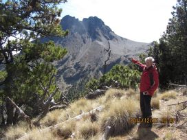
Bob points to Nevado de Colima. The right (south) summit is higher. (DG) |
Sometimes a compromise is required between an early arising and the benefit of eight hours sleep, and in such cases a discussion arises before agreeing on a specific leaving time. Today, for instance, we initiate the climb by hiking on a road; and so may begin conveniently early to hedge against unforeseen events later in the day.
We reach the road's end at a bevy of communication towers and maintainance facilities. Without detailed route information we hike its switchbacks, and top-out at the highest towers along a narrow rock ridge. Clearly we should have left the road lower down!
|
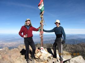
| Rob (left) and Adam atop Colima. (DG) |
After descending the rock band we follow tracks to the southern flank of the two obvious peaks. The going is slow from both sandy terrain and the altitude. Nearby Volcán de Colima is at roughly the same elevation, and poses a striking figure just 3 miles south.
At 13,500 feet we are led into a broad gulley where the route is suddenly not obvious. You would think that after hundreds of people have climbed it, and with the Internet, somebody would have the forethought and goodwill to describe the way. Nope. We have to guess which way to turn, and guess correctly that it's to the upper right (northeast).
Here we cross over into another drainage at some 13,700 feet. It's the obvious way, and we can verify that with an obvious gulley above us extending 200 vertical feet to a saddle. From the saddle we see the summit within a stone's throw to the west, and so hike there on easy terrain for a wonderful, 30 minute break with shirtsleeve weather!
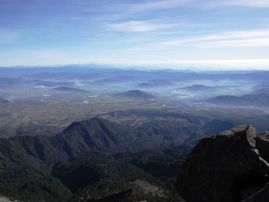
|
| Nevado de Colima summit vista |
It's a gloriously good time, and we generally feel OK except Rob who requests aspirin for a mild headache. The views are spectacular, Colima's considerable vertical relief serving admirably. Rob shares an eight-inch round confection with pumpkin seeds and other nuts that I bought early-on.
On the descent we avoid that rock band, heading directly for the road below where it switchbacks to access the communication facilities. Soon after Bob Packard appears, hoping to climb what might be a "P300 summit", i.e., a hill with at least 300 feet of prominence. Rob and Duane join him while I return directly to the camper.
Rob Woodall's Nevado de Colima trip report and photo album
To Climb Nevado de Colima (ultra prominence and Jalisco state highpoint)
Location: 19.56305° N, 103.60853° W
50,000:1 chart E13B25 "Ciudad Guzman"
Southwest of Ciudad Guzman leave the paved highway at (19.63283° N, 103.52959° W) and
zero the odometer. Drive 10.7 miles to a lower gate and pay 25 Pesos / person for continuing
an additional 4 kilometers to an upper gate with camping facilities. Park here at
(19.58232° N, 103.61518° W), elevation 12,312 feet. Allow 1 hour 15 minutes for the
13.5 road miles.
Hike the road generally south and east until just under a series of communication facilities.
Leave the road at a switchback (19.56493° N, 103.61707° W), elevation 13,054 feet,
taking a footpath bound for the southern of two obvious summits.
Ascend the path on stable scree to (19.56269° N, 103.61074° W) at 13,404 feet.
Now ascend to the right until the base of a broad slope at 13,500 feet.
Climb this slope, the peak's south face, for some 300 vertical feet, trending to the right skyline.
At the skyline descend a few feet into the next drainage (19.56195° N, 103.60860° W) at 13,812 feet.
You are at the base of a gully. Ascend it for 150-200 vertical feet to top-out at a 13,963 foot saddle
(19.56251° N, 103.60824° W). Turn left (northwest) to summit at (19.56305° N, 103.60853° W).
I measure 14,030 feet with GPS device.
Return the ascent route. Class 2+. Total elevation gain is 1,700 feet. Allow 4-5 hours but more time if unacclimatized.
We return to Ciudad Guzman for shopping. However the first of several tire problems with Duane
and Rob's rental forces us to get it repaired. These tires are simply not up-to-snuff for driving
the rocky roads we must negotiate. I get an ice cream bar - and suddenly, as I talk to the repairman,
everybody else gets them as well from an OXXO convenience store across the street.
So it is that we drive towards our next goal later than expected. Hours after, well beyond sundown
we find ourselves parked just before a bridge crossing this minor stream. We cannot find a way to
cross it except via the bridge, followed by backtracking to where we likely have to bushwhack
straight upslope to encounter an old logging road grid. It looks unsavory - and unlikely to succeed.
Furthermore, Bob is worried about his vehicle's safety: we have passed many run-down shacks -
and so by now the entire area knows that we are here.
The likelihood of vandalism is considerable while we are gone for the whole day.
So I drive with Duane back to the last home. Just beforehand we meet a teenage boy and his mother
on two horses. I describe our plans, and, remarkably, he replies in English! So I talk directly to
the father, one "Hector", who agrees to guard our vehicles at his home. Cash is not mentioned.
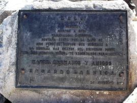
Nevado de Colima summit plaque
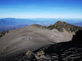
Rearward view of the Colima
route from about 13,400 feet.
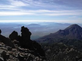
Volcán de Colima from
the Nevado de Colima route.
Wednesday, December 28 - Cerro las Capillas

|
|
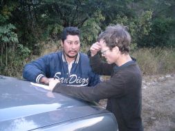
Hector (left) and Adam discuss available route options. (BP) |
Hector describes a route, penciling it on paper, which has us ascend the valley, heading south, until a major dirt road is reached at a cabin. At that point we can walk the road east, a road which, in his translated words, is of highway-like quality.
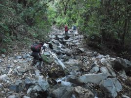
We set-off at 7:37 a.m., quickly finding the road largely destroyed from erosion. Two or three stream crossings are required. At one point we cannot find the continuation, and waste maybe 20 minutes, or even a half-hour, searching in vain. My hopes for a summit are now very slim.
|
| When in doubt take the riverbed. |
Suddenly Rob finds the road's continuation by backtracking roughly 100 yards. That's a welcome relief! We continue, the skyline saddle seemingly never within our grasp. Finally the terrain eases, with the gradient as well, and in the ten-o'clock hour we reach this cabin with a nearby, well-maintained road heading exactly in the desired direction!
However this windfall is illusory. The road is very very convoluted, and, after wrapping around a prominent hill, descends 700 feet to a saddle. It is already 1 p.m. and we have only gone one-half the ground distance to our goal. I fill a liter of water at a lucky stream before continuing.
The hours drag-on endlessly as we inch our way to the top (in an air distance sense) along this sinuous road. Finally we summit around 4:40 p.m. with only about two hours of useful daylight. Views are negligible. However there is a group of structures only a few hundred feet southwest, and as originally discovered with Google Earth satellite imagery.
|
|
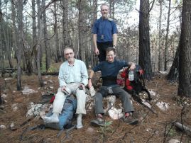
Capillas summit with Duane (left), Adam and Rob (standing). Taken by Bob with Rob's camera. |
It's clear that we'll be walking the road in darkness. To myself at least, and hopefully to others as well, it is simply too risky descending the final 4 miles without daylight. So I resign myself to a night at the cabin with neither supper nor sleeping bag. I eat my summit sandwich realizing that it must now serve the role of "supper" instead of "lunch".
We return to the stream around 7 p.m. in complete darkness. Here we agree to sleep until somebody wakes up cold; whence we shall continue, now uphill, that thankless 700 vertical feet. It's a bit surreal, walking like half-sentient zombies with personal bright lights under the tree canopy. Shortly after topping-out we take another nap, lasting again for about 45 minutes. There is yet a third nap around 11 p.m. or so...

|
|
Rob Woodall (left) and Bob Packard fireside before dawn. (DG) |
At 1 a.m. in the morning we arrive at the cabin. There is a hardpacked dirt floor inside, and everybody lies down only to find that it's simply too cold for comfort. Bob is the first to discard it, and builds a fire at 2 a.m. which he tends for the night's balance.
Meanwhile I have loaned an orange space blanket, essentially an emergency item for just such an instance, to Rob. Although I am not particularly cold, I cannot sleep because I desire getting on my side - and that's uncomfortable for me without some object, preferably a soft pillow, between my knees. So when Rob offers to share my space blanket I squeeze inside ... and BOY is that unwelcome! We are sandwiched so tightly that one cannot move without the other's cooperation. Perspiration is lining the bag's interior, and, being cold to touch, I keep hands on my chest instead.
It's surely among the top five worst nights of my life. Somehow I am not hungry even though, of all possible times when plenty of calories are required, this is surely one of them - after some 15 hours of hiking with 27 miles and 6,000 feet of elevation gained. Yet no supper.
We agree to continue at daybreak.
Rob Woodall's Capillas trip report and photo album

|
|
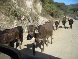
| After the Capillas effort. (BP) |
Soon after 9:30 a.m. we return to a set of shacks a few hundred yards north of our trailhead where one nearly toothless man seems to live. Hector is there with our rental (such that we do NOT have to walk another two miles). Yet, sadly, we see a tire sitting along the car's side. Our hearts sink - yet another tire has been punctured.
Hector reports it happened soon after he started driving back home. He has replaced it with the spare, and after we all get to his house, is compensated for this service as well as guarding our vehicles.
To Climb Cerro las Capillas (ultra prominence)
Location: 19.55500° N, 104.14750° W
50,000:1 chart E13B23 "El Chante"
From El Grullo, a major community, drive south to El Chante and then through La Cidrita. Continue south, passing rustic homes, and camp at (19.60797° N, 104.20516° W) 100 yards north of a bridge and at 4,849 feet. Waypoints provided in the Google Earth file are of value getting to this location.
You may be able to drive another kilometer or so farther south, stopping at our 5,150 feet trailhead a few hundred yards south of a few shacks shown on the topographic chart.
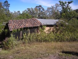
|
| Cabin where route shifts east. (BP) |
Hike the deteriorating road south. Two or three stream crossings have destroyed vehicle access - even an ATV is useless here. It is about 4 miles to a flat, open area with building at (20.55819° N, 103.23454° W) and elevation 6,743 feet.
Just south of the structure is a graded dirt road in excellent condition. It remains to explore a southwest approach, from El Durazno, using this road. According to Hector, a key is loaned upon contacting the relevant authorities to open a gate lower down. IF this plan succeeds one might drive nearly to the summit depending on road conditions below the structure to its west.
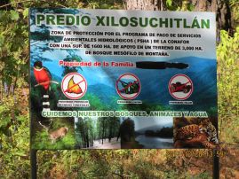
|
| environmental protection (DG) |
Hike the road east as it ascends and winds around a major subpeak before descending 700 feet to a broad high valley. Bear right (east) at (20.56103° N, 103.20371° W), elevation 7,808 feet onto a second road. Stream water is available shortly thereafter.
The road is very convoluted. Indeed, the trailhead to summit air distance is 5 miles while the one-way hiking distance is 15.5 miles.
Leave the road just 1,000 or so feet west of the top, heading cross-country in pine forest. At the top I obtain (19.55503° N, 104.14750° W) at 9,375 feet with GPS unit.
Return the ascent route. The suggested route requires an overnight backpack as the round-trip distance is 31 miles with a 6,100 foot total elevation gain.
Rob Woodall's Capillas trip report has an extensive set of instructions including many GPS-derived waypoints and a complete GPS track.
We return to the nearest community, El Chante, and waste considerable time trying to effect repairs. By this point everybody but myself has had the chance to feed themselves as I have to arrange the repair process and remain with the (inept) repairman as he toils under the rental.
We give up on his services and drive to the far larger city of El Grullo. However I cannot wait to eat, my hunger so considerable that I am getting a headache. While Bob's camper is in-motion I prepare and eat a pizza on his stovetop as "breakfast". It's exacting business, as an open flame is involved along with frying pan. The only thing worse, as I was to learn later, is urinating into a bottle while in the moving camper.
Tire repair is effected in El Grullo. Others get more cash from a nearby ATM. It's already about 1 p.m., again, considerably later than we expected for this point in our itinerary. We drive back through Ciudad Guzman and then encounter very slow going for the day's remainder. Unable to reach our next goal at a sane hour, we stop for the night at an industrial park I happened to locate in my peripheral vision as we drive south from Zamora de Hidalgo to Uruapan.

|
|
|
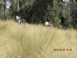
Tall Bunchgrass impedes both movement and visibility. (DG) |
We are fortunate driving to 9,700 feet elevation and a mere one-half air mile shy of this power transmission line forest clear-cut. However Bob's camper cannot pass under a flexible water pipe to park until we lift it manually. We quickly prepare our packs and are "off" at roughly 10 a.m.
The climb proceeds west with the original intention of following the forest clear-cut. However it appears strewn with fallen trees and rocks lower down. Therefore we head generally upslope, trending a bit north, and going through this annoyingly thick bunchgrass which prevents viewing one's feet.
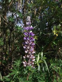
|
| lupin inflorescence |
We top-out on a ridge at 11,500 feet and then head southwest to where the power line crosses the ridge at some 12,100 feet before it descends into a valley immediately east of a massive communications complex. Rather than descend we laboriously follow the ridge as it trends west, sidehilling at first to avoid an obvious rock massif. This latter route choice was a mistake ...
At the communications area we skirt around a large rock massif on its southern edge with a short rock scramble to reach the summit ridge to its west. The roughly level ridge is taken, thence it descends maybe 75 feet prior to a final 200 foot ascent to the highest ground.
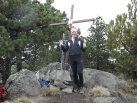
Rob and I top-out first, and he celebrates this 100th ultra peak amid handshakes and some halfway decent views. Rob breaks-out this extremely sweet, heart-shaped caramel fudge confection that I purchased while driving south - and we each get to tear off a chunk sized as desired. I save some to have with hot chocolate later...
|
| Rob Woodall's 100th ultra! |
The descent route differs by going into the valley due east of the towers, following a road for a good fraction of the distance back to the aforementioned 12,100 foot saddle, one reached with perhaps 150 feet of reascent. Thereafter we generally use the power transmission line as a guide, gingerly finding the bare areas between bunchgrass patches.
Luckily we leave the bunchgrass before darkness, hiking the final portion just after sundown. Unfortunately there is another tire puncture with the rental vehicle. It must have been releasing very slowly throughout the day. Therefore we conclude there's enough time to eat supper a few miles down the road without first racing to a repair shop.
We spend the night just short of Uruapan in the back lot of a gasoline station after gaining the operator's permission.
Rob Woodall's Tancitaro
trip report
and
photo album
To Climb Cerro Tancitaro (ultra prominence and Michoacan state highpoint)
Location: 19.41648° N, 102.31950° W
50,000:1 chart E13B39 "Uruapan"
Drive southwest from Uruapan and leave the highway at logical 21.5 km - halfway between the 21 and 22
kilometer markers. Drive 7.7 miles to park east of the peak at (19.41753° N, 102.27393° W),
elevation 9,696 feet. Waypoints in this Google Earth file
are of considerable value getting here.
Hike generally west a combination of minor roads and cross-country to the base of a power transmission line
at (19.41675° N, 102.28317° W), elevation 10,283 feet. If feasible, climb the slope directly under
the power line, topping-out at an important saddle (19.41878° N, 102.29807° W), elevation 12,114 feet.
If not practical to go straight upslope, ascend to the right and hit the ridge at (19.42204° N, 102.29233° W),
elevation 11,504 feet. Ridge-climb to the aforementioned saddle.
Descend west into the valley, losing 150 feet of elevation rather than continuing briefly west
and then north on the ridgeline. Sidehill a bit and then hike a road to just east of the antenna complex.
Ascend to the communication antennae.
Now take the ridge heading west, first by skirting around a rock massif to its south side
with a short Class 2+ section. The ridge is level, then loses about 75 feet elevation before
gaining 200 feet in the final summit push. At the top I obtain
(19.41648° N, 102.31950° W) and 12,640 feet elevation with my GPS device.
Return the ascent route. Class 2+. Total elevation gain is 3,400 feet. Allow 8 hours for the 8 mile round-trip.
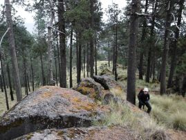
Northeast ridge leading to
12,100 foot saddle. Adam.
Saturday, December 31 - Cerro El Zamorano; Tequila again


|
|
Cerro El Zamorano's northern boulder is likely highest. (BP) |
Rodulfo Araujo had recommended Barbacoa Santiago, and we divert slightly from the optimal route to have a sit-down restaurant meal. Unfortunately holiday crowds have inundated the establishment, and so we settle on a nearby place that does not hold a candle to it. However we do have corn tortillas filled with meat, accompanied by excellent bean/corn soup, and with an array of condiments such as sliced onion, cilantro, fresh lime, and hot salsa. Bob has coconut ice cream in a coconut-shaped bowl, and I have tequila ice cream in a coke-bottle-shaped container.
The turnoff for reaching Zamorano's summit access road comes most unexpectedly as one enters the final, nearest community. Details are provided in the route instructions. After paying the 50 Peso fee we drive the four miles in 53 minutes to park at the base of a vertical rock cliff face - and at the (upper) fenced entrance to a radio communications facility.
|
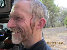
| Rob after his agave encounter. (DG) |
We pass the fence and climb orange stairs about 100 feet to a narrow white building. Here we mistakenly turn left, walking a faded road and then turn sharp right to scramble up Class 3 rock to the summit area.
We explore the top, deciding that the northernmost of several boulders is highest - one that buttresses and supports a tin metal roof. It is here that I discover the correct path "up" by going south on a narrow, artificial walking path with either wood or plastic ties, and then down about 300 feet of rock stairsteps carved into the mountain itself. This brings me back to the southern end of that long, white building - whence the way down is obvious via the orange staircase system.
Bob and I descend the cobblestone summit road, pass through the gate, and then camp maybe halfway down the largely paved approach road leading from the main highway uphill and northeast to several communities.
Meantime Duane and Rob climb Tequila, using the same dead log that Bob and I employed. Rob is attacked by a rogue agave plant on the communication hilltop to plug traverse. Much later they get a moderately priced room in Guadalajara and enjoy restaurant meals.
Rob Woodall's Tequila trip report and photo album
To Climb Cerro El Zamorano (Guanajuato and Querétaro state highpoint)
Location: 20.93340° N, 100.18021° W
50,000:1 chart F14C56 "Colon"
Turn off from Mexico Route 510 at (20.80750° N, 100.18108° W) and drive north-northeast on pavement.
From here is it 12.0 road miles to a
locked gate,
where a 50 Peso fee is levied by the locals.
To get there, drive to a key junction within Los Trigos community at (20.90484° N, 100.21118° W);
and, unbelievably, take the left fork here even though it leads to only a bunch of homes.
Drive about 800 feet and stop at the gate.
Once permission is granted pass through the gate (a right fork) and drive the cobblestone road 4.0 miles
to the second (higher) of two locked gates preventing entry into a large communications facility.
Allow 40 minutes for the drive, one with multiple tight switchbacks. High clearance is not needed.
I obtain (20.93247° N, 100.18134° W) at 10,636 feet for the upper locked gate - your trailhead.
Without wearing a pack slender teenagers and small children can squeeze-by the gate's left (hinged) side.
Adults must generally detour left and ascend the slope as it abuts the high angle rock.
Take the orange staircase 100 vertical feet to a long, white building. Walk south to its opposite end
and ascend rock-carved stairs some 300 vertical feet to the summit area's south end.
Walk north on a gently inclined artificial ramp to summit boulders on your left (west) side.
The highest natural ground is likely the northernmost boulder, one which supports a tin roof
and west of the communication towers.
It lies 20 yards north of the middle boulder, one which might be the highest ground and requires
a bit more than tourist-mode to surmount.
It is nearly certain this elaborate infrastructure exists for the radio workers - not peakbaggers.
As such the legality of accessing these facilities is unknown. However we saw no signs prohibiting activity.
Return the ascent route. Total elevation gain is 400 feet. Allow one-half to one hour round-trip
from the locked gate, and several times longer than that from Route 510 as the driving portion.
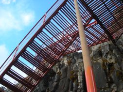
radio worker's orange stairs (BP)
Zamorano summit
communication towers (BP)

|
|
|
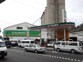
Mexico peakbagger essentials - Pemex station and supermercado. |
Rob and Duane have made good progress heading northeast from Guadalajara, and are set to meet us by 1 or 1:30 p.m. at a Pemex gas station where Bob and I have been waiting since roughly noon. A delicous lunch is eaten (including store-bought hot dogs), and minor chores are performed so the time is not wasted.
There is clearly insufficient time for Cerro Grande, highpoint of San Luis Potosi state and with over 4,000 feet of prominence. It was added to the itinerary at a time during planning when it was believed that two Part I ultra peaks would be unavailable. However only one such ultra was cancelled in-practice. Hence the total peak count is as originally conceived even with Cerro Grande's cancellation - and I for one can live with that result.
|
|
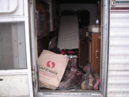
Bob's camper floor after the San Onofre approach. (BP) |
We caravan east through Doctor Arroyo to hike Picacho San Onofre the next day. In theory we don't have to drive there so soon because it's only a short effort. However I suggest we go there now anyway to hedge against unforeseen events.
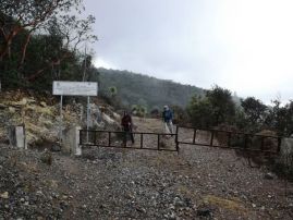
I am correct - we encounter a locked gate well north of the mountain at 9,000 feet, and we carefully back-down the road to camp at a broad, flat saddle 200 feet lower still. From here Rob estimates it will be 20 miles round-trip upon inclusion of nearby Cerro Peña Nevada.
Given that it's a road hike for much of the distance, Bob and I will arise at 4 a.m. and walk at 5 well before first light. Then, Rob and Duane will start later. To this end (and somewhat ironically as I provided him the coordinates!) Rob keys into my GPS unit the waypoints required for traveling independently of him.
I make sure to get enough for supper, and pack with plenty of food for yet another full day.

|
|
|
Locked gate and the implication: walk 20 miles. |
We leave the main road at 11,300 feet about one-quarter mile north of the San Onofre summit. The final 400 vertical feet is cross-country through pine forest while fog and low clouds preclude a warm morning - and making for more "interesting" navigation.
The summit area is most broad, and we have trouble deciding exactly where the highest natural ground is located. For some reason I am plied with food from everybody: a mini cinnamon roll from Duane; a chocolate éclair piece from Rob; and something else from Bob. It's an interesting "conspiracy" (although most likely a pure coincidence); and I eat almost nothing which I had brought for this top.
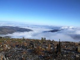
|
|
Cloud layer below us while atop San Onofre. |
With the weather still refusing to cooperate we descend southwest, and encounter the main road as it winds around the east side of a southern subpeak. The road descends several hundred feet as it travels south, then west, then south again to a saddle at the northern flank of Peña Nevada. We stop at a sitting log, cache water (food too for Bob), and climb the peak with a set of zig-zags to avoid deadfall on the upper slopes.
A fence is passed only about 100 vertical feet from the top. I reach it first, and am delighted to find definite proof that Cerro Peña Nevada is the Tamaulipas state highpoint in a rusted metal sign! This is very important news as it means the ridge of Cerro El Borrado, which Bob and I climbed three years earlier to that end, is NOT the highpoint after all.
About 1,000 feet south is another subpeak, and Bob's hand leveling suggests that it may be one or two feet higher. We walk over there, and find no evidence of any previous climbing activity. Depending on whether this southern bump is higher, and whether it lies in Tamaulipas to begin with, the Tamaulipas state highpoint is either the northern or southern summit of Cerro Peña Nevada.
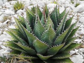
|
|
Agave at San Onofre. How soft and cuddly! |
We now have lunches at the northern bump's summit windbreak, the weather still wavering between cold fog and warm sun. We descend just after 1 p.m.
The uphill walk back to near San Onofre is unwelcome indeed. This time we skirt around the summit's western slope by remaining on the main road as there's no longer any need to visit the top.
Just after a 2 p.m. rest break it begins to rain. It's not a hard rain, yet enough to make us go quickly. My glasses are soon so wet they are useless, and I place them inside a zippered pocket. We cover the remaining distance in only 1 1/2 hours as our ground speed must have been 3 1/2 miles per hour.
My right leg begins to hurt from the pounding motion downhill, in the exact same location that thwarted my Denali bid last June. I take aspirin, and, for the final mile or so borrow Duane's trekking poles. I end the hike both wet and in pain.
Rob Woodall's San Onofre / Peña Nevada
trip report
and
photo album
To Climb Picacho San Onofre (ultra prominence) and Cerro Peña Nevada (Tamaulipas state highpoint)
Location: 23.80049° N, 99.84649° W (San Onofre) 50,000:1 chart F14A17 "Zaragosa"
From Doctor Arroyo follow waypoints provided in the
Google Earth file
to reach an 8,848 foot saddle at (23.83117° N, 99.86776° W). Camp here.
Hike south on the obvious road. After 0.2 mile is a locked gate on an incline
which explains why the recommended trailhead: one cannot find level ground at the gate to park - let alone sleep.
Hike past the gate and, ignoring all minor side roads, continue to (23.80477° N, 99.84666° W)
at 11,208 feet. This is just one-quarter mile north of San Onofre's broad summit.
Hike south in conifer forest to the top.
For Peña Nevada go southwest to intersect the main road. Hike the road south as it passes
to the east of a San Onofre subpeak and then loses elevation as it winds clockwise to the west.
Eventually the road leads south again to an obvious saddle at the north side of Peña Nevada.
Saddle coordinates are (23.78097° N, 99.86092° W), the elevation about 10,700 feet.
Climb the north and/or northeast slopes to the northern of two summit (3,500 meter) contours.
About 100 vertical feet below the top there is a fence which may represent the state boundary.
The northern summit contour has a large windbreak and rusted signs denoting the boundary line.
Walk south perhaps one-quarter mile to the southern summit contour and return to the northern bump
for lunch and contemplation of which bump is highest.
Return the ascent route. Class 1. Total elevation gain is 4,400 feet. Allow 10 hours for the 21 mile round-trip.
At the camper I recommend that we not soil the floor with muddy boots. So we remove and place them into
paper shopping bags before entering. We change into dry clothing and depart immediately afterwards.
It is already dark when we get into Doctor Arroyo. The rental car's front right tire is dangerously low.
Thereby we stop at a Pemex where the tire is losing air at an alarming rate with a noisy hissing sound.
I recommend a vulkanizadora spotted by chance two blocks earlier. The man in-charge there demonstrates
how the tire is not repairable. Duane and Rob buy a second-hand tire for a total of 900 Pesos which includes
the labor and a minor fix to the left front tire which is leaking air slowly - some seventy dollars.
The tire's diameter does not match its left companion, and yet the vehicle will surely get to Mexico City
with this minor deviation from symmetry.
I am quite hungry by now, there being no restaurant in-town, and only jelly beans in the front cab.
We drive onwards into the darkness, stopping at the same Pemex where we met 30 hours earlier
because an extra-delicious ice cream bar variety is for-sale and by agreement we'd stop here just for that
even if not for anything else! I eat one immediately as dessert - as does Bob.
However there's a huge, dark and largely empty lot behind the station where we find it convenient to camp
for the night. It's already 8:30 p.m. and so time to have supper and call it a day. As usual before retiring
I suggest a departure time so everybody is synchronized for the morning drive.
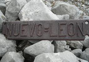
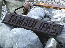
Peña Nevada's north summit -
Nuevo Leon is *here*... (BP)
...and Tamaulipas is *here*. (BP)
23.77028° N, 99.86087° W (Peña Nevada)
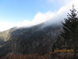
Peña Nevada wrapped in lifting fog. (DG)
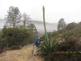
impressive agave spike and Duane (DG)
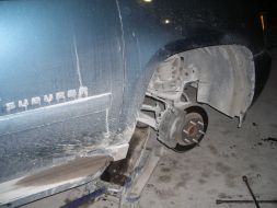
Absent front right tire for
Rob and Duane's vehicle. (BP)

|
|
|
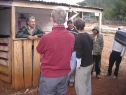
Leo far left; Rob and Adam next; local boys far right. (BP) |
We arrive in Lagunita San Diego around 3 p.m. at the mountain's base. I approach two men and ask about that peak behind us. They deny that's our goal, claiming that "Cerro la Joya" lies elsewhere. Thereby I summon Rob who confirms that his GPS unit points directly to the nearby summit.
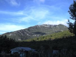
|
| Cerro la Joya from town. |
The younger man says years ago he walked a road around to the mountain's opposite (north) side. Encouraged, I then learn there's cliff bands above the road's end - and that it gets no higher than perhaps within 500 vertical meters (1,600 feet) of the top. Forget THAT idea.
We look at the mountain's south aspect. Clearly, thick brush is THE major impediment. Furthermore, cliff bands break the slope into climbable sections and impassible ones.
Bob is discouraged, says he will not come even if the rest of us do try.
Tough call. I'd certainly not attempt this peak alone. Yet a certain psychology operates when a bunch of grown men are mindlessly set on a goal. Call it "herd mentality", call it what-you-will: I don't think any among us wants to back-down amidst the potential downsizing others might then make of his initiative and drive.
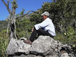
|
| "Pole" the uncle |
So we decide to give it a try, going straight up the south slopes and then divert in an ascending traverse to the left skyline avoiding cliffs on an as-needed basis.
We arrange for the two men to join us in the morning with a 7 a.m. departure. I don't provide an exact cash amount, only stating that,
"Te lo aseguro que vale la pena." - "I assure you that it will be worth the effort".
Then Bob creates a dilemma: he suddenly wants to go. Rob, Duane and I feel this is a mistake because there's only 11 hours of daylight and Bob will not be able to climb and descend in that timeframe given our experiences of the past several efforts. In fact, we don't know if anybody can!
I explain this to Bob, and he insists on coming anyway - but will turn around if he cannot maintain
a pace needed to summit in six hours, namely 550 vertical feet an hour. Sounds fair to everybody.
Wednesday, January 4 - Cerro la Joya

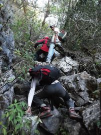
|
| typical bushwhack scene |
We reach the mountain's base in about one hour and follow a rudimentary path for another one-half hour. Then it's up to us. I get the feeling Pole knows no more about the route than we do, and is simply there to "muscle-in" on the payment schedule.
Progress is slow indeed. However it's steady and even encouraging when we reach the summit ridge after about four hours. We now turn right (east) and head towards the top still one kilometer distant. Remaining on the ridge is problematic owing to sharp limestone rock formations. We eventually leave it, as I temporarily lead the group down this Class 4 section which in hindsight seems unduly tough given multiple other options.
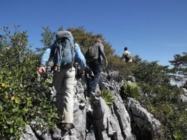
|
|
Summit ridge with sharp limestone projections. |
The summit area is somewhat level, and it's hard deciding which of two or three boulders is the very highest because heavy foliage blocks views between them. We stop at a bare area overlooking the northwestern horizon and have a well-earned lunch. Food is shared, including the men's (cold) burritos filled with the barest amount of eggs or potatoes.
A summit register is emplaced some 30 feet north of what I view as the highest bouldertop. Bob creates the register with a cleaned apricot jam jar. Inside is a printed copy of the Mexico ultra list web page at peaklist.org; plus a paper with the peak's identity ("Cerro la Joya"), the date as "4 Enero 2012" ("January 4"), and our seven names.
We have four hours until sunset - enough time to at least get back to the rudimentary cow path. However Bob becomes increasingly sluggish. Later I learn it's because he was getting dehydrated - and yet I don't know how much water he had brought for the day.
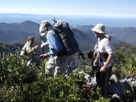
|
| Duane / Leo summit handshake |
We reach the cow path in darkness. That's problematic because the three local men do not have headlamps. Still, a half-full moon helps somewhat. It is not until 8:15 p.m., just over six hours from the top, that we return to the village and our waiting vehicles.
Payment is swift, Bob remaining true to his $100. Duane contributes $60 while Rob and I add smaller quantities. I share tequila with all three local men before they return home, and then enter the camper for supper and bed. Sleep is nearly immediate after yet another action-filled day.
Rob Woodall's Cerro la Joya
trip report
and
photo album
To Climb Cerro la Joya (ultra prominence and Querétaro state largest prominence)
Location: 21.43095° N, 99.13234° W
50,000:1 chart F14C39 "Ahuacatlan"
From Jalpan drive 33 miles east on the main highway to a junction at (21.27384° N, 99.15792° W).
Zero the odometer and turn north. The first 7 km are paved as of January 2012. Use waypoints in this
Google Earth file to navigate past several communities,
eventually stopping in Lagunita San Diego after 17 miles and southwest of the summit.
Locate the green home of Leo Aguillon at (21.39609° N, 99.15757° W), elevation 6,273 feet.
This is your trailhead. Make arrangements for Leo to guard your vehicle (he knows some English),
and possibly for local assistance hacking a route (our path will doubtless be useless in a few years
as brush grows back).
Using a trail well-known to locals, hike around the west (left) end of a small hill to reach the mountain's
base after about one hour. There is perhaps a 200 foot elevation loss at the hill's far (north) side.
A cow path continues for another half hour trending northwest.
A general plan for the (now) cross-country bushwhack is to hit the left main ridge
without being fumbled by limestone rock formations which riddle the slopes. Importantly, stay within the
drainage left (west) of the side-ridge descending south to (21.41800° N, 99.14030° W).
We reached the summit ridge some air 1.1 kilometers from the top at roughly (21.42400° N, 99.14140° W)
with 8,900 feet elevation. There is no reason to believe that hitting the ridge elsewhere provides additional benefit.
Once on the summit ridge turn right (northeast) and either negotiate the rock pinnacles or drop down into the
brush and parallel the ridge 20 feet underneath it.
The summit is heavily vegetated, and there are two or three possible highest boulders, all of which are
lower than your head. A bare patch lies on the northwest side, affording views in that direction.
The apricot jam summit register lies 30 feet north of what I deemed the highest boulder.
Return the ascent route. Class 3. Total elevation gain is 3,700 feet. Allow 11 hours for the 9.4 mile round-trip.
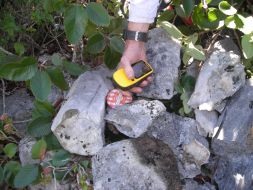
Adam obtains a GPS reading
at the new summit register. (BP)
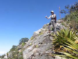
A happy Adam starts down. (DG)
(That average speed is indicative of the route's off-trail difficulties.)
So concludes Part I. Six ultra peaks have been climbed along with five state highpoints owing to overlap in their respective lists. Importantly, we are most pleased at having earned a perfect record. I for one already consider the overall trip a success.