
|
|
|
|
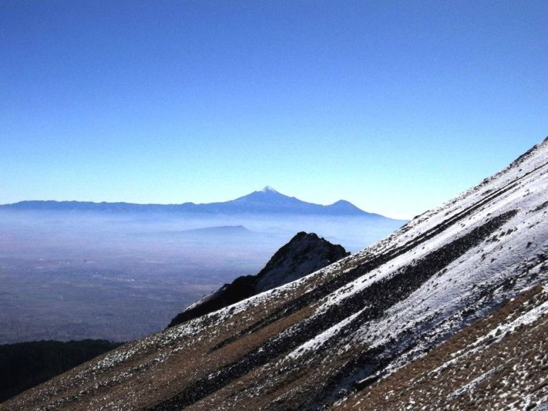
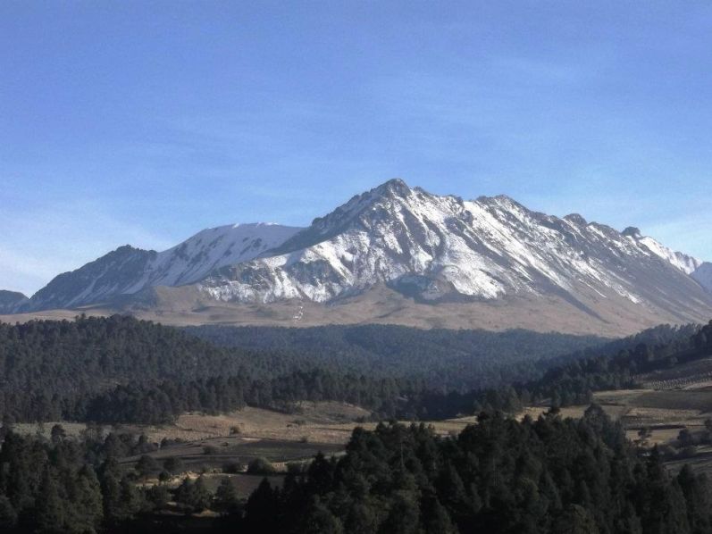
Distant view of Orizaba from Volcán La Malinche. |
This is not working at all. Every bump is magnified, especially the damned topes which are omnipresent in Mexico: raised humps in the roadbed which force every driver to a crawl when going through any community.
I claim that billions of dollars to the national economy are lost owing to their presence; and that the money saved in not hiring hordes of traffic cops is surely overwhelmed by this observation. In essence, everybody is punished because a few people would otherwise drive with reckless abandon.
|
|
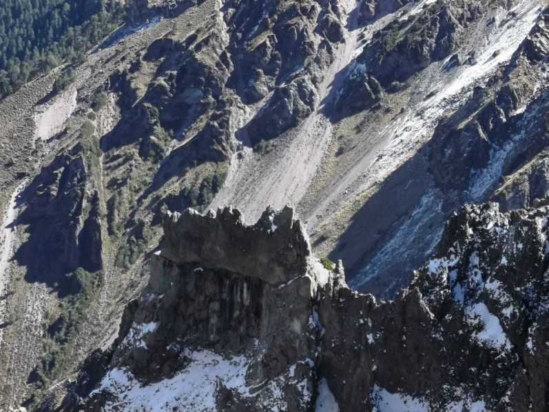
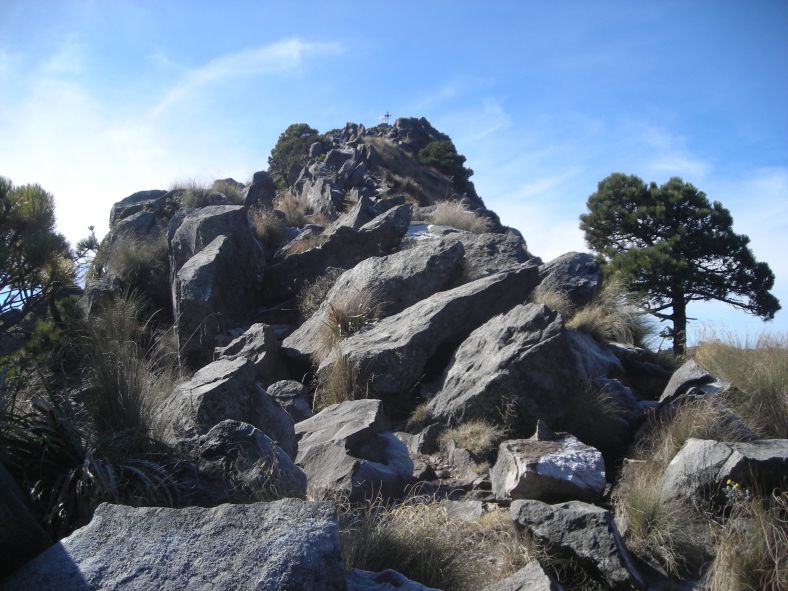
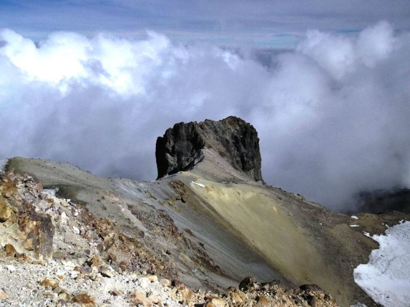
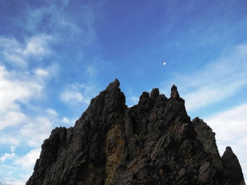
Razorback pinnacles reside high on Volcán La Malinche. |
Eventually Rob and Duane humorously classify topes by their vertical relief - from "P300" to "ultra".
The road straightens north of Pachuca as we enter desert terrain. However we are again behind schedule, and won't reach the airport, for exchanging rental vehicles, until after sunset.
Once in Mexico City the traffic worsens to the point that Bob and I cannot follow Rob and Duane. Drivers constantly cut into your lane even at the slightest provocation. As a result it's extremely challenging to caravan as a pair of vehicles. Major roads suddenly split into parallel tracks, one set of lanes diving down or rising up while the other remains level - and each track goes its own way, funneling one into navigational oblivion 50% of the time: a guessing game. None of these deviations from normalcy are available using Google Maps.
|
|
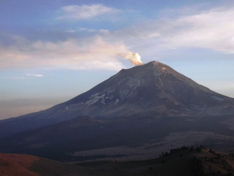
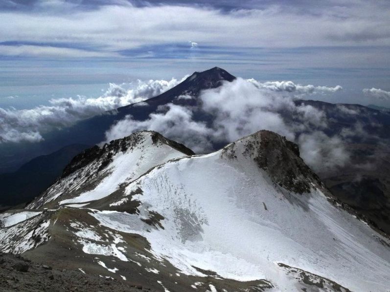
Popocatépetl smoking as viewed from the Ixtaccíhuatl climber's hostel. |
So Bob and I lose Rob and Duane. Suddenly there's no point in us waiting at the auto rental company. The major street we are on has this raised yellow concrete divide that prevents one from turning around as we require for getting to our hotel. We turn-off onto a side street and consider options.
Eventually I solve the problem with a humbling yet effective solution - we hire a taxi driver and follow him to the hotel. This actually works! The driver does his best to let other vehicles pass in front of him so that he does not lose us. Why? Because he has not yet been paid.
|
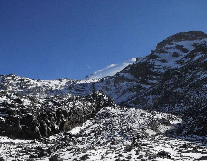
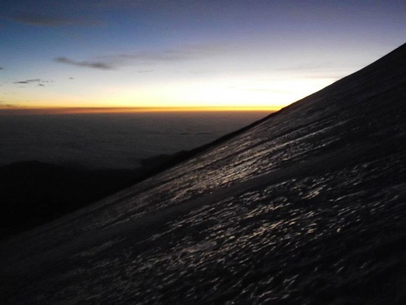
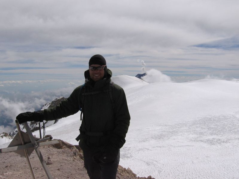
| Orizaba slopes below the glacier. |
Greg, Collin and Ryan are already in their hotel room, and I recommend they eat dinner without us three since it's already about 8 p.m. Bob and I park in the hotel garage and are soon met by Rob and Duane.
The room is fancy and expensive at 875 Pesos for the night, about seventy dollars. After much needed showers Rob and I have dinner in the hotel restaurant - my first (and only) "fancy" meal of the journey. We order drinks (beer for Rob, a "Black Russian" for myself), salads and entrées. I have a house rendition of chicken cordon bleu.
Suddenly the Part II newcomers arrive and join us. Then too Bob Packard sits down for the company as he's already eaten in the camper. It's now a "full house" with everybody congregated (except Duane) - and there is much to talk about.
We agree to a "first light" 6:30 a.m. departure.
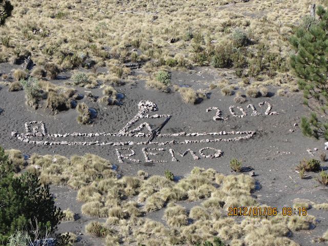
Friday, January 6 - Cerro Ajusco

|
|
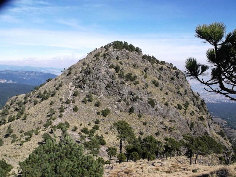
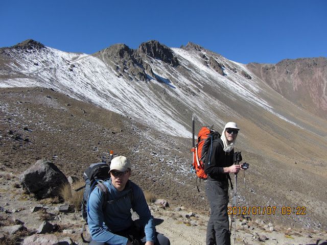
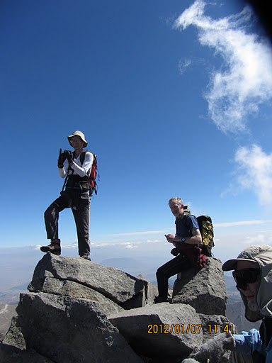
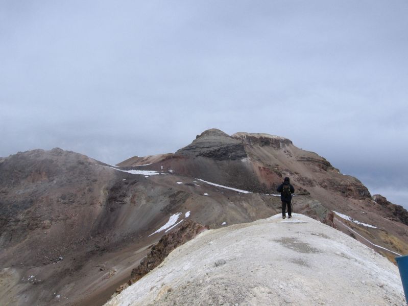
Final portion of the Pico del Águila ascent. (BP) |
A clockwise loop route is selected, going first over a subpeak, Pico del Águila, and with some rock scrambling near the very top. It's chilly with the wind on our ridge. Ryan cannot maintain the pace set, and lags behind along with Bob who at 75 we expect to be slower. I learn that Ryan smokes.
Our true goal is beyond a 200 foot drop, one which I tend towards, and wait for others at the high saddle. Anxious to summit I top-out at this large windbreak with little wind - and spend fully an hour there, consuming both food and views while waiting for Bob and Ryan.
It is wonderful that everybody gets to climb with Bob, some for the first time. Remarkably, six decades of life are represented:
|
|
Duane nears the top of Pico del Águila. |
The loop takes us on a slow descent around and over more subpeaks, followed by a much steeper descent back into the forest cover.
Cerro Ajusco
trip report (Rob Woodall);
photo album 1 (RW);
photo album 2 (Ryan Courtney)
To Climb Cerro Ajusco (Distrito Federal and Mexico City highpoint)
Location: 19.20769° N, 99.25819° W
50,000:1 chart E14A49 "Milpa Alta"
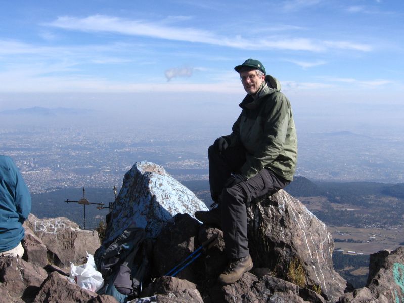
Cerro Ajusco has an official elevation of 3,937 meters (12,917 feet).
It is, therefore, one of Earth's highest city highpoints - and certainly the highest for any major
metropolitan area of comparable size.1 It also has a prominence exceeding 4,000 feet.
Note: Driving in Mexico City is notoriously problematic. Handling traffic early on a
weekend morning seems less onerous.
In Mexico City get onto the southern beltway known as the "Anillo Periférico"
(or "Blvd. Adolfo Ruiz Cortines"). Turn south onto "Entronque Picacho Ajusco"
at (19.30580° N, 99.20586° W).
At (19.26598° N, 99.22799° W) remain on Picacho Ajusco by staying straight rather
than veering slightly to the right onto "Bosques".
Continue driving until (19.23299° N, 99.23059° W),
whence proceed straight (south-southeast) to initiate a counterclockwise loop around the mountain.
(Forking left here takes one in the corresponding clockwise loop. Be aware that both forks
may be named for Cerro Ajusco!
The road, now outside of the developed areas, continues to climb through evergreen forest.
At the far (west) end of several roadside eateries turn left (south) at (19.22918° N, 99.26813° W),
the elevation 10,758 feet. This side road may be closed on weekdays. If so, pay 20 Pesos per vehicle to park in
the lot immediately southeast and walk an additional one-eighth mile each-way.
If the road is open, proceed to find parking near the standard trailhead with large red-tile
building (Albergue Alpino) at (19.22713° N, 99.26708° W) and 10,825 feet elevation.
From here the net elevation gain is 2,085 feet and the summit air distance is 1.5 miles.
Getting to the trail itself is confusing. Walk past a set of children's swings and note a footbridge
crossing a dry riverbed. Do NOT take the bridge. Rather, continue to the right about 100 yards and find a
steep trail heading upslope on the riverbed's opposite bank. Take it.
The trail becomes an old road which leads to a junction. Turn left (north). In about 50 yards
is a second road junction. Staying straight starts one on a clockwise loop route that first includes
Pico del Águila and then the main summit. Turning right reverses the loop's sense.
I recommend the clockwise option after consideration of the terrain features: that way near the climb's end
you descend an unforgivingly loose, steep scree path rather than ascend it.
After several hundred feet turn left towards the obvious ridge as the road now reverts to a footpath.
Reach the ridge and climb south to Pico del Águila. The top 100 feet entails some Class 2-3 rock.
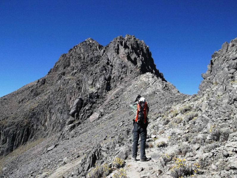
Take a break on-top, noting the peak shortly beyond and 200 feet higher still.
Descend to the intervening saddle by a path on the connecting ridge's right hand side. From the saddle
it's a 400 foot elevation gain south to the highest summit ("Cerro La Cruz del Marquez")
with significant windbreak, large cross, huge rock cairn and the stump of a prismoidal concrete triangulation pillar.
To return, head towards the set of subpeaks to the west on a broad path that used to be a two-track.
After several subpeaks (and gorgeous backward views of Pico del Águila) the trail descends into the forest.
It is loose and steep - hence the loop-direction recommendation.
The route is trivial apart from going over Pico del Águila. Total elevation gain is 2,500 feet.
Allow 3-4 hours for the round-trip.
The effort complete around noon, most of us explore a restaurant and order blue corn
quesadillas for take-out. They are quite delicious, and set the standard that we hereafter
seek at several other feeding opportunities. I particularly like the chorizo and potato variety.
Bob departs for Texas, and will be county highpointing there - eventually getting ten more
including a "virgin" as Zavala County.
We caravan into major city Toluca using backroads rather than suffering through Mexico City.
Bodega Aurrera is a supermarket chain, and we purchase water and much snack food.
Nevado de Toluca looms ever-larger in our views. It's an impressive sight indeed,
its beauty heightened with more than a dusting of snow at the higher elevations.
We camp in the national park at a pullout, our elevation 12,400 feet. We could have
driven farther to the current trailhead, yet I feel that 13,600 feet will bring headaches.
Besides, sleeping at 12,400 feet is very adequate anyway for acclimatization.
Without Bob's camper it's the first night that my camping stove is used.
I cook a quarter pound of dry spaghetti and flavor it with cheddar-potato soup mix,
perhaps adding some turkey SPAM for protein. Others generally have boil-in-bag meals,
which, although convenient (no pot need be used and then cleaned), are several times more expensive
compared with just buying pasta packages at the supermarket and flavoring them as desired.
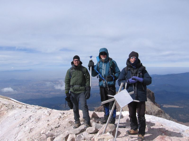
Greg atop Pico del Águila. (GS)
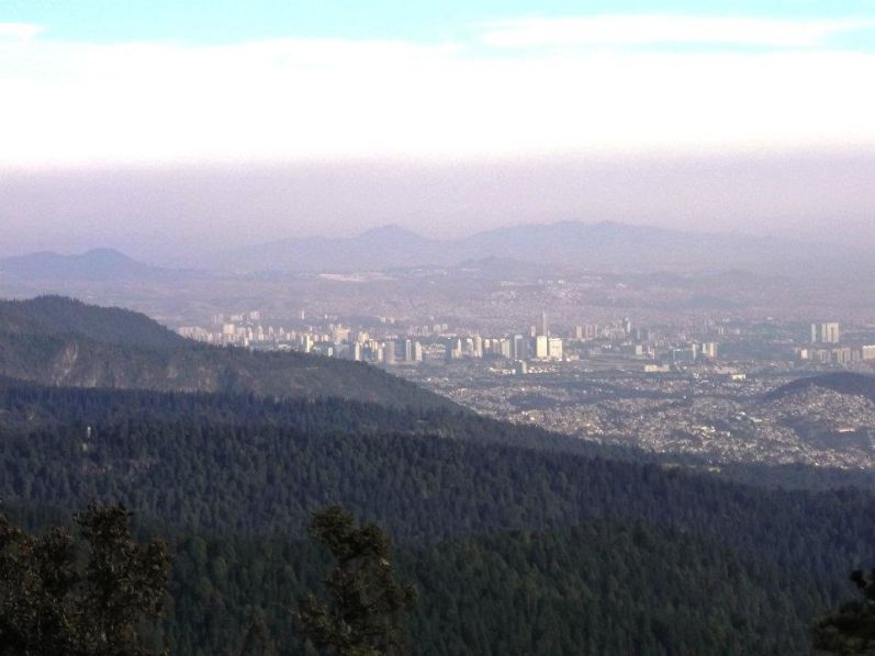
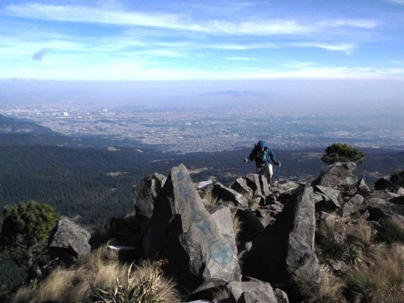
Mexico City
near the Águila - Ajusco saddle (DG)
View back to Pico del Águila.
Quito, Ecuador and Bogota, Colombia might also have higher highpoints than Mexico City.
However, again, their populations pale by comparison.
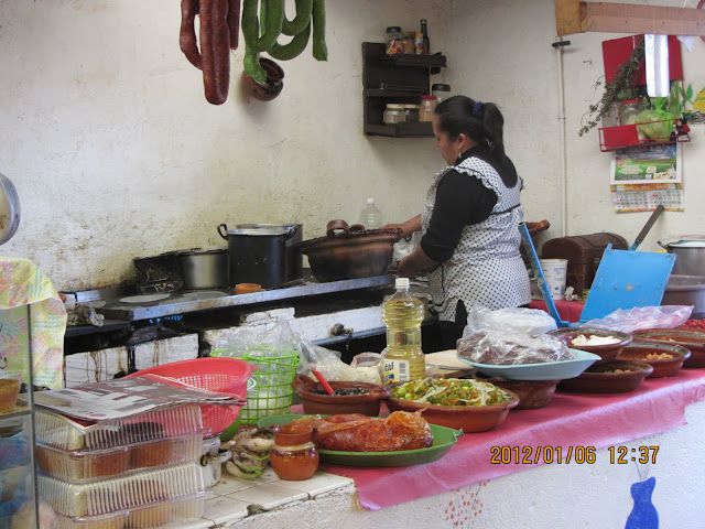
Restaurant cook prepares our
food in the traditional fashion. (DG)
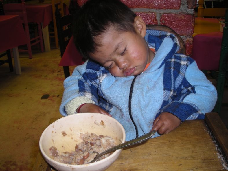
Inside the restaurant
and oblivious to all. (BP)
Saturday, January 7 - Nevado de Toluca ("Xinantécatl")

|
|
Nevado de Toluca is even more attractive with this snow. |
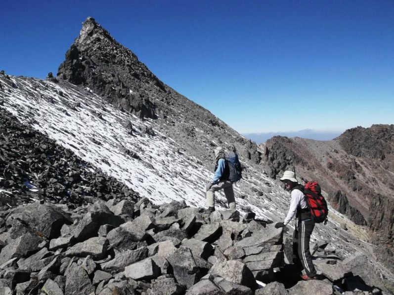
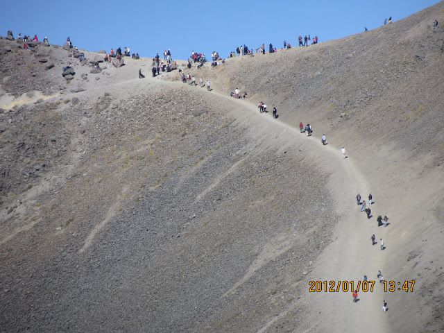
The trailhead has been moved so that a pair of pristine lakes and their immediate area will not be "trashed" by hordes of car-enabled weekend warriors. For us this means an extra two kilometers each-way, and over a 14,000 foot pass both directions.
We are fortunate to pay for a 6-person room to use this evening, considerably more accomodating than tent-camping in the cold. Soon we are off, along with a gathering horde of Mexicans enjoying their weekend in "high-fashion". The vast majority simply walk to the pass and enjoy views overlooking the lakes.
|
|
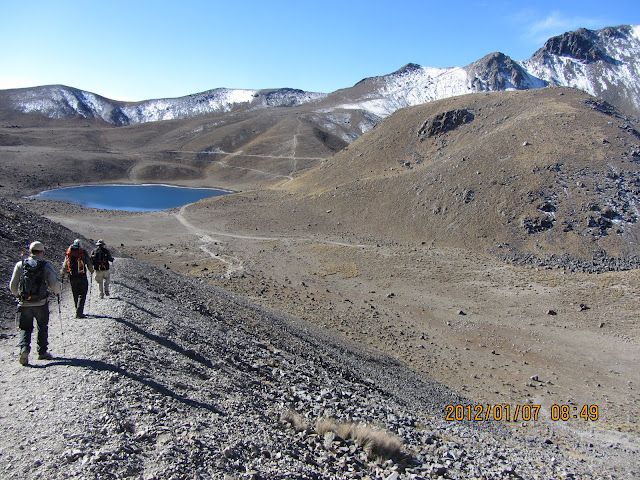
Descending from the "tourist saddle" to the pair of ice cold lakes. (DG) |
Of course we have grander plans. After descending to the lake's level, at 13,800 feet, we hike an obvious path to a significant 14,600 foot saddle on the main summit ridge. There does not appear to be snow or ice along our intended route. So I mistakenly recommend that we cache ice axes and crampons behind a boulder and return this way rather than descending an easy scree slope on the summit's opposite side.
We wait for Collin because he's having trouble with the altitude, and for Ryan because he is simply slow. Still, it's a beautiful, sunny day with plenty of time to waste.
After skirting the west side of a hill our route is no longer obvious. Greg explores going "straight up" the rock face, and on topping-out finds cairns on the other side. I follow, and soon enough come Duane and Rob as well.
|
|
Collin (left front) and Greg in front of Toluca's main ridge. |
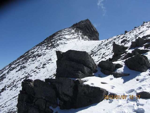
An ascending traverse on easy terrain follows, leading to the right (east) skyline. Now we traverse on an east-facing slope, going north on tedious mixed snow and rock. The summit ridge is again reached, and we are quite close to the summit pinnacle - "El Fraile".
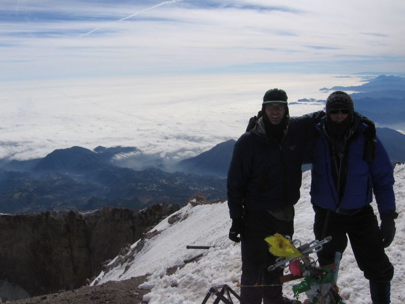
"The Friar" is reached by first passing around/through a rock arch near its base. The right (east-facing) aspect is now used, our route eventually corkscrewing a bit counterclockwise. Snow forces caution, at least for myself, and I am given the honor of first to summit as this is my one-hundredth ultra prominence peak worldwide.
After a few minutes of glory we descend and wait for one-half hour, sunbathing at 15,200 feet on the summit ridge waiting for other groups to appear in addition to Collin and Ryan. Eventually they show - and head for the summit along with roughly nine other climbers in three or four separate groups. Most are teenagers and all are Mexican. Regardless, It's going to be a traffic jam up there.
|
|
Greg examines the first rock pitch on Toluca's main ridge. |
Wise enough to have carried his metalwork, Duane descends the far side and by agreement waits for us at the smaller lake.
By now I've eaten nearly all my food and grow impatient. Greg and Rob re-ascend the pinnacle partway as I guard their stuff. I shout to learn that Collin and Ryan have not begun to descend, and ask them to please come down immediately.
Only when we are back together do I learn that Collin has a serious high altitude headache, and that Ryan is quite slow descending rocky terrain.
Back at the earlier rock face I descend efficiently to meet Duane in a timely manner. Meanwhile Greg sets up a rope for belaying Colin and Ryan.
|
|
Adam hand-signs "100" at Nevado de Toluca's tippy-top. (DG) |
Duane is relieved to see me come. He's waited 1 1/2 hours, and of course has no idea what's been going on. We head back, the 200 foot rise to that high pass most unwelcome. By now, at around 4 p.m. there are dozens of people milling about. Soon we are at the rental, and perform the usual post-climb chores.
Greg and Rob appear soon enough. However Collin and Ryan don't show until after it starts getting dark. Ryan later states that he remained behind to ensure Collin made it safely back.
|
|
Duane (center) and Adam approach El Fraile - Toluca's highest summit. |
We prepare our suppers in the cabin and have a lazy conversation in the reserved room. A world-class marathon runner is staying in the next room over, and describes his training regimen. On the mountain are a few other men (and boys) in-training because of the conditioning afforded by our high elevation.
I sleep in the car while everybody else gets to witness Collin throw-up several times tonight. Still, both he and Ryan now have new personal high altitude records of roughly 15,400 feet.
Nevado de Toluca is a fun mountain, one that I would consider doing again were the opportunity to conveniently present itself. Remarkably, its prominence cell extends into the continental United States as shown on this ultra completion map.
Nevado de Toluca trip report (Rob Woodall); photo album 1 (RW); photo album 2 (Ryan Courtney)

|
I have been spared any symptoms whatsoever, and attribute this, in part, to the Diamox I have taken prophylactically - a diuretic which alters the body's carbonate / bicarbonate ion concentrations. These changes enhance one's ability to acclimatize at high altitude.
|
|
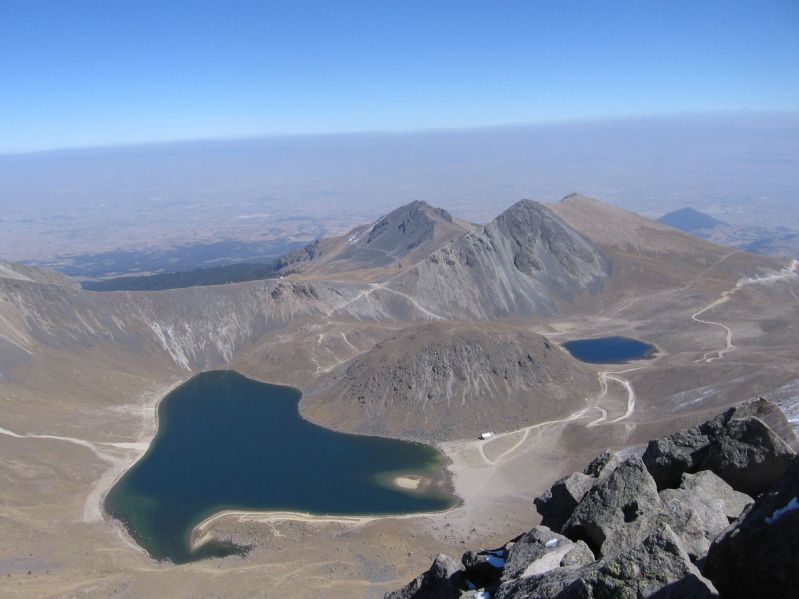
"Sun" and "moon" lakes from high on Toluca. (GS) |
The author is not concerned about Collin's future high altitude prospects. AMS (Acute Mountain Sickness) can effect anybody with a seeming randomness which physiologists have yet to decipher. On the next trip I could be stricken while Collin remains healthy.
|
|
View back towards the top during Duane's descent. (DG) |
Several thousand feet lower and in decent temperatures we stop at the first Pemex to discuss our driving options for getting around both Toluca and Mexico City. We decide to simply meet at our trailhead, not realizing that on weekends traffic would be considerably less onerous.
In Mexico City Duane, Rob and I are temporarily lost, and somewhat humorously, after taking a wrong turn and entering a major bus terminal! The many employees are amused by our error, and we laugh alongside.
We have a lunch break at the highway's highest point at some 10,500 feet and just north of the Ixtaccíhuatl / Popocatépetl pair. It's a nice way to remain acclimatized while providing relief from the driving monotony. My pint of canned carrots, tuna fish, corn tortilla chips, hot salsa and bland cheese is eaten, as usual, as passenger to pass the time.
|
|
Dozens of local visitors swarm at the 14,000 foot saddle. (DG) |
We pass through Puebla and head north, viewing our next goal from the west. The storm of New Year's Day has left its mark on it as well, with snow on the top thousand feet or so.
I get a cell phone call from the other group - they are already at the trailhead, have secured a nice cabin for all of us, and have notified a park employee of our arrival.
The IMSS has created a most comfortable place to stay. Our cabin has hot showers, a refrigerator, portable electric radiator, and seats in addition to six bunks and plenty of bedding.
|
|
Our cabin at the base of Volcán La Malinche. (GS) |
We eat dinner at a bona fide restaurant! Both Mexican and American-style food is served. While Rob and I are wonderfully adventurous, many have cheeseburgers with french fries. Rob's dessert of peaches drenched in rompope liqueur has me jealous - it's arguably even tastier than my blackberry cheesecake slice. Then too his egg / garlic soup sounds quite appealing...
Duane gets enough to eat even though he's generally a vegetarian through special orders not on the menu such as black beans with melted cheese.
Collin's appetite is minimal, his meal only one-third eaten. This concerns me,
as does Ryan's comment that he will not be attempting Volcán La Malinche
to save his energy for Orizaba fully two days later.
Monday, January 9 - Volcán La Malinche
|
|
Greg and Malinche right after leaving the forest. (GS) |
A group of five teenagers are also on the trail, two of them Mormons from Utah. They race ahead, unaware that when going high it's the tortoise who often wins.
The trail is actually a straight, paved pathway that heads upslope while being repeatedly intersected by the road which one is no longer allowed to drive. At 11,300 feet the gradient changes markedly, with some truly steep sections (for a trail) up to roughly 12,000 feet. I cache water at a 12,100 foot log.
|
|
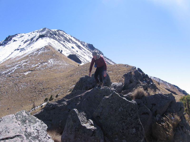
Malinche's summit ridge with about 100 vertical feet left. |
We break-out of the forest at around 12,500 feet and get our first close-up views of the mountain. It's beautiful this morning. The road provides tolerable if not stellar footing; and so we continue along it rather than bushwhack to the right (east) ridgeline.
Somewhere around 13,300 feet we leave the road and turn directly to a small ridgeline hilltop where the other group has gathered. There, at 13,800 feet or so, the wind gathers force and we add layers.
Now we climb the moderately-angled ridge with a fierce wind. The gradient steepens just under a large rock obstacle as snow arrives underfoot to make for cautious, measured movement. The boys are moving slowly, having only tennis shoes and neither gloves nor wool hat. They are somewhat underdressed, and we pass them by soon enough with only a short distance remaining.
|
|
Rob atop Malinche with broad Ixtaccíhuatl and conical Popocatépetl. |
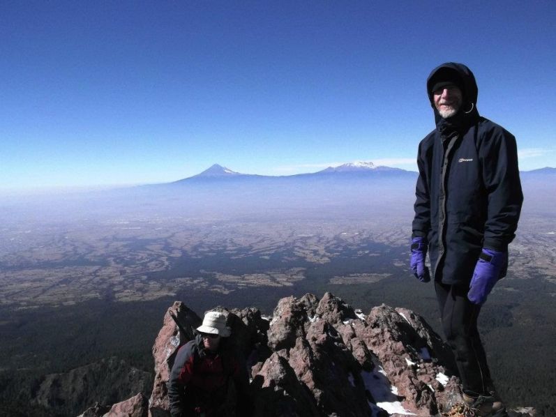
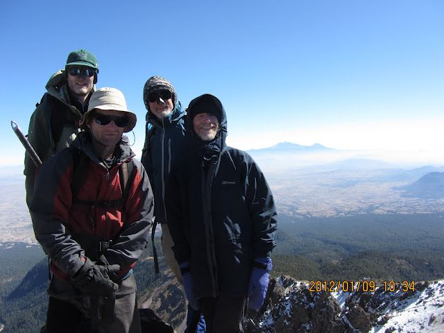
The final 20 vertical feet is a rock scramble. Orizaba is to the east, 'Ixta and 'Popo southwest. This is Tlaxcala state's highest point and my final peak of the journey. The other group arrives after a few minutes, and we all revel in the sights with pictures taken on each other's behalf.
We eat lunch about 50 feet down at a nice, relatively wind-free flat spot. Spectacular rock pinnacles are seen in the mid-distance.
I am somewhat slow going down the mixed terrain, and Duane graciously waits for me. Greg and Rob decide to speed ahead for climbing a low-prominence subpeak which we dub "Little Tahoma" for its resemblance to Mount Rainier's Little Tahoma. Meanwhile, Duane and I return to the small ridgeline bump, remove layers, and head down to the steep road.
|
|
Atop Malinche. From left: Greg, Duane, Rob and Orizaba. (DG) |
I find better footing just off the road in sparse bunchgrass. As we re-enter the forest care is taken to fork slightly left at a minor junction.
Back in the forest and while retrieving my water Ryan suddenly appears! Duane and I recommend that he continue just one-quarter mile farther to get open views of the peak. Shorter afterwards Greg and Rob arrive, having tagged the pair of adjacent bumps atop "Little Tahoma".
We complete the effort together.
|
|
Rob during the side-trip for climbing "Little Tahoma". (GS) |
Back at the cabin I hurriedly shower to have my own peaches with rompope liqueur before the restaurant closes at 5 p.m. In-truth it's my "appetizer" (!) before having a main dish in another sit-down meal. We are burning through Pesos far faster than imagined, what with multiple nights in cabins and restaurant opportunities. I have vastly underestimated how much cash people should convert to Pesos.
The tequila is polished-off soon enough, with Ryan and Colin getting small amounts. Soon I decide it's a fine idea to take the radiator outdoors so that folks can be warmer on the front steps where they seem to have congregated. Greg vetoes that plan, stating that I should know better than try to heat the outdoors! With the radiator back safely inside, I remind folks that the sun does a GREAT job doing just THAT. Greg comments that it's putting out considerably more BTUs (British Thermal Units) than our six-finned electric wonder. How much more? I calculate 1.3 billion billion billion BTUs per hour.
A driving route for efficiently getting to our next goal is discussed and agreed upon.
Volcán La Malinche trip report (Rob Woodall); photo album 1 (RW); photo album 2 (Ryan Courtney)

|
|
|
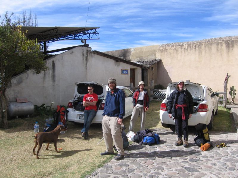
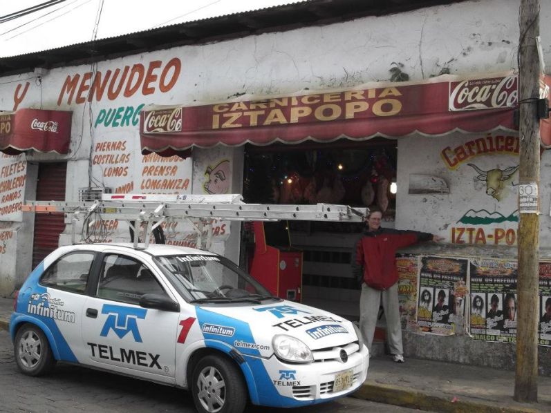
Within Señor Reyes' compound prior to Pico de Orizaba. Dog is "Canela" - "cinnamon". (GS) |
Collin and I remain behind. My original intent was to guard gear for climbers at the hut. However on learning of the $70 transfer fee per person I change my mind completely, and spend a pleasant day in town after the truck departs.
After ice cream we have an extended Internet session. Then we have lunch at a pizzeria, Collin with a medium-size pepperoni and myself with a plate of hot chicken wings plus extra condiments on request. His appetite has returned, eating five pizza slices and a soft drink. In fact, he is thinking of Ixtaccíhuatl three days from now.
|
|
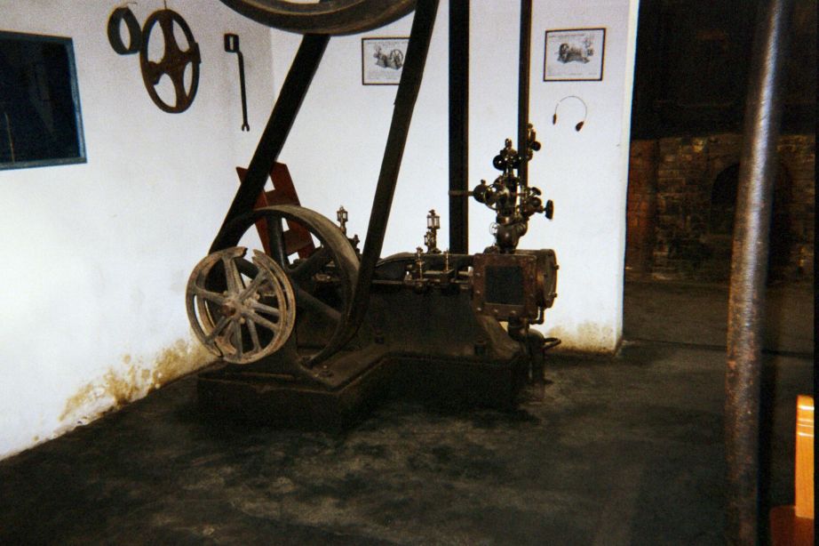
40 horsepower motor for running machinery in the soap factory. (AH) |
A Belgian couple spots us in the central square around 4:30 p.m., and we direct them to the Reyes edifice for their own climbing bid. They have bicycled from Canada to the Mexican border, and seem most fit and eager to explore what's it like far, far higher than they've ever been.
The dormitory is upstairs in an old soap factory. It's a fascinating place, with all manner of industrial-size mechanical devices for soap production, ranging from a steam boiler that generates 40 horsepower to giant pots for holding assorted liquids in the manufacturing process.
Señor Reyes' father has training in chemistry as I deduce from the Spanish language chemistry textbook lying about published in Barcelona - during the Second World War. Later he confirms my hypothesis, and with that a certain rapport has been established.
|
|
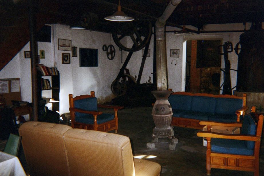
Ground level interior of Señor Reyes' dormitory. (AH) |
As I sleep in my bunk bed thoughts are almost exclusively of the four companions poised to climb Mexico's highest mountain.
The following is an excerpt from Greg Slayden's Orizaba report as posted at peakbagger.com, serving here as their story.
"We paid Sr. Reyes his money in dollars, and his driver soon loaded our packs on to the roof on a modified pickup truck. The four of us clambered into the back compartment of the truck, a rather claustrophobic space with not many windows and bench seats facing each other.
Joining us for the trip were two climbers from San Diego, Blair (who sat up front with the driver, since he could speak Spanish), and Vlad, who sat back with us. We left a little after 11 AM, pretty much on schedule.
|
|
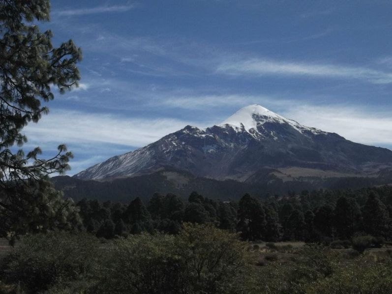
Orizaba during the Piedra Grande hut approach drive. |
The jeep ride to Piedra Grande took about an hour and a half, the last part of it on a very rough, rutted, rocky road. I think most of us in back were a bit motion sick from the jostling and lack of windows � I was glad to have taken a Dramamine pill. We stopped a couple times to get out and take photos of the imposing form of Orizaba ahead, its summit area impossibly white with fresh snowfall.
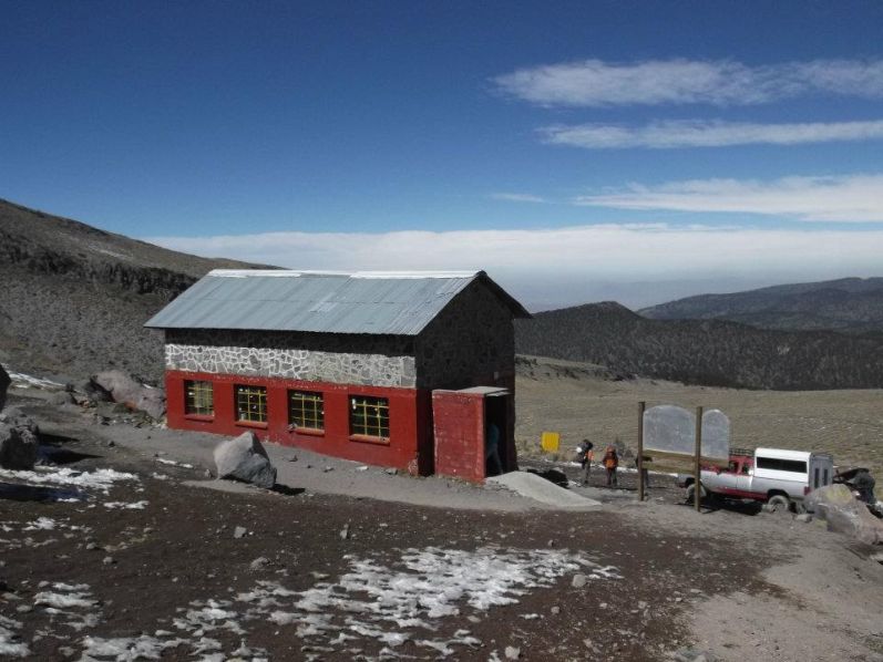
By 1 PM we arrived at Piedra Grande�I tipped the driver and he told us he�d be back at 4 PM tomorrow for us. A large group was leaving as we arrived, so we had almost the entire large hut to ourselves at first. A smaller hut uphill was also empty, and Blair and Vlad took space there, but we thought it was too cramped for us. The big hut had nice windows and was relatively clean and well kept. The outhouses, though, were quite grim, practically overflowing and therefore barely usable.
After the 4 of us claimed bunk space on the second of three levels of plywood planks, hung out for a bit, and then Rob and Duane decided to do a reconnaissance hike uphill bit, hoping to avoid any route-finding errors in the dark tomorrow morning. Ryan and I hung out inside the hut, trying to nap unsuccessfully and chatting with the other groups there.
|
| Piedra Grande hut |
A young Polish couple was there with 2 Mexican guides, and a party with some Spaniards I chatted with for a while, and another group. Overall the hut was not super crowded, though�I could picture it with far more people.
Duane and Rob returned after a couple hours, having climbed about 500 meters up the trail� I was glad I had rested instead, saving myself for tomorrow�s effort. We cooked our meals, tried on our crampons, and relaxed until it got dark.
Not long after we finally settled into our sleeping bags for the night, we heard Duane muttering about some liquid dripping down on him from above, where the Polish couple was sleeping on the third sleeping level. He started mopping it up, but something seemed odd to him. Then the Polish woman came down the ladder, apologizing, saying her husband has just thrown up� she handed Duane a pile of napkins to help with the cleanup. What a mess�the vomit had leaked through the seam in the plywood sheets. The Poles had come to this hut (4200 m) after only one night in Mexico City, definitely too fast.
Once that was cleaned we all settled in for some very fitful sleep."
|
|
"Rob�s alarm beeped at 2 AM; so Ryan, Duane, Rob, and I got up, put on all our warm clothes, and ate some breakfast. It was a bit windy out, but not terribly cold, and the lenticular cloud we had seen yesterday was gone, so we decided to go for it. My intestines were not happy, and I was forced to use the foul outhouse in the frigid darkness. Ugh.
|
| dawn at Orizaba |
Ryan started first, planning a slower pace, and Rob, Duane, and I set off at 2:40 AM, about 15 minutes later. There was some moon, but I was very fortunate to be following Rob and Duane, who had scouted the trail yesterday and had a GPS track. The path started out atop an old concrete aqueduct, partially collapsed with booby trap holes, then it turned left uphill on a muddy gravel path that wound up a steep, bouldery slope for a while. There were pockets of snow on the trail right away, but the treadway was pretty good as it switchbacked uphill. Rob and Duane tried to match the dark landscape with their memories of yesterday, and successfully guided us uphill. We passed Ryan fairly low down, and hoped he could follow our headlamps for a while to help his route-finding.
The path seemed to crest a slope, then enter a ravine of sorts, and then slab up the side of the rocky valley to gain a flat, rocky area. Somewhere up here was where Rob and Duane had turned back, so above this area I led, since I had the strongest headlamp. The path passed some huge rocks and soon came to a slope of steep, icy snow. It looked like the remainder of our route would be like this�climbers had compacted the snowy route up through the talus into ice, so we stopped to put on our crampons.
|
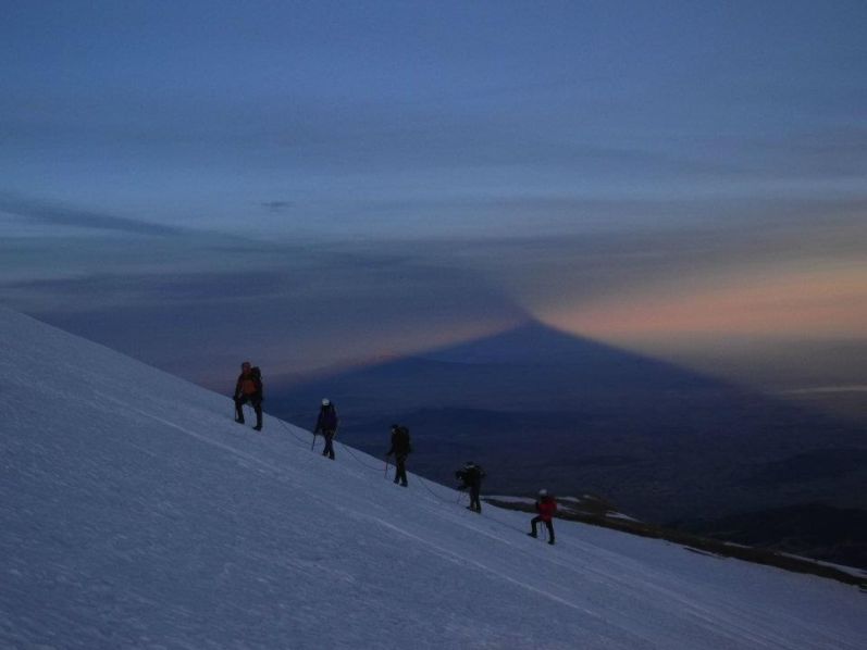
|
Rope team on the glacier. Orizaba's VERY long shadow. |
The party with the Spaniards passed us while we were doing this�it was a bit of an awkward spot. Duane discovered, to his horror, that one of his crampons was missing the screw that attached the front and rear halves. He tried going without it, but it came right off. So he and I rigged up some safety pins and duct tape to hold it together, and we were amazed that this field repair, done in the frigid pre-dawn darkness, actually held up all day.
We continued uphill for a few hundred meters, cramponing up the ice between the rocks and following a crampon print path, until there were no more rocks and we were on the huge glacial snowfield covering the top of Orizaba. We could see a snowy ridge connecting the Sarcofago sub-peak to the main peak, and the route appeared to scale the side of this ridge for 1000 meters or so towards the distant summit. The snow was hard and icy, but with crampons the footing was good, and a climber�s path led upwards, straight up at first and then switchbacking a bit.
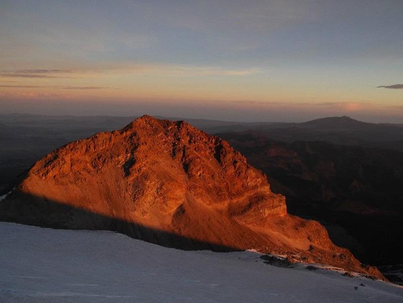
|
| Rock ablaze at sunrise. |
It was now very cold as we trudged up this crevasse-free glacier. The wind was strong, and even though it was now sunrise, the sun was appearing directly on the other side of the peak from us, leaving us in cold shade for our entire ascent. There were 2 parties ahead of us, one of about 7 that had camped out at about 16,000 feet, and the group with the Spaniards. We kept them in sight as we plugged up the endless Sisyphus slope.
Rob went on ahead, needing to move at this normal rate to keep warm, and I followed the best I could, losing ground. I was still troubled by my intestinal bug and I had to stop a couple of times for emergency pants-drops, and the altitude was definitely palpable, so I was not performing at my peak. I was also very cold�Duane had loaned me a light down jacket I used as a fourth clothing layer, and once I stopped and tried to put on my snow pants, but gave up when I dropped my water bottle and realized it was too awkward and too cold to try a major clothes change on a steep, icy slope.
|
| endless snow slope... |
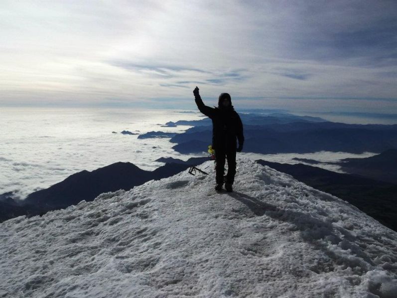
Towards the top I was a few minutes ahead of Duane on the final switchbacks up the immense snow dome, glad he and I were traveling at about the same pace. The two parties ahead of us had disappeared, and finally Rob came bounding downhill, with the good news that he had made the top and that it was not far for us. Excited, I rest-stepped my way up for another twenty minutes or so and soon saw the rocks of the crater rim. Our route took us to the rim at a point very close to the main summit, so a few minutes of ups and downs took me to the highest point in Mexico at about 9:30 AM.
The group of 7 or so backpackers was at the summit, and I chatted with them and we took each other�s photos as I sat down and rested. The far end of the summit was out of the wind, and now that I was on top we finally had some sun, warming me rapidly. I had been on top for 10 minutes when I saw Duane hiking the crater rim, so I went over to enthusiastically congratulate him as he arrived�we bear hugged and got our pictures taken by the other group before sitting down in the sheltered spot to eat and savor our success.
|
|
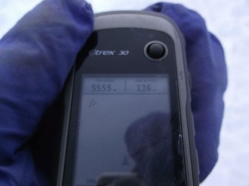
5,555 meters elevation on the GPS unit - some 18,225 feet. |
The view was similar to that from many super-prominent peaks, basically what you might see from an airplane. A thick cloud layer covered Veracruz state and the Atlantic Ocean, but to the west Malinche, Popo and Izta were visible. We ate some food and rested as the other group left, and we took pictures of ourselves and the fallen-down crosses at the top.
At about 10:15 or so we started down. At first we plunge-stepped down the icy snow with our crampons on, but after a bit Duane decided to try a sitting glissade. He had some success, since the snow had a breakable crust that made it somewhat easy to brake with one�s feet. I decided to try it, too, so I took the time to take off my crampons, put on my snowpants, and try a few slides. But I didn�t feel comfortable�the snow was rough on my butt, and it was steep and icy, and a fall would send me a long way down, despite begin safe with no cliffs or rocks below. So I tried plunge stepping, but that was squirrelly without crampons, especially down low, so in the end it seemed best to put my crampons back on and walk down that way. Duane eventually agreed and followed my gear change.
|
| Rob atop all of Middle America. |
This all took time, but we got to the base of the giant snow cone without any real issues. I retrieved the water bottle I had lost on the ascent, lying on the snow where it had fallen, and after a rest at the first rocks we were cramponing downhill through the boulder landscape of the lower mountain. We probably took off our crampons too soon and had to skate down some icy sections before hitting the trail for the long, muddy descent on gravel switchbacks.
We took a couple rests as we headed downhill, and a few hundred feet above Piedra Grande we also came upon the Polish couple and their guides from the hut last night. They again apologized to Duane for barfing on him, and we asked if the guy was feeling better. He said �no� and pointed to another vomit pile at the side of the trail. Again, we were surprised professional guides had taken these people so high so fast.
|
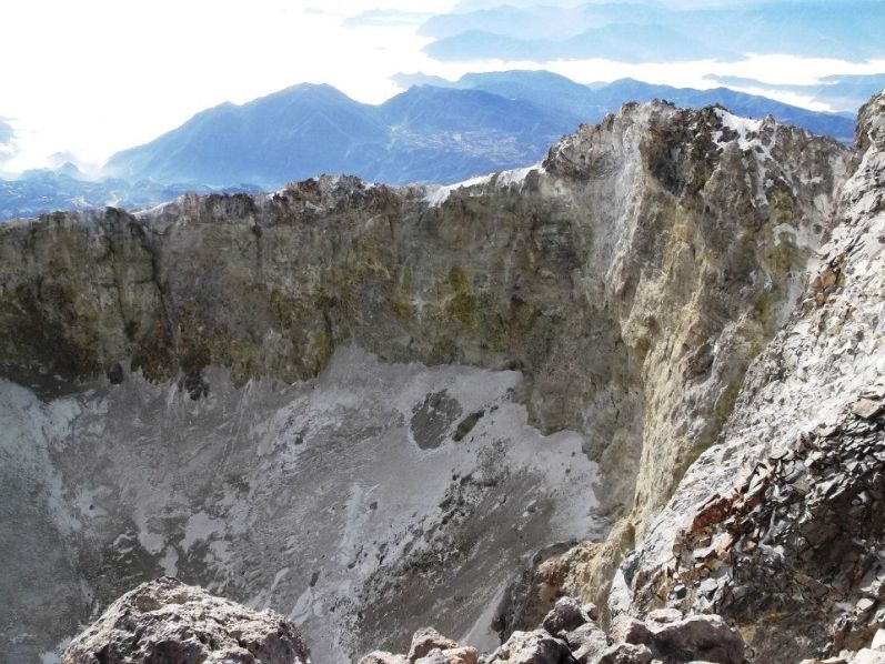
| Orizaba summit crater |
By 2 PM we had the hut in sight, and I was glad the jeep driver had told us yesterday that our ride down was at 4 PM, giving us an extra 2 hours over what Sr. Reyes has initially told us. At 2:20 PM Duane and I met Ryan hanging out just above the hut�he had turned back at about 14,700 feet when he could not follow our headlamps any more, I think. He also told us that our driver was actually here already and waiting for us. I was glad we would be getting down soon and didn�t have to wait, but we did have to scramble a bit to get our stuff together and throw it all in the truck. We quickly cleared out our stuff from the hut, and we even found Duane�s missing crampon screw.
We had no issues leaving behind our sleeping bags, pads, stove, etc. at Piedra Grande during our climb, and it seemed like a pretty safe place to stash gear like that. There are a lot of climbers there pretty much all the time and theft of used climbing and camping equipment seems very unlikely.
|
|
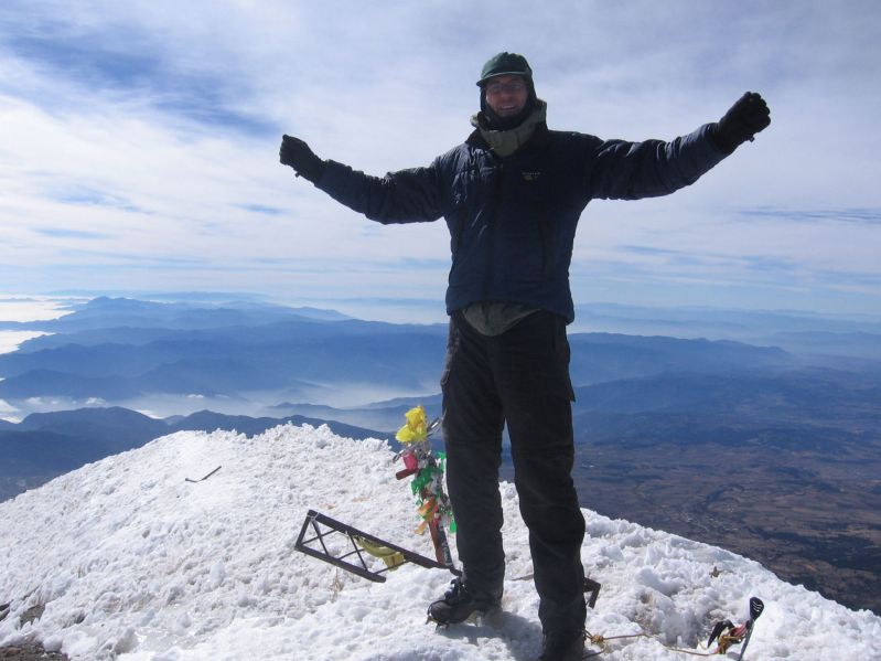
Greg is again the highest person on North America. (GS) |
For our ride down we had a nicer truck, with bigger windows in the back, and just the 4 of us heading down. I got to sit in the front passenger seat due to being able to speak Spanish to the driver; while Duane, Rob and Ryan piled in the back. I had a fun time chatting with the driver on the 1.5 hour drive back down, stretching my limited but workable Spanish to the limit. I also got to see first-hand the road's roughness out the front windshield.
Back in Tlachichuca I didn�t know we were right in front of the Servimont compound when I saw Adam on the street. As the driver eased us in to the gate Adam gestured with a thumbs up and down, and I gave him the thumbs-up, with three fingers. Once in the compound we told our stories to Adam and Collin, who had spent the day sightseeing in town.
... ... ...
Rob, Duane, and I were very happy to have Orizaba, the 7th most prominent peak in the world, under our belts. We had to fight cold, strong wind, icy conditions, and unusually low snow levels to make our climb, but the acclimatization hikes we had done over the past week allowed us to day-hike to the summit without too much trouble."
|
| Greg and Duane at the summit. (GS) |
Meantime Collin and I have a rather boring time with nothing much at all to do - let alone accomplish. I read from a climber register, from National Geographic, from assorted books lying about. Mostly I am just waiting for the others to return.
When they do return I am outside on the street as Greg hand-signs with three fingers to indicate how many of them made the summit - evidently, all but Ryan who did not get much above the hut.
We have a celebratory dinner at Casa Blanca which appears to be the only decent Mexican restaurant around. Rob and I order a bottle of red wine, and the full liter is enjoyed by others too. I am SURE that Greg, Duane and Rob are MOST PLEASED!
The weather forecast calls for possible rain on Saturday the 14th, such that if Ixtaccíhuatl is to be climbed (and why not?) then it really must be on Friday, so leaving Saturday as a "free day".
Pico de Orizaba trip report (Rob Woodall); photo album 1 (RW); photo album 2 (Ryan Courtney)

|
We enjoy a hot lunch at one of the only full-service restaurants. Ryan's pozole is sizeable and seems most enticing - a huge bowl of reddish hominy (lime-slaked corn) soup with pork and all manner of condiments.
|
|
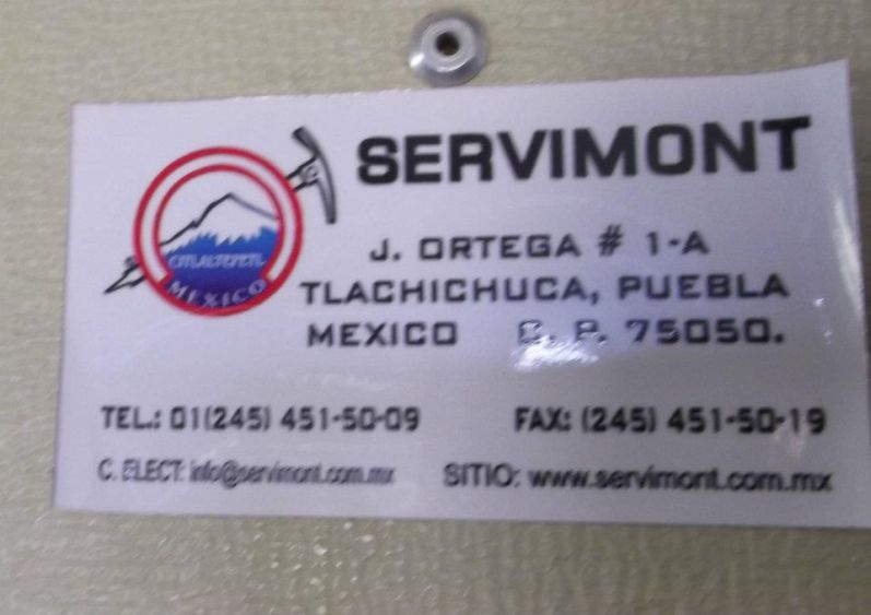
Servimont contact information - Señor Reyes' company. |
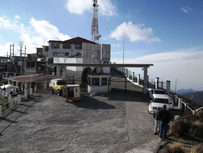
We stop at the famous Paso de Cortes where a museum is maintained at some 12,200 feet elevation between the two prominent mountains. Evidently a major effort is made to protect the local environment, and the museum's dioramas emphasize that significant point. Then, after verifying our permits a man opens this gate for our continuing progress to the trailhead.
The trailhead situation for Ixtaccíhuatl is a bit complicated. We drive to a 12,800 foot saddle and find a large television broadcast complex to our south atop a hill. Is that where our hut is located? The road turns to cobblestone and steepens, and we carefully drive there to confirm that, indeed, a smaller building houses climbers in each of three rooms - the Altzonomi Hostel.
|
|
Amecameca-based Ixta-Popo- Zoquiapan Park office. |
However the actual trailhead at "La Joyita" (there is also a former "La Joya" trailhead farther on) lies on the saddle's opposite side closer to Ixtaccíhuatl's true base. Go figure.
Everybody but myself packs for the next day. Indeed, both Collin and Ryan are going up - yet earlier than the others to account for different speeds.
I will bide my time in the building just reading and munching on snack food. When they are done a cell phone call will alert me to reach the saddle on-foot: nobody wants to drive the hill road again. If I do NOT get a cell signal then somebody will retrieve me. Regarldless, such plans, and without an overnight pack, force me to spend the day with a minimum of material as I will only have my daypack and empty hands to carry things down.
A can of anchovies in olive oil plus grated parmesan cheese enhance my pasta dish. We all turn-in quite early, a pre-dawn start planned for all climbers.
|
|
|
|
Climber's cabin is smaller building at left behind the yellow pickup truck. |
I return to bed and remain there until about 8:30. The day is spent alternating between National Geographic, snack food and taking-in the views. Popocatépetl releases a cloud of smoke around 9.
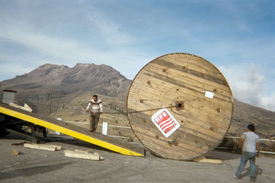
Around 2:30 p.m. Greg calls to notify me that they'll be later than expected with a 6:30 to 7 p.m. estimate. That's quite disheartening to learn. Fortunately things liven-up when I see a large cylinder atop one truck slowly ascending the valley. It parks in front of the television broadcasting complex, unable to pass a concrete arch above the locked gate.
I document the off-loading process as it unfolds over nearly two hours. The 10,000 pound wood cylinder contains cable that will boost power output for several of the broadcast channels, according to one of the engineers.
|
|
Huge wooden disk with electronic cable. Ixtaccíhuatl in background. (AH) |
After sundown I have already packed, waiting for a phone call. I chance to be outside and look towards the saddle when I see a white vehicle with headlights stop.
"Shall I come?"
"YES"
"I'm coming down."
Soon enough I learn that everybody made the summit apart from Ryan who, although having reached 17,000 feet (a new personal altitude record), still had a full mile of horizontal travel to the top.
|
| Ixtaccíhuatl from the climbing hostel. |
The Ixtaccíhuatl climb itself is described here as extracted from Greg Slayden's posted story.
"Rob, Duane and I got up at 5 AM, quickly ate some breakfast, got our packs ready, and then Duane drove us slowly and carefully down from the Altzonomi hostel and then on to La Joya, the end of the road and the usual Izta trailhead. By 6:20 AM we were hiking up the trail in the dark, soon discovering that our trailhead was actually �La Joyita� and the path led us to the real �La Joya�, no longer car-accessible. From there a narrower trail started a long traverse up the slopes of Izta. I had been on this path in 1993 (one day off from exactly 19 years ago) and tried to recall landmarks, but the fog of time was too much.
|
| sandy trail (GS) |
Our first notable place was a pass (the �first portillo�), where we rested and saw a memorial plaque. The path here descended briefly down the other side (and didn�t go up like I thought), then slabbed uphill on sandy, eroded braids to the next pass at 4400 meters (my 1993 turn-around point). From there the trail switched to the �left� side of the ridge and climbed up to a third pass at 4500 meters, the col between the �feet� of Izta and the main mass of the mountain. We were making OK time, and the sun was now out, but there was a strong wind and a fair number of low clouds blowing around.
From this pass the trail switched to the east side of the ridge and climbed uphill more, soon taking a steeper line towards some castle-like rock formations. These were easily bypassed with trivial scrambling, and the trail led up to the side of a high ridge before flattening out and then descending a short ways to the Grupo del Cien hut, a small white structure that we welcomed as a refuge from the wind. Ahead we saw the steep cliffs of the �knees� and thought we maybe saw climbers up high there.
|
| Rob and rock pinnacles (GS) |
Rob, Duane, and I sat inside the hut for a while, ate some food and warmed up. I went out after a while to see if the climbers were Collin and Ryan, but instead heard Spanish voices and saw a pair of climbers descending a large scree slope from the top of the knees. A bit later I went out again to greet the two Mexican climbers, who soon joined us in the hut. They were tough hombres who had spent last night in the hut with no sleeping bags. They did not recommend their route for us, since it was hard to find without the detailed knowledge of the mountain they had.
We took off again, and I thought the Mexicans had told us to go up to the ridge with the crosses on it above the hut. But my poor Spanish had led me to misunderstand them�we needed to stay low on the sand at first on the obvious trails, then head for the rocky ridgecrest. They yelled at us until we were on the right path. This was the longest sustained climb on Izta, a meandering path that went up sandy slopes and rock outcrops, and faint yellow paint spots marked the route. Up higher, there was some easy class 3 scrambling around a large metal cross.
|
| rock mass outlier and colorful terrain |
The top of the �knees� was a somewhat pointy peak, with ruins of an old hut, at over 5000 meters. We were excited because we thought the hard work for this climb was done, but ahead loomed several false summits, and we didn�t yet realize that the real top was not even in sight yet. At first we cruised along the crest of a high ridge with minor ups and downs to a windy high point where a large snowfield had to be crossed. Here we saw Collin and Ryan for the first time, heading across the snow. We three took a rest, put on our crampons, and descended icy snow for a bit and then did a long flat crossing of the crusty glacial remnant to the other side, where we finally caught up with Collin and Ryan.
Now a five man party, we cached our crampons and climbed up some rocky/sandy slopes uphill towards another false summit. I was a bit winded from the altitude on this stretch, and Ryan was lagging a bit, too. I followed others to the left side of the rounded peak but this was sketchy terrain with loose scree�on the way back we found it was easier to go over the top. Up here I waited for Ryan while the others dropped down a nice snowy ar�te and headed up the next rise. Once on the false summit Ryan told me he was turning back�he was lagging, and had already smashed his old personal height record (we were just over 17,000 feet), and he was worried about being slow on the descent.
|
| false summits (GS) |
I followed the others down the ar�te and then up a short slope of about 100 vertical feet to our last false summit of the day, a rounded top one might call the South Summit. Ahead was another huge flat field of snow, and the snake-like ridge on its far side appeared to be the real summit. So the four of us, led by the energetic Rob, trudged crampon-less across this expanse, up the east end of the little rocky ridge, then along the crest for 150 horizontal meters to a high point crowned with some small metal crosses�the summit at last! It was about 1 PM.
We took a bunch of photos and had hearty hugs and congratulations all around�Duane, Rob, and I were especially happy for Collin, making his first climb of the trip since he was hit hard by the altitude a week earlier on Toluca, and in the process setting a new personal highest point. The wind was pretty strong here, though, so after our photo session we decided to go back along the ridge and find some rocks to sit in the lee and take a rest and eat.
|
| more false summits and Popocatépetl |
After a snack and a nice rest basking in the intermittent sun and the happiness of reaching the summit, we headed down the little ridge and decided to make a detour over to a hump one could call the West Summit that looked just as high as both the cross-marked North Summit and the South Summit we had already been to. The West Summit was a bit icy and tricky without crampons, but we traversed it and then back to the South Summit. Our GPS units read pretty much the same elevation on all three humps, so we felt good about being thorough in hitting all of them, but the presence of crosses and cairns on the North Summit likely means that was surveyed as the highest.
The descent was fairly long and tiring as we dealt with all the false summits, just as they had worn us out on the ascent. We caught up with Ryan pretty quickly, as we were crossing the large snowfield where we used crampons once again. He was pretty tired, though, and needed extra time to descend the steep rocks and sandy scree of the big slope above the hut. We stayed with him and made sure we all made it to the hut safely, where we took a nice rest. The weather had been improving, and it was now wind-free and sunny, so we didn�t bother going inside the hut�the rocks outside were very pleasant resting spots.
|
|
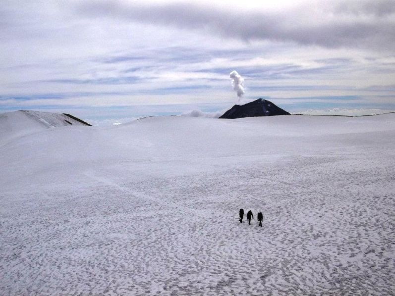
Crossing the crater icefield and Popocatépetl. |
From the hut we headed down the well-marked path, with its crossings of the ridge on passes and occasional short uphills, as the afternoon turned into evening. We knew we would be pretty late in getting down, so we tried to call Adam a few times on Collin's cellphone to let him know we were behind schedule, but we had connection problems�I think he got the general message, though.
At the 4400-meter saddle we let Rob and Duane go ahead so they could get to their car and pick up a likely bored Adam from the Altzonomi hostel, while Collin and I stayed back to make sure Ryan got down safely. I felt sorry for Ryan, trapped on a trip with some very fast hikers�at his own pace, he could have made the summit and maybe spent the night at the hut or gotten down super late but still safely. But our current plans meant we had to get down tonight, so he bravely slogged on down. The rocky braided trail section below the 4400-meter saddle was actually pretty difficult to hike heading down, too, even for experienced hikers like Collin and I.
|
| Collin's highest mountaintop! (GS) |
The sun set as we made the long traverse down from the final saddle, and eventually Collin and I took off to get to the car and start the process of loading it up. It got dark, though, and we missed the path to La Joyita and had to bushwhack across the grassy tussocks to our parking lot at the end. We arrived back around 6:45 PM.
At the car Collin and I loaded up our packs and waited for Ryan, who made the same route-finding error as we did and also had to bushwhack in the dark down to the car. At 7 PM we drove the 2 km up the rutted dirt road to the Altzonomi turn-off, where Duane, Rob, and Adam were waiting for us. I insisted that we arrange our stuff for a few minutes�our car had all Adam�s bags in it and there was hardly any room for us at all. So Adam got his things out, and I retrieved my sneakers from Duane�s car to make driving easier, and we were soon off, headed back to the Paso de Cort�s."
|
|
Atop our final ultra prominence: From left: Collin, Duane, Rob (GS) |
We caravan downhill, have the gate opened (a guard is still in the museum), and head for Amecameca. All I want, and what I've been waiting for some 12 hours, is something hot to eat - even just a bowl of soup and with Ryan's pozole at the list's top-end. However I am unanimously outvoted: everybody else wants to get hotel rooms and shower. Sleep attenuates my hunger, and I try without success on the windy road.
We arrive to a moderately expensive "auto motel" only to suspect that it's a place for cheating husbands to have extramarital sex: Greg notes curtains hide the parked automobiles. So we return to downtown and get a pair of cheap rooms in the San Carlos for just 250 Pesos apiece.
|
| rock and moon composition |
Everybody else now showers as I lie down with nothing to do but dream of hot soup. Finally, after 9 p.m. we find the nearby restaurants closed - including the one my heart is set on where we had lunch yesterday. Only food stalls are open for business - and a pizza place that neither Greg nor I want. I remind folks, facetiously, that we HAVE, at least, secured a hotel room and showered. My words are not well received.
On a tip we walk several blocks and find a 24-hour place serving nothing but tacos with an assortment of meat fillings. It looks kind of sleezy, and all but Rob, Duane and I decide to just skip supper. No soup. No ensalada. No recognizable beverages. No dessert. Just tacos. With such a limited menu it's a miracle that I find something for Duane: a trio of tacos filled with melted cheese and mushrooms. Rob and I also have three apiece, including a steak and cheese taco, a "taco al pastor", and a cheese with mushroom taco. Satisfied yet thirsty we return to the hotel.
Volcan Ixtaccíhuatl
trip report (Rob Woodall);
photo album 1 (RW);
photo album 2 (Ryan Courtney)
Saturday, January 14 - Free Day; Amecameca; Sacromonte Chalchiumomozco

|
|
Butcher shop named for the local mountains. |
A sit-down breakfast is hard to find - apparently, restaurants do not open here until 10 a.m. We do encounter a small yet marginally adequate place and have a final meal together. Although the hot cocoa with cinnamon is grand, our main dishes are served luke warm - unacceptable for scrambled eggs.
The Greg-Collin-Ryan car wishes to explore sights in Mexico City, and are willing to splurge on a fancy hotel room tonight. The Duane-Rob-Adam car decides to remain in town, favoring the cheap hotel rate and exploring the ethnic market.
Mexico City
photo album (Ryan Courtney)
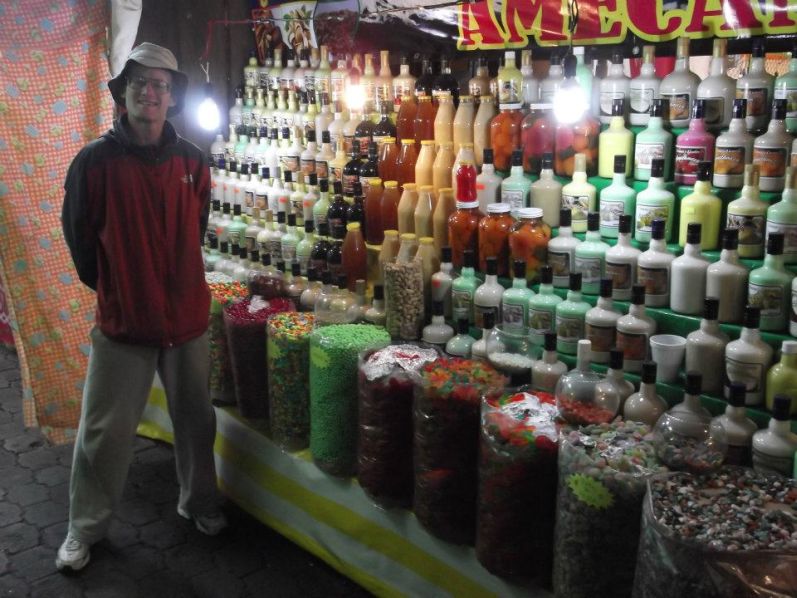
Rob and I locate a candy stall and I make several purchases. Then we encounter a stall where the girl is clearly
trying to sell us something regardless of how many samples of liqueur are required! A small bottle of delicious
coffee/nut flavored liqueur is secured for our enjoyment later today.
Seriously cheap milkshakes entice us all at just 10 Pesos each.
The rental car is hand-washed by a boy who does a meticulous job - and Duane provides a sizeable tip.
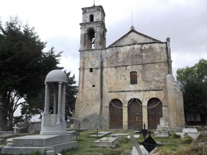
What's that hill over yonder? Rob is intensely curious. There's a church on-top and a watchtower.
So around 4:30 p.m. we three investigate.
After walking south from the main square several blocks we take a cobblestone road north and west as it
ascends past about a dozen "stations" for the Catholic devout. Soon enough we are at the hilltop church,
and find it's the centerpiece of a cemetery with dozens of marble and concrete graves going back to the
Nineteenth Century.
The hilltop ridge heads west, descends a bit, and then rises again as a second possible highest bump
about 200 yards from the church. It's a pleasant way to end our trip, some 300 feet above the surrounding community.
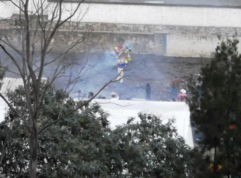
We descend by taking the cobblestone road north for a loop-route. Partway down we hear and then see
fireworks - in daylight! Investigating, we see a crowd gathered watching this man wearing a large costume
from which firecrackers are exploding. It's some kind of old pagan ritual. Bizarre.
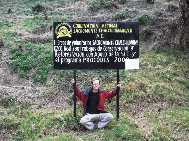
A sign provides us the hill's name as "Sacromonte Chalchiumomozco".
We return to town and, being nearly 6 p.m, solicit a seafood restaurant that was passed by enroute to the hilltop road.
We start with spicy and hot black bean / blue corn tortillas (not on the menu!). Then we each have fish dinners.
I don't now WHAT kind it was, but my whole fried fish with garlic was delectable right down to the pesky bones.
Duane also enjoys watching an NFL playoff game on the restaurant television set.
Tomorrow shall be a thankless day of travel. However I have no idea of the reality.
Open air market -
liqueurs for sale.
summit church
Man-on-fire (click to see clearly).
Rob Woodall's Sacromonte Chalchiumomozco
trip report;
Amecameca / Sacromonte Chalchiumomozco
photo album
Sunday, January 15 - Flights Home and Government Corruption

|
|
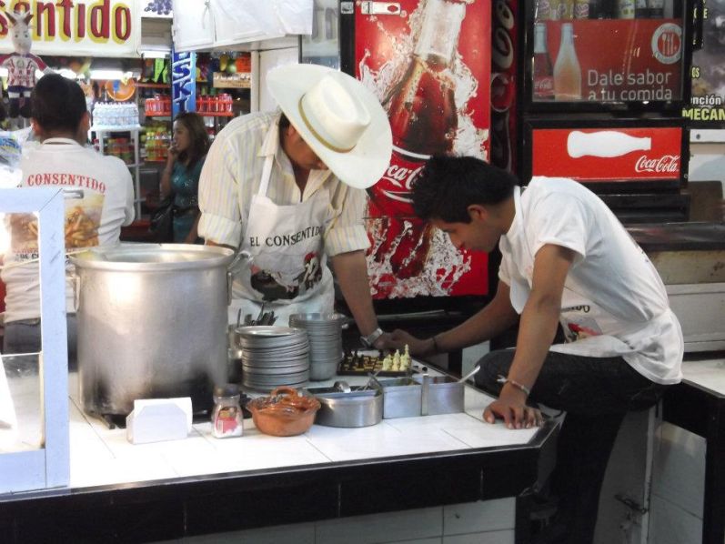
Amecameca - unexpected juxtaposition of butchers playing chess. |
First Duane and I deposit Rob at Terminal 2 for his earlier flight. We return the rental car near Terminal 1, and suffer the standard ritual of checking-in our luggage, going through security, and waiting at the actual gate.
About one-half hour prior to boarding an announcement is made that all passengers should check with the desk. I present my passport and boarding pass. They ask for a green tourist card. I don't have it. I am told to go elsewhere and get a new one with a stamp.
|
| Amecameca - parade |
(Question: WHY is this document not collected sooner in the
check-in process than immediately before one's flight?
Answer: It's a government scam, designed to fill people with anxiety so as to force payment
rather than losing one's flight.)
I visit a small kiosk and the official examines my passport. He finds no stamp for my entry into Mexico and says (on translation)
"You are in trouble. Go to the office before security checkpoint and explain."
I go ballistic, dashing back to the gate and running so hard that the cell phone falls out of my pocket. I shout to Duane and Greg to watch our luggage. (Greg has just arrived to join us on the same Houston-bound flight.) I try to recall instructions yet cannot find the exit for getting back before security.
|
| at Sacromonte Chalchiumomozco |
I solicit the assistance of another airline staff member who tells me that United / Continental is required to assist me in finding the immigration office. I return to the gate desk and they refuse to help. However a map is drawn, and I use it to locate the remote office. By now it's too late for making my flight.
The immigration lady (DAMN HER) asks for "tee-ket" as proof that I entered Mexico at so-and-so date and location. Yet I already told her that I arrived by automobile through Nogales on December 23, such that it is impossible to present an airline ticket.
Then I search my passport and find a stamp for December 23 ... yet with the "2010" not visible. This was when I passed through Mexico City enroute to La Paz, Bolivia 13 months earlier - a coincidence. Then I find a stamp for January 15, 2011 (today's month and day) ... when I passed again through this very airport on the way home from Bolivia. Neither passport stamps have any bearing, although I showed them to her anyway in case she was THAT stupid as to exonerate me.
|
|
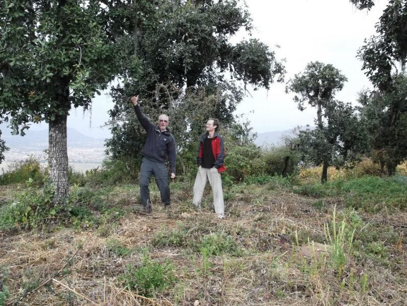
Sacromonte Chalchiumomozco - the second possible highest ground with Duane (left) and Adam. |
Without proof of having legally entered she quotes a figure of five thousand nine hundred eighty-two Pesos as fine. I realize that's about $450, a rather excessive amount indeed in my view. A bank teller is immediately available, yet he will not accept credit card payment.
(Of course not: by this means transactions are untraceable.)
Miraculously there is an ATM machine just outside the office. Is that coincidence? I should think NOT. Inserting my credit card I request a 6,000 Peso cash advance. I enter the wrong PIN number and am rejected. Now the office's security guard is watching me. He snickers and seems to be laughing at my predicament. I tell him to "Go to Hell".
|
|
Sacromonte Chalchiumomozco - Adam and sign identifying the hill's name. |
Now the sum of all fears is upon me: a rejected PIN number means one is locked-out of the system. If I don't get this money I don't know WHAT will happen next.
I try another PIN number - and it works. With a bit of relief and a huge amount of dissatisfaction I pay the bank cashier. There follows a large number of forms to fill-out, including one with a written description, in the language of my choice, as to why I don't have the required documents.
At the security checkpoint my boarding pass is rejected because it's too late for that flight. I return to airline check-in where I get a new boarding pass for the very next flight to Houston. My bags are already being transferred to that flight anyway.
|
|
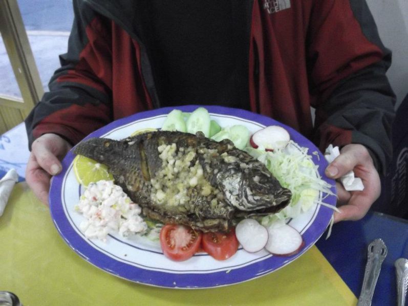
Amecameca - Adam holds dinner: a whole garlic-enhanced fish. |
I am placed on stand-by until an actual seat can be assigned.
Right after sitting in 12-E I eat the balance of a peanut butter strawberry jam sandwich Duane made for me the night before so I don't have to pay for airline food. I was not hungry for it. Rather, it was a "reward" for having dodged a bullet. Thank you Duane!
The flight is uneventful. A tasteless sandwich is served, and the potato chips are flavored with my Cajun spices and parmesan cheese.
U.S.A. customs is very efficient. I examine the electronic boards and guess which flight Duane and Greg will shortly take to Seattle/Tacoma. Then at Gate E2 I meet them, once again, and only to let them know that I am indeed back in the USA.
They board while I have over an hour until my own flight. A triple dip ice cream settles my nerves, with banana pudding, mocha chip and "birthday cake" flavors atop a waffle cone. Normally I would not spend $5.95 like this. However I really "needed it" in an emotional sense.
My San Diego flight is uneventful.