| Elevation Gain and 5,000+ Foot Elevation Gain Lists 1,2,3 |
|
A description of elevation gain is given. Armed with it, logical arguments are presented for how the current elevation gain rules might be modified. Although the arguments are just the author's, he feels that given the insight provided by the current description, any reasonable person would be led to the same conclusions regarding modification of the current elevation gain rules.4
The chief proposed modification is a climbing route-dependent evaluation of elevation gain for the purposes of maintaining the FRL (Front Runner List) elevation gain categories. To expedite this change, there follows a list of 5,000+ foot elevation gain routes for county highpoints. This list stands alone, providing valuable route information independently of its use in the corresponding 5,000+ foot FRL elevation gain category.
The web page concludes with a proposal for how to administer the FRL elevation gain categories.
4These rules were instituted after a group vote, and do not reflect the opinion of any
single individual, and in particular, Elevation gain is central to assessing the effort of climbing a mountain.
Since the chief obstacle in reaching a summit is often the physical labor required,
it is reasonable to use elevation gain as a yardstick for personal climbing achievement.
The physical effort attached with elevation gain is correlated with the extent of
uphill travel, including possible uphill travel on return from the summit.
This so-called TOTAL elevation gain is unquestionably the metric used when
elevation gain is invoked as a measure of human climbing effort.
If anybody doubts the close association of effort with TOTAL elevation gain,
let them climb the same flight of stairs one hundred times. The NET gain will be zero
(see below), yet the total gain is substantial.
Elevation gain is also a measure of the "change in viewshed" afforded the climber
as he proceeds from trailhead to summit. Here, changes in NET elevation are responsible
for a sense of pleasure attached with the knowledge than one has traveled high in pursuit of
a grand and often spectacular vista.
When elevation gain is used as a measure of change in viewshed, it is NET elevation gain
that is the appropriate metric.
TOTAL elevation gain is the sum of ALL uphill travel
for a given route. A trail that weaves up and down without gaining net elevation will nevertheless
have a substantial total elevation gain. This definition is not to be confused with the narrow,
constrained definition provided in the current elevation gain rules.
The physical effort of traversing this route is greater than the effort
required to traverse a perfectly level route. If fact, additional effort is applied by the hiker
for even the shortest of uphill sections. This observation is used below in the discussion
of proposed changes to the current elevation gain rules.
NET elevation gain is the difference in elevation between the highest
and lowest point on a route.
The lowest point may not be the trailhead, and, although unusual, the highest point may be
not even be the summit. Said elevation difference is the appropriate yardstick for assessing
elevation gain in terms of the corresponding change in viewshed; ecological lifezones; and overall
sense of personal accomplishment.
Net elevation gain poses certain advantages over total elevation gain in certain peculiar
scenarios that do (example 1) or might (example 2) arise in practice. In both examples, the use of
net elevation gain (appropriately) excludes recognition of the two hikes in the corresponding
records categories.
Example 1 - A backpacking trip of several weeks duration,
e.g. hiking the Appalachian Trail. During the journey a hiker passes over innumerable little hills,
descends into several valleys, and generally never reaches a substantial mountaintop ... until
near the very end. Said mountain supports a trail system that, were it to be climbed for its own sake,
would require just 3,000 feet of elevation gain. However the hiker has accumulated over
20,000 feet of TOTAL elevation gain during his soujourns, even though the net elevation
is far less.
A NET elevation gain criterion (appropriately) precludes counting this hike as a
"5,000+ foot" effort for said mountain. An exception arises if the net elevation gain for the
entire backpack exceeds 5,000 feet, such as would occur in walking from the Hudson River Valley (160 feet)
to the summit of either Mount Washington or Mount Mitchell. In that case one would
appropriately count the backpack as constituting a 5,000+ foot effort on said mountain.
Example 2 - A person decides to "pad" his 5,000+ foot elevation gain
statistic in the FRL by repeatedly walking up and down the same sixty-foot
high slope one hundred times.
The total elevation gain is 6,000 feet, while the net elevation gain is just sixty feet.
Appropriately, said effort is excluded from consideration in the relevant elevation gain category
if said category is based upon NET elevation gain.
The total elevation gain of a route equals the net elevation gain plus twice the sum of
all elevation differences encountered during downhill travel.
Suppose a route begins at 9,000 feet and summits at 13,000 feet. The net elevation gain is
4,000 feet. A section at 12,000 feet descends to 11,500 feet prior to resuming the uphill direction.
Twice the elevation difference for this downhill segment equals 1,000 feet. Adding, the total
elevation gain is 5,000 feet, i.e. the total amount of UPHILL travel is 5,000 feet.
There are often multiple routes to climb a given mountain, each route demanding a
specific degree of physicality that is DIFFERENT from the remaining routes.
Although the mountain's presence ensures the existence of multiple routes in the first place,
the degree of effort is determined by the route selected. In particular, the required effort
is NOT ascertained solely by the mountain's identity.
Numerous examples may be cited, and logical arguments provided, for why the elevation gain,
be it either the net or total flavor thereof, is a property of the route and not of the mountain.
I repeat:
The current elevation gain rules define the elevation gain
for climbing a mountain, REGARDLESS OF THE ROUTE EMPLOYED,
based upon the elevation gain for a specific route, namely, that unique route with the lowest total
elevation gain from a trailhead which is accessible by a high-clearance, two-wheel-drive motor vehicle
(henceforth this route shall be referred to as simply the "2WD route").
What a stilted and biased rule!! It is "stilted" because one has to "jump through hoops"
to define the specific trail through convoluted and arbitrary rules based on vehicle type.
It is "biased" because the specific trail must have the LEAST total elevation gain -
rather than say, the most popular; or the most conveniently located.
We MUST do away with a single-valued elevation gain for a given mountain, based in turn
on the current 2WD route prescription.
Such a stilted, unsupportable (and unpopular) rule is the result of trying to
straightjacket what is inherently a route-dependent entity, elevation gain, into a single value
for all routes on a given mountain. Frankly, it is nonsensical and I am surprised that
the current rule has survived so long without being seriously contended.
In late August 2004 I initiated a discussion group thread on revamping
the 5,000+ foot elevation gain categories, based in turn upon route-dependent gain criteria.
My original, detailed message is provided here
as a parody between a climber who ascended more than 5,000 feet and yet did not receive credit
in the FRL because a higher starting point exists from a different trailhead.
You are encouraged to read that original message.
In response to my post, counterarguments were made that maintaining a list of climbing routes
would be difficult, tedious, time consuming. Therefore, the argument went, we should retain the
status quo and insist that every route on a mountain be accorded the same elevation gain value
insofar as determining credit for the corresponding FRL category.
I base my arguments upon logic, not on how much work is involved to generate a route list!
The amount of work to produce a list of climbing routes along with their respectively elevation gains
is definitely NOT excessive. Indeed, this web page includes below just such a list.
During that discussion thread I also detected that the majority of county highpointers
did not understand the issues involved, to the point that were a vote for change be made,
the votes would come largely from people
without a sound grasp of the relevant arguments provided here.
This web page largely exists so that highpointers can understand the issues
and therefore cast their votes wisely. The current elevation gain rules specify that in order for an uphill segment of a route to count
in the calculation of total elevation gain,
said segment must support at least two forty foot contour intervals on the relevant USGS topographic chart.
The mean elevation gain for such a hill is eighty feet, as the average of forty and one hundred twenty feet.
However, the uphill section need not be forty, let alone
eighty feet in vertical extent for additional physical effort to apply - ten feet of gain will suffice -
as occurs when climbing a single flight of stairs!
Who would be so unreasonable as to claim that climbing a flight of stairs should not be counted
as additional effort relative to walking on level ground?
If, as is surely the case, we desire TOTAL elevation gain to measure required effort,
then one concludes that use of a forty or eighty foot "cutoff" as the minimum gain to "count"
IS MERELY A CONVENIENCE designed to measure gain based solely on USGS topographic charts
with the corresponding contour intervals.
When it comes to pass that a hiker actually traverses the route
in question, he can then report a more accurate total elevation gain based upon his summed experience
traversing all minor bumps that require exertion -
not just those that happen to appear on some map. A dichotomy exists between net and total elevation gain. On the one hand, total elevation gain
is most closely correlated with the effort of climbing a mountain by a particular route.
On the other hand, net elevation gain correlates with the sense of accomplishment in reaching
a lofty viewpoint worthy of one's effort. Furthermore, net elevation gain eliminates from consideration
certain hiking scenarios that are not in the spirit of what the elevation gain FRL categories
are designed to measure (c.f. preceeding subsection).
Both this webmaster and the elevation gain list maintainer, Edward Earl,
support the concept of maintaining simultaneous lists for both net and total elevation gain.
We support this concept for both a 1,000 foot and a 5,000 foot cutoff value, so making for a
total of four elevation gain categories in the FRL.
The lists below indicate which county highpoints support routes
that require at least five thousand feet of elevation gain. Highpoints are grouped
by state, and, within a state, are grouped into five categories that are inclusive of all
highpoints that could possibly support a route with at least five thousand feet of elevation gain.
The first four categories are distinguished by whether the 2WD route requires 5,000+ feet
of total elevation gain, and possibly of net elevation gain as well. Of these four categories,
The first two correspond to highpoints that constitute valid 5,000+ foot ascents
under the current elevation gain rules.
The third and fourth categories correspond to the ADDITIONAL highpoints on which credit
for a 5,000+ foot ascent MAY be forthcoming should the suggested, route-dependent
elevation gain rules be instituted.
The final, fifth category is not defined in terms of the 2WD route. I have labored to rewrite
these descriptions as simply as the topic will allow - but no simpler.
do not reflect the opinion of Edward Earl, the rule maintainer.
Edward is too "logical" a person to agree wholeheartedly with the current rules.
Why Consider Elevation Gain?
Elevation Gain Definitions and Examples
Relationship between Net and Total Elevation Gain
Elevation Gain is a Route-Dependent Construct
Elevation Gain is a Property of the Route
Proposed Changes to the Elevation Gain Rules and the FRL
1. Route-Dependence of Elevation Gain
Route-Dependent Categorization of Mountains by Elevation Gain
Therefore a mountain in this fifth category could also be listed on exactly ONE
of the first four categories.
and at least 5,000 feet of net elevation gain using the 2WD route
(cf total elevation gain rules).
and although likely, not necessarily at least 5,000 feet of net elevation gain.
For a given state, highpoints falling in the same category as
defined above are listed in descending order of their summit elevations.
For a given highpoint, routes are listed in descending order of their total elevation gains.
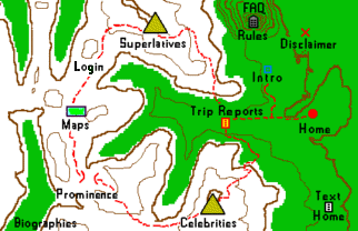
Colors on the elevation gain map
correspond to the total elevation gain using the 2WD route
(cf total elevation gain rules).
The following section contains the route lists as categorized above.
5In case the group at-large were to eventually vote upon insisting on a 5,000+ foot NET elevation gain (i.e. not TOTAL elevation gain) as the sole valid means of FRL value incrementation, after returning from the summit of both Mount Wilson and Wilson Peak, Edward Earl and I dropped down some 200 vertical feet BEYOND the trailhead - so making for a 5,000+ foot NET elevation gain ascent and ensuring that our effort would be "counted" regardless of the vote's outcome.
| Borough | Highpoint | Elev | Route | Total | Distance | Net | Description |
| ******** | ********* | **** | ***** | ***** | ******* | *** | ********** |
| Denali | Mt McKinley | 20,320 | Wonder Lake | ? | ? | 18,320 | very long approach |
| Muldrow Glacier | ? | ? | ? | ||||
| West Buttress | 20,620 | 32 | 13,320 | most popular route | |||
| Yakutat | Mt Saint Elias | 18,008 | standard (?) | extremely challenging | |||
| Valdez-Cordova | Mount Bona | 16,500+ | standard (?) | see report | |||
| Skagway-Hoonah-Angoon | Mt Fairweather | 15,300 | standard (?) | ||||
| Matanuska-Susitna | Mt Hunter | 14,573 | standard (?) | ||||
| Southeast Fairbanks | Mt Hayes | 13,832 | standard (?) | ||||
| Kenai Peninsula | Mt Torbert | 11,413 | standard (?) | ||||
| North Slope | Mt Chamberlin | 9,020 | standard (?) | ||||
| Mt Isto | 8,975 | standard (?) | |||||
| Northwest Arctic | Mt Igikpak | 8,276 | standard (?) | ||||
| Anchorage | Bashful Pk | 8,005 | standard (?) | see report |
| County | Highpoint | Elev | Route | Total | Distance | Net | Description |
| ****** | ********* | **** | ***** | ***** | ******* | *** | ********** |
| Inyo/Tulare | Mount Whitney | 14,494 | Whitney Portal | 6,200 | 22 | 6,200 | see description |
| Mountaineer's | 6,200 | ? | 6,200 | same trailhead but class 3 | |||
| Siskiyou | Mount Shasta | 14,162 | Avalanche Gulch | 7,200 | ? | 7,200 | see report |
| "old ski area" | 6,322 | ? | 6,322 | road may no longer exist | |||
| Fresno | North Palisade | 14,242 | Le Conte | 5,300 | 4,500 | see report | |
| U-Notch | see report | ||||||
| Madera | Mount Ritter | 13,143 | Agnew Meadow | 5,300 | 17 | 4,800 | see report |
| San Bernardino | San Gorgonio | 11,499 | Vivian Creek Trail | 5,440+ | 15.6 | 5,440 | see report |
| South Fork Trail | 4,700 | ? | 4,700 | less popular route | |||
| Riverside | San Jacinto | 10,804 | Lykken Trail | 10,300 | 32 | 10,300 | see report |
| Snow Canyon | > 9,830 | ? | 9,830 | north side; class 3 | |||
| Deer Springs | 5,200 | 19 | 5,200 | one of 4 routes from Idyllwild | |||
| Seven Pines | 4,900 | 15 | 4,400 | (same) | |||
| Marion Mountain | 4,400 | 11 | 4,400 | (same) | |||
| Devils Slide | 4,300 | 16 | 4,300 | (same) | |||
| Long Valley | 2,500 | 10 | 2,400 | aerial tramway |
| County | Highpoint | Elev | Route | Total | Distance | Net | Description |
| ****** | ********* | **** | ***** | ***** | ******* | *** | ********** |
| Alamosa/Costilla/Huerfano | Blanca Peak | 14,375 | from desert floor | 5,615 | 14 | 5,615 | see report |
| Como Lake | 2,700 | 8 | 2,700 | 4WD-accessible only | |||
| La Plata | Mount Eolus and Windom Peak | 14,083 | Chicago Basin | 7,650 | 21 | 5,900 | |
| Larimer | Hagues Peak | 13,560 | Lawn Lake Trail | 5,000 | 18 | 5,000 | |
| Eagle | Mount Holy Cross3 | 14,005 | > 5,000 | < 5,000 | see report | ||
| Boulder | Longs Peak | 14,255 | Keyhole | > 5,000 | < 5,000 | see report | |
| West Couloir | 4,900 | 4,900 | see report | ||||
| Dolores | Mount Wilson | 14,246 | Silver Pick | > 5,000 | < 5,000 | ||
| Woods Lake | 5,766 | 15 | 4,846 | see report | |||
| Lake | Mount Elbert3 | 14,433 | > 5,000 | < 5,000 | |||
| Saguache | Crestone Peak | 14,294 | west approach (2WD) | 5,854+ | 15 (est.) | 5,854 | |
| east approach (4WD) | 4,794+ | ? | 4,794 | ||||
| Gunnison/Pitkin | Castle Peak | 14,265 | > 5,000 | ? | < 5,000 | ||
| El Paso | Pikes Peak | 14,110 | Barr Trail | 7,500+ | 24 | 7,500 | |
| drive-up | 0 | 0 | 0 | ||||
| Fremont | Bushnell Peak | 13,105 | east approach | 5,305+ | ? | 5,305 | see report |
| Kerr Gulch | 4,983+ | ? | 4,983 | see report | |||
| Brooks Creek | 3,743+ | ? | 3,743 | in Colorado highpoints guidebook |
| County | Highpoint | Elev | Route | Total | Distance | Net | Description |
| ****** | ********* | **** | ***** | ***** | ******* | *** | ********** |
| Hawaii | Mauna Kea | 13,796 | from sea level | 13,796+ | ? | 13,796 | state highpointers HAVE done this |
| from Onizuka Astronomical Museum and Visitor Center (9,200 ft) | 4,800 | ? | 4,600 | Edward Earl and Adam Helman did this | |||
| drive-up | ~100 | 0 | < 100 | minimal hike to true highpoint | |||
| Maui | Haleakala | 10,023 | from crater interior | 2,600 | 4 1/2 | 2,600 | see report |
| drive-up | 0+ | 0 | 0+ | walk from summit parking lot to true highpoint |
| County | Highpoint | Elev | Route | Total | Distance | Net | Description |
| ****** | ********* | **** | ***** | ***** | ******* | *** | ********** |
| Custer | Borah Peak | 12,662 | standard | 5,200 | 10 | 5,200 | see report |
| Butte | Diamond Peak | 12,197 | standard | 5,10011 | 8 | 4,70011 | see description |
| Lemhi | Bell Mountain | 11,612 | standard | 5,200 | 10 | 4,962 | see report |
| Valley | Big Baldy | 9,705 | route 1 | 9,400 | 36 | < 5,000 | see report |
| route 2 | 8,350+ | 32 | 1,700 | see report | |||
| Blaine | Hyndman Peak | 12,009 | standard | 5,000- | 12-14 | 4,970 | see report |
| County | Highpoint | Elev | Route | Total | Distance | Net | Description |
| ****** | ********* | **** | ***** | ***** | ******* | *** | ********** |
| Park | Granite Peak | 12,799 | Froze to Death Plateau | 7,600 | 26 | 6,250 | see report |
| Huckleberry Creek | 6,250 | 21 | 6,250 | ||||
| Stillwater | Mount Wood | 12,649+ | standard (?) | 6,500 | 11 | > 5,000 | see report |
| "Golf Course" | 5,000 | 17 | 3,600 | see report | |||
| Glacier | Mount Cleveland | 10,466 | Stoney Indian | 6,666 | 22 | 6,266 | see report |
| Southwest Bowl | 6,466 | 11 | 6,266 | same trailhead | |||
| Flathead | Mount Stimson | 10,142 | Coal Creek | 10,000? | 40? | > 5,000 | see commentary |
| Nyack Creek | 6,500 | 25? | > 5,000 | shorter but sustained class 4 | |||
| Two Medicine Lake | 12,700+ | 40+ | 5,850 | large elevation gain yet no major river ford; intense bushwhacking; see report |
|||
| Lake | McDonald Peak | 9,820 | Ashley Lakes | 6,000 | 12 | 4,870 OR 5,120 | see report |
| Missoula | Lowary Peak ("Peak X") | 9,369 | 6,600 | 9 | 5,400 | see report | |
| Carbon | Castle Mountain | 12,612 | Clay Butte Trailhead | 7,350 | 30 | 3,012 | see report |
| Sundance Pass Trail (#1)/Bridge/Silt Lakes/Omega Lake/South Ridge | 4,800 | 20 | 4,700 | see report | |||
| Lincoln/Sanders | Snowshoe Peak | 8,738 | Snowshoe Lake | 6,600 | 17 1/2 | 6,300 | see report |
| Leigh Lake | 4,500 | ? | 4,500 | MUCH shorter; borderline Class 4 |
|||
| Sweet Grass | Mount Douglas | 11,282 | Upsidedown Trail/Lake Plateau | 7,575 | 29 | 4,925 | see report |
| Madison | Hilgard Peak | 11,280+ | Avalanche Lake | 5,250 | 15 | 4,400 | see report |
| County | Highpoint | Elev | Route | Total | Distance | Net | Description |
| ****** | ********* | **** | ***** | ***** | ******* | *** | ********** |
| Elko | Ruby Dome | 11,387 | begin at locked gate | 5,400 | 15 | 5,400 | see report |
| begin at trailhead | 4,900 | 13 | 4,900 | shaves-off 500 feet |
| County | Highpoint | Elev | Route | Total | Distance | Net | Description |
| ****** | ********* | **** | ***** | ***** | ******* | *** | ********** |
| Clackamas/Hood River | Mount Hood | 11,239 | Timberline Lodge | 5,300 | 8 | 5,300 | see description |
| Jefferson/Linn | Mount Jefferson | 10,497 | SW Ridge/Pamelia Lake TH | 7,400 | 22 | 7,400 | see report |
| SW Ridge/Woodpecker Ridge TH | 7,500 | ? | 6,100 | see report | |||
| Wallowa | Sacajawea Peak | Ice Lake/West Fork Wallowa River | 5,800 | 20 | 5,200 | see report | |
| 9,838 | Hurricane Creek | 4,800 | 14 | 4,800 | see report | ||
| Union | Eagle Cap | 9,572 | see footnote 5 | > 5,000 | ? | < 5,000 | less frequented route |
| Lostine Canyon TH | 4,000 | 20 | 4,000 | see report | |||
| Jackson | Mount McLoughlin | 9,495 | see footnote 8 | 5,055+ | ? | 5,055 | |
| Mount McLoughlin TH | 4,000 | 10 | 4,000 | see report | |||
| Marion | Mount Jefferson liner | 9,000+ | Whitewater Creek Trail | 4,900 | ~15 | ~5,000 | see report |
| County | Highpoint | Elev | Route | Total | Distance | Net | Description |
| ****** | ********* | **** | ***** | ***** | ******* | *** | ********** |
| Juab | Ibapah Peak | 12,087 | low clearance vehicle trailhead4 | 5,950 | ? | 5,950 | see report |
| 4WD trailhead4 | 5,250 | 5,250 | see footnote 4 | ||||
| Duchesne | Kings Peak | 13,528 | Uinta Canyon/Chain Lakes/Atwood Basin/Painter Basin | 6,700 | 52 | 5,700 | see footnote 6 |
| Swift Creek/Bluebell Pass/Yellowstone Basin | 6,100 | 44 | 5,400 | see footnote 7 | |||
| Henrys Fork/Dollar Lake/Gunsight Pass | 4,100 | 24 | 4,100 | most popular route see description |
|||
| Utah | Mount Nebo | Willow Creek Trail | 5,107+ | 11 | 5,107 | see report | |
| northern route | 3,300 | 10 | 2,568 | see report |
| County | Highpoint | Elev | Route | Total | Distance | Net | Description |
| ****** | ********* | **** | ***** | ***** | ******* | *** | ********** |
| Pierce | Mount Rainier | 14,410 | Paradise | 9,000 | 16 | 9,000 | see description |
| Emmons Glacier | ? | ? | ? | ||||
| Yakima | Mount Adams | 12,276 | Cold Springs trailhead | 6,800 | ? | 6,650 | see report |
| Whatcom | Mount Baker | 10,781 | Coleman Glacier | 7,300 | ? | 7,300 | see report |
| Snohomish | Glacier Peak | 10,520+ | standard (?) | > 5,000 | ? | > 5,000 | |
| North Fork Sauk/south ridge | 11,100 | 34 | 8,448 | see report | |||
| Chelan | Bonanza Peak | 9,511 | Holden Lake and Pass | 6,300 | 17 | 6,300 | see report |
| Skagit | Buckner Mountain | 9,080+ | Cascade Pass/Sahale camp | 7,700 | 18 | 5,500 | see report |
| Okanogan | North Gardner Mountain | 8,956 | standard (?) | 7,250 | ~30 | 6,250 | see report |
| Jefferson | Mount Olympus | 7,969 | Hoh River/Glacier Meadows | 8,700 | 43 + camp side-trails | 7,369 | see report |
| Clallam | Gray Wolf Ridge | 7,218 | standard (?) | 5,500 | ? | 4,100 | see report |
| Mason | Mount Stone | 6,612 | Putvin Trail | 5,267 | 9.6 | 5,047 | see report |
| King/Kittitas | Mount Daniel | 7,960+ | Peggy's Pond/southeast ridge | 5,300 | 20 | 4,700 | see report |
| Skamania | Mount Adams liner | 8,920+ | Stagman Ridge | > 5,000 | ? | ? | see report |
| Cold Springs/Round-the-Mountain | 4,200 | ? | 3,300 | ||||
| Mount Adams liner | 8,920+ | Taklakh Lake/Divide Trail | 4,250 | ? | 4,250 | see report | |
| pre-eruption highpoint9 | Dogshead route from Spirit Lake | > 6,479 | ? | 6,479 |
| County | Highpoint | Elev | Route | Total | Distance | Net | Description |
| ****** | ********* | **** | ***** | ***** | ******* | *** | ********** |
| Teton | Grand Teton | 13,770 | Exum Ridge | 7,038 | 15? | 7,038 | Class 5.6 |
| Owens Spalding | 7,038 | 15? | 7,038 | Class 5.4, safer in questionable weather see report |
|||
| Fremont/Sublette | Gannett Peak | 13,804 | Glacier Trail | over 8,000 | 50 | ? | see description |
| Pole Creek Trail | 7,500-8,000 | 44 | 4,300 | see description | |||
| Ink Wells Trail | 8,000 | 34 | 4,300 | see report | |||
| Park | Francs Peak | 13,153 | standard | 5,153 | 10? | 4,753 | see report |
| Big Horn/Johnson | Cloud Peak | 13,167 | standard | 4,70010 | 24? | 4,100 | see description |
Note: These rules described below are a suggestion for how to govern the 5,000+ foot FRL category, and are subject to discussion, deliberation and eventual agreement by the county highpointing group. In a nutshell, these rules are tentative only!!
Any route successfully employed to climb a highpoint with at least 5,000 feet of total elevation gain will fall into one of the first four categories above, and as such is listed there. Provided a highpointer used that route, his 5,000+ foot FRL statistic may be incremented by one.
Should NET elevation gain become tracked as an FRL category distinct from TOTAL elevation gain, the above 5,000+ foot lists can be used to ascertain when credit is accorded in said NET elevation gain category.
Should a vote come that results in no separation of the FRL into NET and TOTAL gain categories, I maintain that the resulting single category be based upon TOTAL elevation gain. I recommend that TOTAL elevation gain be the criterion for FRL value incrementation because it, and not NET elevation gain, corresponds most closely to the physical effort of climbing a mountain.
NET elevation gain falls short of TOTAL elevation gain, seeing as it measures items that in my (singular) opinion, are of secondary importance - change in viewshed, life zones, and overall sense of accomplishment upon realizing the summit. That said, and as noted above, both Edward Earl and myself prefer tracking both types of elevation gain in the Front Runner List. Edward's opinion here is essential because HE is the individual who would have to do the paperwork required to maintain multiple elevation gain FRL categories.
In reference to TOTAL elevation gain, the following rules are proposed -
| elevation gain records | elevation gain map | elevation gain rules |