

|

|

|
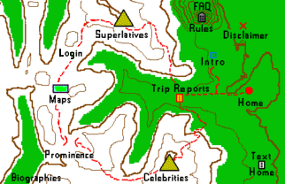
| County Highpointers Introduction Information on finding and hiking the US county highpoints. Navigate or take a web site tour by following the red trail in the topographic chart at right. NEW - Now Updateable! County HP Completion Maps All Completion Maps Index Member Log-In Join the Discussion! Text-only Version of Home Page |


Custom Search
|
| Highpoints and Peaks | Topo Charts / Weather | Literature |
| Summitpost, Seven Summits | Acme.com, Topoquest, MyTopo | General Hiking and Camping |
| Peakbagger Lists Of John | NOAA/NWS, Weather.com, Wunderground | General Mountaineering |
| state highpointers, HPF | USGS Topographical Data | Highpoint-Specific Literature |
| More Useful Links |
County Highpoint Trip Reports
As of January 2015 there are just over 7,800 county highpoint trip reports, several dozen for National Park highpoints and a small number for National Monuments. Additional reports are available by linking to external websites. Some of these reports are available only by special request from the webmaster. To view county highpoint reports click on relevant state(s) from the following map. Some reports may no longer be valid. Hence for a given county they should be reviewed in reverse chronological order. Other reports provide little substantive information, yet are retained after a community-wide discussion for their potential historical and/or entertainment value. The reader determines which reports are of value for his specific goals - not the webmaster. Hence all reports are presented. |
Submit A Trip Report
(Please use plain text. Include your name, the trip date, and the relevant county)
Trip report author recommendations
-- -- -- -- next tour link -- -- -- --
You are visiting a profit-free zone, a superb privilege in this world run mad with
"The Bottom Line" and worker productivity. Forget it ALL - this is a FUN HOBBY!!
The county highpointers website was maintained and refined by webmaster Adam Helman with the assistance of numerous other highpointers; all selflessly dedicated to promoting our hobby through the power of information. This effort continues. However there ARE certain ongoing expenses to be made good...
Paypal provides for secure, worldwide electronic funds transfer without the hassle of checkbook, stamp, and trips to the bank. Please consider a donation via Paypal by clicking the Donate button below.
If you have a Paypal account then proceed as instructed. If not, a credit card number is required. A roughly 4% deduction is charged to the funds recipient, e.g. we "see" $19.12 of a $20 donation.
If you prefer to donate in the traditional manner, please E-mail the treasurer for their home address and the name to put on your check, indicating the amount you wish to contribute.
Donations to the County Highpointers are not tax deductible.
Disclaimer
Attempting to reach some of the points listed in this web site can be dangerous, and could lead to accidents resulting in injury or death. Some of the summits lie in rugged and isolated regions, where even minor mishaps can escalate into a life threatening crisis. Other locations lie on private property, military bases, and other areas where access is restricted. Trespassing in these areas can result in being arrested, shot at, or worse. Right of access to these areas is constantly changing, and access in the past does not guarantee present access. By use of these web pages, the reader hereby releases the trip report authors, trip report compiler, and webmaster from liability for any injury, including but not limited to monetary loss, death, and other damages that might in any way be connected with this web site.