Small Kentucky State Map East Kentucky County Trip Reports East Kentucky County Map

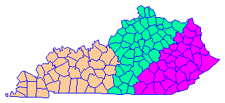
Click on any region from the map above
to access the corresponding reports.
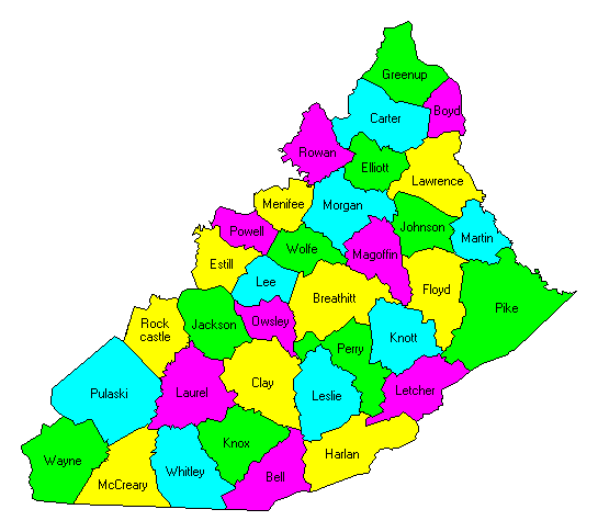
Click on any county for highpoint information.

Kentucky main page First Ascent List Disclaimer


    topographic chart (Acme)     aerial photograph (Flash Earth)                     Explanation

topo chart / aerial image scale:     normal     regional overview

(coordinates are not yet available)


Bell County - three areas on Cumberland Mountain (3,400+ feet)

Boyd County - one area (1,140+ feet)

Breathitt County - BM Tenmile on Elkbutt Knob and five areas (1,600+ and 1,620+ feet)

Carter County - eight areas (1,300+ feet)

Clay County - spot elevation (2,235 feet) and two areas (2,200+ feet)

Elliott County - two areas (1,360+ feet)

Estill County - five areas on Zion Mountain and Happy Top Mountain (1,511 and 1,500+ feet)

Floyd County - five areas (2,320+ feet)

Greenup County - two areas (1,200+ feet)

Harlan County - Black Mountain (4,145 feet and State Highpoint)

Jackson County - spot elevation on Cruse Ridge (1,633 feet) and one area (1,620+ feet)

Johnson County - Stuffley Knob (1,508 feet) and one area (1,480+ feet)

Knott County - one area at Letcher, Pike tri-county junction (2,360+ feet)

Knox County - spot elevation (2,322 feet)

Laurel County - one area (1,760+ feet)

Lawrence County - one area (1,320+ feet)

Lee County - spot elevation (1,367 feet)

Leslie County - Peters Knob and one area (2,600+ feet)

Letcher County - on state boundary (3,720+ feet)

McCreary County - Ryans Creek Mountain (2,165 feet)

Magoffin County - four areas (1,640+ feet)

Martin County - three areas (1,600+ feet)

Menifee County - five areas with Coburn benchmark (1,428, 1,427, and 1,420+ feet)

Morgan County - nine areas (1,400+ feet)

Owsley County - one area (1,720+ feet)

Perry County - Delphia benchmark (2,539 feet)

Pike County - Birch Gap benchmark on Pine Mountain (3,149 feet)

Powell County - Pilot Knob, Rotten Point, and five areas (1,440+ feet)

Pulaski County - at county boundary on Green River Knob (1,680± feet)

Rockcastle County - one area on Cruse Ridge (1,640+ feet)

Rowan County - Limestone Knob (1,435 feet) and two areas (1,420+ feet)

Wayne County - Miller benchmark (1,788 feet) and 12 areas (1,780+ feet)

Whitley County - two areas (2,220+ feet)

Wolfe County - one area (1,480+ feet)


Disclaimer

Attempting to reach some of the points listed in this web site can be dangerous, and could lead to accidents resulting in injury or death. Some of the summits lie in rugged and isolated regions, where even minor mishaps can escalate into a life threatening crisis. Other locations lie on private property, military bases, and other areas where access is restricted. Trespassing in these areas can result in being arrested, shot at, or worse. Right of access to these areas is constantly changing, and access in the past does not guarantee present access. By use of this web page, the reader hereby releases the trip report authors, trip report compiler, and webmaster from liability for any injury, including but not limited to monetary loss, death, and other damages that might in any way be connected with this web site.

FAIR WARNING: These are "armchair mountaineer" articles, an offering for amusement, not action. Many of these peaks are potentially life threatening, or are on private property. Adequate mountaineer training and/or owner's permission are required if you choose to pursue this list. The authors cited on this page accept no responsibility for injury, or any liability related to these route descriptions.


State Hyperlinks / Text-only Home Page Introduction Highpoint Superlatives
Highpoint Maps Topographic Prominence Highpointer Celebrities Disclaimer